Ladysbridge

Last updated

Ladysbridge
Droichead na Scuab
Village
The Thatched Inn, Ladysbridge-Droichead na Scuab - geograph.org.uk - 1900595 (cropped).jpg
Thatched Inn pub in Ladysbridge
Ireland adm location map.svg
Red pog.svg
Ladysbridge
Location in Ireland
Coordinates: 51°53′46″N8°02′10″W / 51.896°N 8.036°W / 51.896; -8.036
Country Ireland
Province Munster
County County Cork
Population
 (2016) [1]
658
Time zone UTC+0 (WET)
  Summer (DST) UTC-1 (IST (WEST))

Ladysbridge (Irish : Droichead na Scuab), [2] known for census purposes as Knockglass (Irish : An Cnoc Glas), [3] is a village in County Cork, Ireland. As of the 2016 census, the area had a population of 658 people. [4]

The village of Ladysbridge lies at the junction of the R632 and R633 regional roads, approximately 1.5 kilometres (0.93 mi) south of Castlemartyr. Ladysbridge, sometimes spelled Lady's Bridge, is also connected to Castlemartyr via a way-marked nature trail. [5] This walking route crosses the nearby Womanagh River on a pedestrian bridge. [6]

Ightermurragh Castle is a 17th-century fortified house which is located on the south bank of the Womanagh River approximately 2 kilometres (1.2 mi) east of Ladysbridge village. [7] Within the village itself, a number of buildings date from the 19th century, including the former national school (dated 1891) and Ladysbridge Roman Catholic church (dated to c.1820). [8] [9] This church, which is dedicated to Saint Mary, is in the parish of Ballymacoda and Ladysbridge and the Roman Catholic Diocese of Cloyne. [10] The local GAA club, Fr. O'Neill's GAA, represents the same parish area. [11]

A monument in the centre of the village commemorates the Manchester Martyrs, one of whom was from the Ladysbridge area. [12]

Related Research Articles

<span class="mw-page-title-main">Kinvara</span> Village in south County Galway, Ireland

Kinvara or Kinvarra is a sea port village in the southwest of County Galway, Ireland. It is located in the civil parish of Kinvarradoorus in the north of the barony of Kiltartan. Kinvarra is also an electoral division.

<span class="mw-page-title-main">Castlemartyr</span> Village in County Cork, Ireland

Castlemartyr is a large village in County Cork, Ireland. It is around 30 kilometres (19 mi) east of Cork city, 10 km (6 mi) east of Midleton, 16 km (10 mi) west of Youghal and 6 km (4 mi) from the coast. Approximately 1,600 people live in the village and its hinterland. It is situated on the N25 national primary road and the R632 regional road.

<span class="mw-page-title-main">Ballintra</span> Village in County Donegal, Ireland

Ballintra is a village in the parish of Drumholm in the south of County Donegal, Ireland, just off the N15 road between Donegal town and Ballyshannon. Ballintra lies on the northern bank of the Blackwater river. The river rises in the hills that lie inland from the town, and flows through a number of small lakes before spilling over a small waterfall in a gorge behind the village.

<span class="mw-page-title-main">Dromcolliher</span> Town in County Limerick, Ireland

Dromcollogher, officially Dromcolliher, is a village located at the crossroads of the R522 and R515 regional roads in the west of County Limerick, Ireland. It is part of the parish of Dromcollogher-Broadford. It is also very close to the boundary of north County Cork.

Rockchapel is a village in north County Cork in Ireland. It is located near the border of counties Cork, Kerry and Limerick. Rockchapel is within the Dáil constituency of Cork North-West.

<span class="mw-page-title-main">Ballinadee</span> Village in County Cork, Ireland

Ballinadee is a village in County Cork, Ireland. It lies in the parish of Courceys, approximately 12 km by road west of Kinsale and 9 km south east of Bandon. Ballinadee is on the banks of the River Pound, which flows into the River Bandon, and has a school, two churches and two pubs.

East Cork lies in south-west Ireland, in Ireland's largest county, County Cork. The term "East Cork" is used in tourism, sporting and other contexts, and is the name given to one of eight municipal districts of Cork County Council.

<span class="mw-page-title-main">Durrus</span> Village in County Cork, Ireland

Durrus is a village and civil parish in West Cork in Ireland. It is situated ten kilometres (6 mi) from Bantry in County Cork, at the head of the Sheep's Head and the Mizen Head peninsulas.

<span class="mw-page-title-main">Newmarket, County Cork</span> Town in County Cork, Ireland

Newmarket, historically known as Aghatrasna, is a town in the barony of Duhallow, County Cork, Ireland. It is situated at the junction of the R576 and R578 regional roads. Newmarket is within the Cork North-West Dáil constituency

<span class="mw-page-title-main">Kilbrittain</span> Village in County Cork, Ireland

Kilbrittain or Killbrittain is the name of a village, townland and parish in County Cork, Ireland. The village lies about 5 miles (8.0 km) southwest of Bandon, and near Courtmacsherry and Timoleague. The coastal route around the edge of the parish is the R600 road. The village itself is around 1 mile (1.6 km) inland from the coast.

<span class="mw-page-title-main">Rostellan</span> Village in County Cork, Ireland

Rostellan is a civil parish, townland and village in the historical Barony of Imokilly, County Cork, Ireland. An electoral division of the same name forms part of the Cork East Dáil constituency. For census purposes, the village of Rostellan is combined with the neighbouring villages of Farsid and Aghada. As of the 2011 census, the combined settlement of Aghada-Farsid-Rostellan had a population of 1,015 people.

<span class="mw-page-title-main">Farran</span> Village in County Cork, Ireland

Farran is a village in County Cork, Ireland, in the parish of Ovens. It lies on the southside of the River Lee. Farran is 12 miles (19 km) west from Cork City on the N22 road.

<span class="mw-page-title-main">Glenville, County Cork</span> Village in County Cork, Ireland

Glenville is a village and townland in County Cork, Ireland. It is situated approximately 20 km northeast of Cork city. Glenville is part of the Cork North-Central.

<span class="mw-page-title-main">Dromina</span> Village in County Cork, Ireland

Dromina is a village and townland in County Cork, Ireland. 9 km south-west of Charleville, the village is in the civil parish of Shandrum, close to the village of Newtownshandrum. As of the 2016 census, Dromina had a population of 275 people, up from 207 as of the 1996 census.

<span class="mw-page-title-main">Ballingarry, North Tipperary</span> Civil parish in County Tipperary, Ireland

Ballingarry is a civil parish and a townland in the barony of Ormond Lower, County Tipperary in Ireland. It is located on the N52 between Borrisokane and Birr. Ballingarry townland has an area of 5.3 square kilometres (2 sq mi), and had a population of 170 people as of the 2011 census.

Carlanstown is a village and townland in County Meath, Ireland. As of the 2016 census, there were 664 people living in the village.

<span class="mw-page-title-main">Castlemagner</span> Village in County Cork, Ireland

Castlemagner is a village and townland in the Duhallow area of north-west County Cork, Ireland. Castlemagner is within the Cork North-West.

Killenard is a village in County Laois, Ireland. It lies in the historic barony of Portnahinch and within the administrative area of Laois County Council.

Ballymacoda is a small village in County Cork, Ireland. As of the 2016 census, the village had a population of 185 people.

<span class="mw-page-title-main">Freemount, County Cork</span> Village in County Cork, Ireland

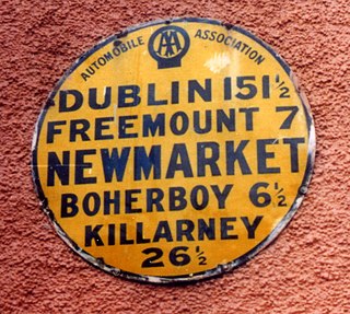
Freemount is a village in County Cork in Ireland. It lies on the River Allow, which is crossed by Allow Bridge on the R578 regional road. As of the 2016 census, Freemount village had a population of 159 people.

References

  1. "Knockglass (Ireland) Census Town". citypopulation.de. Archived from the original on 1 March 2020. Retrieved 1 March 2020.
  2. "Droichead na Scuab / Lady's Bridge". logainm.ie. Retrieved 22 April 2020.
  3. "An Cnoc Glas / Knockglass". logainm.ie. Retrieved 17 April 2020.
  4. "Sapmap Area - Settlements - Knockglass". Census 2016. Central Statistics Office. April 2016. Retrieved 22 April 2020.
  5. "Sites - Castlemartyr". coillte.ie. Retrieved 22 April 2020. Ladysbridge Loop (4.7km, 1 hour 30 mins, easy) links Castlemartyr and Ladysbridge villages together
  6. "Pedestrian Access Between Ladysbridge and Castlemartyr With Official Opening of Ladysbridge Loop". eastcorkjournal.ie. East Cork Journal. 15 July 2017. Retrieved 22 April 2020.
  7. "Ightermurragh Castle". castles.nl. Retrieved 22 April 2020. Ightermurragh Castle, lies in a field south of the Womanagh River, east of the village of Ladysbridge, in County Cork
  8. "Ladysbridge National School, Ladysbridge, County Cork". buildingsofireland.ie. National Inventory of Architectural Heritage. Retrieved 22 April 2020.
  9. "Ladysbridge Roman Catholic Church, Ladysbridge, County Cork". buildingsofireland.ie. National Inventory of Architectural Heritage. Retrieved 22 April 2020.
  10. "Parish: Ballymacoda and Ladysbridge". cloynediocese.ie. Diocese of Cloyne. Retrieved 22 April 2020.
  11. "Fr O'Neill's and Russell Rovers the embodiment of East Cork dreams". irishexaminer.com. Irish Examiner. 17 January 2020. Retrieved 22 April 2020. Fr O'Neill's are Cork's 2019 Premier Intermediate Champions. They represent the parish of Ballymacoda and Ladysbridge
  12. "Rathcallan, Ladysbridge, County Cork". buildingsofireland.ie. National Inventory of Architectural Heritage. Retrieved 22 April 2020. Monument commemorating, among others, Michael O'Brien of Ladysbridge, William Allen and Michael Larkin, collectively known as the Manchester Martyrs following their [1867] execution