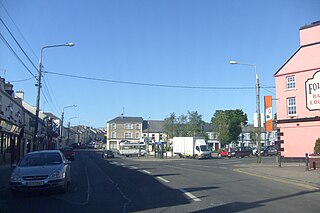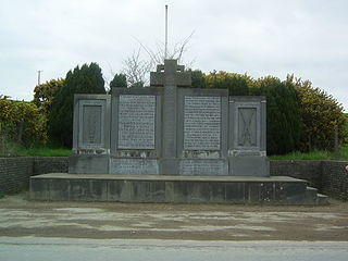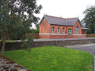
Tubbercurry or Tobercurry is the second-largest town in terms of both population and land area in County Sligo, Ireland. It lies at the foot of the Ox Mountains, on the N17 national primary road, and is 30 kilometres (19 mi) south-west of Sligo town. The town is twinned with Viarmes in France. Tubbercurry achieved status as a Fairtrade town in September 2008.

Patrickswell, historically known as Toberpatrick, is a small town in County Limerick, Ireland. It is primarily a commuter village for people working in Limerick, including the nearby industrial suburb of Raheen. The population was 848 at the 2022 census.

Coachford is a village in County Cork, Ireland. It is located on the north side of the River Lee. The village is located in the civil parish of Magourney. Coachford is part of the Dáil constituency of Cork North-West.

Cork, Bandon and South Coast Railway (CB&SCR), was an Irish gauge railway in Ireland. It opened in 1849 as the Cork and Bandon Railway (C&BR), changed its name to Cork Bandon and South Coast Railway in 1888 and became part of the Great Southern Railway (GSR) in 1924.

Innishannon or Inishannon is a large village on the main Cork–Bandon road (N71) in County Cork, Ireland. Situated on the River Bandon, the village has grown due to its proximity to Cork city, and is now a dormitory town for city workers. As of 2022, it had a population of 1,043.

Kent Station is an Iarnród Éireann railway station in Cork, Ireland. Originally opened in 1893, the station operates as a hub for Intercity services to Dublin and Tralee and commuter services to Mallow, Cobh and Midleton. In 2016, Kent Station was the fifth busiest station in the Republic of Ireland, as well as the busiest outside of Dublin.

Ballintemple is a suburb of Cork city, Ireland. The village is situated on the east side of the city with its limits extending to the River Lee and the village of Blackrock further to the east. Originally, Ballintemple was a separate village but today it has been enclosed by the city.

Tower, Ordnance Survey Ireland name Model Village, is a village within the administrative area of Cork city in Ireland. It is located to the northwest of the city, approximately 3 km from the town of Blarney on the R617 road. Together with Blarney, Tower is a satellite or dormitory town of Cork city. Tower is part of the Dáil constituency of Cork North-Central. As of the 2022 census of Ireland, the village had a population of 3,300.

Junction railway station was just outside the village of Crossbarry, on the Cork and Bandon Railway in County Cork, Ireland.

The Crossbarry ambush, also known as the Battle of Crossbarry, occurred on 19 March 1921 and was one of the largest engagements of the Irish War of Independence. It took place near the small village of Crossbarry in County Cork, about 20 km south-west of Cork city. About a hundred Irish Republican Army (IRA) volunteers, commanded by Tom Barry, escaped an attempt by about 1,200 British troops to encircle them. During the hour-long battle, ten British troops and three IRA volunteers were killed.

Little Island, County Cork, is a civil parish and mainly industrial area to the east of Cork city in Ireland. It is no longer an island since the northern channel separating it from the mainland has filled over. To the west and south is Lough Mahon, part of Cork Harbour; across a channel to the east is Fota Island. Little Island is within the Dáil constituency of Cork North-Central.

Cork is the second largest city in Ireland, the county town of County Cork, the largest city in the province of Munster and third largest on the island of Ireland. At the 2022 census, it had a population of 224,004.

Crossbarry is a small village on the R589 regional road in Innishannon parish, County Cork, Ireland. It is about 20 km southwest of the city of Cork. The River Owenabue flows through the village. The West Cork Railway once ran through the village, and Junction railway station served as a connection to Kinsale, just to the east. The Crossbarry ambush took place at the village during the Irish War of Independence.

Farran is a village in County Cork, Ireland, in the parish of Ovens. It lies on the southside of the River Lee. Farran is 12 miles (19 km) west from Cork City on the N22 road.
The Tooreen ambush was an ambush carried out by the Irish Republican Army (IRA) on 22 October 1920, during the Irish War of Independence. It took place near Roberts Farm, Tooreen, near Ballinhassig in County Cork. The IRA ambushed two lorries of British soldiers, killing three and wounding four others. The British surrendered and their weapons and ammunition were seized by the IRA. Later that night, British soldiers went on a rampage in nearby Bandon.

The Upton train ambush took place on 15 February 1921, during the Irish War of Independence. The Irish Republican Army (IRA) mounted an attack on a train carrying British soldiers at Upton, County Cork. The action was a disaster for the IRA; three of its volunteers were killed, two wounded and one captured. Six British soldiers were wounded, three seriously. At least eight civilian passengers were killed and ten wounded in the crossfire.

Ballinora or Ballynora is a small rural parish and townland near Cork city and Ballincollig in County Cork, Ireland. The townland, which lies in the civil parish of Kilnaglory, is home to several education facilities and sporting clubs. The village of Waterfall is nearby.

Knockavilla is a small village in County Cork, Ireland, a few of kilometres from Crossbarry and Innishannon. The local Roman Catholic church is dedicated to Saint Patrick. There is also a school, a pub, a graveyard, and a community hall. Knockavilla Celtic is the local association football club.

Knocknadobar at 690 metres (2,260 ft), is the 102nd–highest peak in Ireland on the Arderin scale, and the 123rd–highest peak in Ireland according to the Vandeleur-Lynam scale. Knocknadobar is one of the main mountains of the Iveragh Peninsula in County Kerry, Ireland, and has been one of the most important sites of pilgrimage in Ireland since medieval times.
Ballinora GAA is a Gaelic Athletic Association club located in the townland of Ballinora, County Cork, Ireland. The club fields teams in both hurling and Gaelic football.


