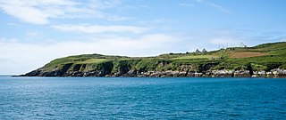
Clear Island or Cape Clear Island is an island off the south-west coast of County Cork in Ireland. It is the southernmost inhabited part of Ireland and had a population of 110 people as of the 2022 census.

Glounthaune is a village in County Cork, Ireland, some 7 kilometres (4.3 mi) east of Cork city, on the north shore of Cork Harbour, the estuary of the River Lee.
Castleknock is an affluent suburb located 8 km (5 mi) west of the centre of Dublin city, Ireland. It is centred on the village of the same name in Fingal.
The twin villages of Ballineen and Enniskeane, or Enniskean, in County Cork in Ireland are 43 km (26.72 mi) southwest of Cork City, on the R586 road. The linear settlement lies on the River Bandon between Bandon and Dunmanway. The combined settlement is designated as a 'key village' by Cork County Council for planning purposes and, as of the 2016 census, had a population of 692 people.

Aherla is a small village in County Cork, Ireland, with a population of 562. It is in the townlands of Aherla More and Rathard. Aherla is built on a limestone shelf typical of County Cork's ridges and valleys. The village is within the Cork North-West Dáil constituency.

Laytown is a village in County Meath, Ireland, located on the R150 regional road and overlooking the Irish Sea. Historically it was called Ninch, after the townland it occupies. Together with the neighbouring villages of Mornington, Bettystown and Donacarney, it comprises the census town of Laytown–Bettystown–Mornington–Donacarney, which recorded a population of 15,642 in the 2022 census.

Rathmore is a small town in County Kerry, Ireland, lying immediately west of the border with County Cork. Rathmore is divided into two parts, one being the main commercial centre, and the other being the administrative centre where the schools and churches are located which is colloquially known as Rath Beg. It lies at the heart of the Sliabh Luachra area known for its traditional Irish music and culture. The local GAA club is Rathmore GAA. The SAG is in Rathmore and helps the elderly in the area. The town host the farmer's market every Saturday in the community centre.

The villages of Killucan and Rathwire are co-located in the east of County Westmeath, Ireland. As of the 2016 census, they had a combined population of 1,370. Killucan is on the R156 road about 15 km (9.3 mi) from Mullingar and 60 km (37 mi) from Dublin.

Gort an Choirce or Gort a' Choirce, anglicised as Gortahork, is a village and townland in the northwest of County Donegal, Ireland. It is a Gaeltacht community, where the Irish language is the main language spoken in the area. Along with Falcarragh, it forms part of the district known as Cloughaneely. The nearest town is Falcarragh, 3 km to the north-east.

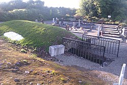
"New Inn" is a village in east County Galway, Ireland. It lies mostly within the townland of Knockbrack, 14 km (8.7 mi) northeast of Loughrea. The village is on the Eiscir Riada, a series of hills which stretches across the Great Plains of Ireland. There are many ancient forts or raths scattered throughout the parish, as represented in local placenames such as Rathally and Rathglass. The townland of Grange, to the west of New Inn, contains a cemetery wherein lies the ruins of a Cistercian monastery. The Dunkellin River flows through New Inn and rises in nearby Woodlawn.

Kilnaboy or Killinaboy is a village, townland and civil parish in County Clare, Ireland. It is located in the Burren, and as of the 2011 census the area had 347 inhabitants.

Whitegate is a small village in East Cork on the eastern shore of Cork Harbour in County Cork, Ireland. It lies within the townlands of Ballincarroonig and Corkbeg. Whitegate is within the Cork East Dáil constituency.
Derrinturn is a village in County Kildare, Ireland. It is part of the parish of Carbury. It is located about 60 km (37 mi) from Dublin.

Knockavilla is a small village in County Cork, Ireland, a few of kilometres from Crossbarry and Innishannon. The local Roman Catholic church is dedicated to Saint Patrick. There is also a school, a pub, a graveyard, and a community hall. Knockavilla Celtic is the local association football club.

Parteen is a village in County Clare, Ireland. It is situated in the townland of the same name that is part of the civil parish of St Patrick's. It is also part of an Ecclesiastical parish of "Parteen-Meelick" in the Roman Catholic Diocese of Limerick. The village has a large church, three public houses, a national school, and one shop. It is within sight of the Ardnacrusha hydroelectric power station.

Baile Ghib is a small village and Gaeltacht in County Meath, Ireland. It is about 70km northwest of Dublin city. Local Link bus route 186 was introduced in October 2024 and links the area several times daily to Kells and other villages in Meath & Cavan.
Fermoy is a historical barony in County Cork in Ireland. It is bordered by the baronies of Orrery and Kilmore to the north-west; Duhallow to the west; Barretts to the south-west; Barrymore to the south; Condons and Clangibbon to the east; and Coshlea, County Limerick to the north. It is bounded to the south by the Nagle Mountains and the valley of the Munster Blackwater. The Ballyhoura Mountains mark the northern boundary. A tributary of the Blackwater, the Awbeg has two branches in its upper stretches; one branch forms the northern boundary while the other near Buttevant, forms the western limit. To the east, lies another Blackwater tributary, the Funcheon. Anomalously, the namesake town of Fermoy is actually in the barony of Condons and Clangibbon. The town with the greatest population in the barony is Mallow.
Knockanure is a civil parish in County Kerry, Ireland. It is near the town of Listowel and the village of Moyvane.

Ladysbridge, previously known for census purposes as Knockglass, is a village in County Cork, Ireland. As of the 2016 census, the area had a population of 658 people. In 2022, Ladysbridge had a population of 809.

Rathtoe, also spelled Rathoe, is a village and townland in County Carlow, Ireland. The village is located in the civil parish of Gilbertstown, between Tullow and Ballon, County Carlow. The Burren River flows through the area. Rathtoe is a census town, and had a population of 296 as of the 2022 census.