The Drakensberg is the eastern portion of the Great Escarpment, which encloses the central Southern African plateau. The Great Escarpment reaches its greatest elevation – 2,000 to 3,482 metres within the border region of South Africa and Lesotho.

Gansbaai is a fishing town and popular tourist destination in the Overberg District Municipality, Western Cape, South Africa. It is known for its dense population of great white sharks and as a whale-watching location.

Stilbaai, also known as the Bay of Sleeping Beauty, is a town along the southern coast of South Africa about four hours by car from Cape Town. It is part of the Hessequa Local Municipality in the Western Cape province. Alternate spellings of the town's name include Still Bay.

The Cape Floral Region is a floristic region located near the southern tip of South Africa. It is the only floristic region of the Cape Floristic Kingdom, and includes only one floristic province, known as the Cape Floristic Province.

Helderberg refers to a planning district of the City of Cape Town metropolitan municipality, the mountain after which it is named, a wine-producing area in the Western Cape province of South Africa, or a small census area in Somerset West.

Springbok is the largest town in the Namaqualand area in the Northern Cape province of South Africa. It was called Springbokfontein until 1911, when it was shortened to Springbok. Springbok is located on the N7 national route which connects the Cape with Namibia, and at the western end of the N14, which connects it with Upington and Pretoria. It is the main town of the Nama Khoi Local Municipality, which also includes a number of surrounding towns such as Okiep and Nababeep.

De Hoop Nature Reserve is a nature reserve in the Western Cape Province of South Africa.

The Waterberg is a mountainous massif of approximately 654,033 hectare in north Limpopo Province, South Africa. The average height of the mountain range is 600 m with a few peaks rising up to 2000 m above sea level. Vaalwater town is located just north of the mountain range. The extensive rock formation was shaped by hundreds of millions of years of riverine erosion to yield diverse bluff and butte landform. The ecosystem can be characterised as a dry deciduous forest or Bushveld. Within the Waterberg there are archaeological finds dating to the Stone Age, and nearby are early evolutionary finds related to the origin of humans.

The Kogelberg is a range of mountains along the False Bay coast in the Western Cape of South Africa. They form part of the Cape Fold Belt, starting south of the Elgin valley and forming a steep coastal range as far as Kleinmond.
CapeNature is a governmental organisation responsible for maintaining wilderness areas and public nature reserves in Western Cape Province, South Africa.
Pinnacle Point a small promontory immediately south of Mossel Bay, a town on the southern coast of South Africa. Excavations since the year 2000 of a series of caves at Pinnacle Point have revealed occupation by Middle Stone Age people between 170,000 and 40,000 years ago. The focus of excavations has been at Cave 13B (PP13B), where the earliest evidence for the systematic exploitation of marine resources (shellfish) and symbolic behaviour has been documented, and at Pinnacle Point Cave 5–6 (PP5–6), where the oldest evidence for the heat treatment of rock to make stone tools has been documented. The only human remains have been recovered from younger deposits at PP13B which are c. 100,000 years old.

De Hel Nature Area is a 21.3-hectare (53-acre) nature reserve protecting a river valley and indigenous forest on the lower eastern slopes of Table Mountain, Cape Town, South Africa.

Macassar Dunes Conservation Area is a 1,116-hectare (2,760-acre) coastal nature reserve in Macassar, within the City of Cape Town, South Africa.

Kogelberg Nature Reserve is a nature reserve of 3,000 ha comprising the Kogelberg Mountain Range, to the east of Cape Town, South Africa.
The Cape Winelands Biosphere Reserve is located in the Western Cape Province of South Africa approximately 40 km east of Cape Town. The Biosphere Reserve extends from the Kogelberg Biosphere Reserve in the south, northwards along the Cape Fold Belt Mountain Chain and the adjoining valleys constituting the Cape Winelands. The Biosphere Reserve incorporates key portions of the registered Cape Floral Region Protected Areas World Heritage Site. The Reserve was designated in 2007.

The Gamkaberg Nature Reserve is situated in the Little Karoo region of the Western Cape province, South Africa.
The Kammanassie Mountains are a mountain range in the Western Cape, South Africa. The highest peak is Mannetjiesberg at 1,955 metres above sea level and the mountain range is one of the prominent east-west trending ranges composing the southern branch of the Cape Fold Belt.

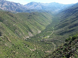
The Swartberg Nature Reserve is a protected area in the Western Cape province of South Africa. This 1210 km2 protected area is part of the Cape Floral Region Protected Areas World Heritage Site. It is administered by CapeNature.


