Maxie, Mississippi | |
---|---|
Coordinates: 30°58′41″N89°11′45″W / 30.97806°N 89.19583°W Coordinates: 30°58′41″N89°11′45″W / 30.97806°N 89.19583°W | |
Country | United States |
State | Mississippi |
County | Forrest |
Time zone | UTC-6 (Central (CST)) |
• Summer (DST) | UTC-5 (CDT) |
GNIS feature ID | 693891 [1] |
Maxie is an unicorporated area in Forrest County, Mississippi. It lies within the De Soto National Forest and was a stop on the Gulf and Ship Island Railroad (G&SIRR). It had a post office from 1900 until 1967. [2] In 1964 it had a population of 125. [3] William Henry Bucklew, who became mayor of Laurel, Mississippi and published the Southern Baptist News, was born in Maxie. [4] Beaverdam Creek runs through Maxie. [5]
In the early 1900s, at the height of the timber boom in Mississippi, the G&SIRR built a loop off the main railroad line so as to connect Maxie to Mendenhall, Mississippi. [6] At that time, the town of Maxie was reported to be prosperous. [7]
Camp and Hinton Company built a rail line for forest products terminating in Maxie. [8] Operation of the line changed hands several times and varied from forest products to freight and passengers. By about 1930, the area's forests had been depleted. [9]
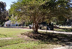
Once the virgin pine resource was exhausted in south Mississippi, small towns like Maxie, that depended on commerce in forest products, faded rapidly. In 2019, a church and cemetery were the only features bearing the Maxie name.
Nesbit is an unincorporated community in DeSoto County, Mississippi, United States. Nesbit is approximately 7 miles (11 km) south of Horn Lake, approximately 9 miles (14 km) south of Southaven and approximately 5 miles (8.0 km) north of Hernando near U.S. Route 51 and Interstate 55. Nesbit is located on the former Illinois Central Railroad.
Perthshire is an unincorporated community located in Bolivar County, Mississippi, United States along Mississippi Highway 1. Perthshire is approximately 5 miles (8.0 km) south of Deeson and approximately 3 miles (4.8 km) north of Gunnison. Perthshire is located on the Riverside Division of the former Yazoo and Mississippi Valley Railroad. Perthshire was once home to six general stores.
Rich is an unincorporated community in Coahoma County, Mississippi, United States.
Lakeshore is an unincorporated community on the western end of Hancock County, Mississippi. It is part of the Gulfport–Biloxi, Mississippi Metropolitan Statistical Area.
Round Lake, also spelled Roundlake, is an unincorporated community located in Bolivar County, Mississippi, United States along Mississippi Highway 1. Round Lake is approximately 7 miles (11 km) west of Duncan and approximately 2 miles (3.2 km) north of Deeson. Round Lake is located on the former Yazoo and Mississippi Valley Railroad. Round Lake was formerly home to three general stores and two grocery stores.
Clover Hill is an unincorporated community located in Coahoma County, Mississippi, United States. Clover Hill is approximately 4 miles (6.4 km) north of Lyon and approximately 4 miles (6.4 km) south of Rudyard. The community is located on the former plantation of J. T. Fargason. Clover Hill once had a depot on the former Yazoo and Mississippi Valley Railroad. A post office operated under the name Clover Hill from 1884 to 1935.
Howard is an unincorporated community located in Holmes County, Mississippi and is approximately 5 miles (8.0 km) south of Tchula. The community was once a stop on the Yazoo and Mississippi Valley Railroad. Howard was incorporated in 1888 but lost that status at an unknown date. A post office operated under the name Howard from 1887 to 1920.
Elliott is an unincorporated community and census-designated place (CDP) in Grenada County, Mississippi, United States, and part of the Grenada Micropolitan Statistical Area. As of the 2010 census it had a population of 990.
Hardy is an unincorporated community located in Grenada County, Mississippi and part of the Grenada Micropolitan Statistical Area. Hardy is approximately 10 miles (16 km) north of Grenada near Interstate 55.
LeFlore is an unincorporated community located in Grenada County, Mississippi, United States and part of the Grenada Micropolitan Statistical Area. LeFlore is approximately 10 miles (16 km) south of Holcomb, Mississippi and approximately 3 miles (4.8 km) north of Avalon, Mississippi on Mississippi Highway 7.
Gallman, also known as Wyoming, is an unincorporated community in Copiah County, Mississippi, United States. Gallman is located along Interstate 55 and U.S. Route 51 4.25 miles (6.84 km) south-southwest of Crystal Springs. Gallman has a post office with ZIP code 39077, which opened on November 8, 1872.
Carlisle is an unincorporated community in Claiborne County, Mississippi, United States.
Wildwood is a ghost town in Coahoma County, Mississippi, United States.
Comeby is a ghost town in Rankin County, Mississippi, United States.
Success is a ghost town in Jasper County, Mississippi, United States.
Wingate is an unincorporated community located in Perry County, Mississippi.
Martinsville is an unincorporated community in Copiah County, Mississippi, United States. Martinsville is located on the former Illinois Central Gulf Railroad. Martinsville was named for B. F. Martin, a former postmaster.
Knoxville is an unincorporated community in Franklin County, Mississippi, United States.
Shipman is an unincorporated community in George County, Mississippi. Prior to the creation of George County, Shipman was located in Jackson County. The community was originally called Brushy, but the name was changed to Shipman in 1907. Shipman is likely named for William A. Shipman, who moved to the community from Georgia and operated a sawmill in the area.
Point is an unincorporated community in Lauderdale County, Mississippi, United States. Its ZIP code is 39323.