
Washington Township is one of fourteen townships in Morgan County, Indiana, United States. As of the 2010 census, its population was 17,073 and it contained 7,171 housing units. The township contains a portion of the Morgan–Monroe State Forest.
Bloomington Township is one of eleven townships in Monroe County, Indiana, United States. As of the 2010 census, its population was 44,167 and it contained 15,346 housing units.
McVille is an unincorporated community in Beech Creek Township, Greene County, Indiana.
Hazelwood is an unincorporated community in Liberty Township, Hendricks County, Indiana.
Donaldson is an unincorporated community in West Township, Marshall County, Indiana.
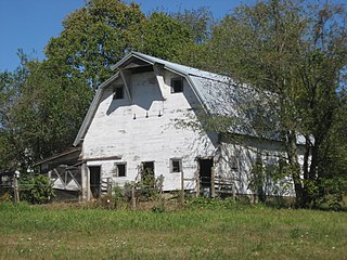
Miller is an unincorporated community in Madison Township, Morgan County, in the U.S. state of Indiana.

Cunot is an unincorporated community in Jackson Township, Owen County, in the U.S. state of Indiana. It lies near the intersection of Indiana Highway 42 and Indiana Highway 243, which is a community about twenty miles north of the city of Spencer, the county seat of Owen County. Its elevation is 722 feet, and it is located at 39°27′23″N86°51′17″W. Although this community is located within Owen County on its northern boundary, it has an address of Cloverdale, Indiana in Putnam County, which is about six miles northeast of the community.
Denmark is an unincorporated community in the southwest portion of Marion Township, Owen County, in the U.S. state of Indiana. It lies near the intersection of County Road 1400 West and County Road 150 South, which is a community about fifteen miles west of the city of Spencer, the county seat of Owen County. Its elevation is 722 feet, and it is located at 39°16′11″N87°1′33″W.
Farmers is an unincorporated community in the southwest corner of Franklin Township, Owen County, in the U.S. state of Indiana. It lies just south of US Highway 231 at the intersection of 650 West, which is a community about twelve miles south of the city of Spencer, the county seat of Owen County. Its elevation is 591 feet, and it is located at 39°10′31″N86°53′30″W. This community is also known as Farmers Station.
Freeman is an unincorporated community in the center of Clay Township, Owen County, in the U.S. state of Indiana. It lies near the intersection of County Road 650 South and Indiana Highway 43, which is a community nearly nine miles south of the city of Spencer, the county seat. Its elevation is 541 feet (165 m), and it is located at 39°11′44″N86°44′1″W.
Lewisville is an unincorporated community in the northeast corner of Harrison Township, Owen County, in the U.S. state of Indiana. It lies near the intersection of County Road 700 East and West Lewisville Road, which is a community about twenty miles northeast of the city of Spencer, the county seat. Its elevation is 771 feet, and it is located at 39°28′16″N86°37′55″W. This community lies on the border of Owen County and Morgan County.
New Hope is an unincorporated community in the southeast corner of Franklin Township, Owen County, in the U.S. state of Indiana. It lies near the intersection of County Road 740 South and County Road 285 West, which is a community about nine miles southwest of the city of Spencer, the county seat. Its elevation is 522 feet, and it is located at 39°10′59″N86°49′40″W.
Maxville is an unincorporated community in Huff Township, Spencer County, in the U.S. state of Indiana.
Jackson is an unincorporated community in Otter Creek Township, Ripley County, in the U.S. state of Indiana.
Cary is an unincorporated community in Monroe Township, Putnam County, in the U.S. state of Indiana.
Woodcrest is an unincorporated community in Washington Township, Morgan County, in the U.S. state of Indiana.
Wolff is an unincorporated community in Washington Township, Morgan County, in the U.S. state of Indiana.
Shelburne is an unincorporated community in Washington Township, Morgan County, in the U.S. state of Indiana.
Taggart Crossing is an unincorporated community in Washington Township, Morgan County, in the U.S. state of Indiana.
Turkey Track is an unincorporated community in Baker Township, Morgan County, in the U.S. state of Indiana.


