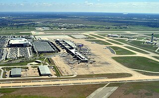
McKinney National Airport

Last updated
McKinney National Airport
McKinney Airport 2020 January.jpg
McKinney National Airport control tower and unfinished new terminal, January 2020
Summary
Airport typePublic
OwnerCity of McKinney
Serves Collin County, Texas
Elevation  AMSL 589 ft / 180 m
Coordinates 33°10′41″N096°35′26″W / 33.17806°N 96.59056°W / 33.17806; -96.59056
Maps
TKI airport map.PNG
FAA airport diagram
Relief map of Texas.png
Airplane silhouette.svg
TKI
Usa edcp relief location map.png
Airplane silhouette.svg
TKI
McKinney National Airport
Runways
Direction LengthSurface
ftm
18/367,0022,134Concrete
Statistics (2023)
Aircraft operations142,001
Based aircraft203

McKinney National Airport( ICAO : KTKI, FAA LID : TKI), formerly Collin County Regional Airport at McKinney, is a general aviation airport located in McKinney, Texas, United States, about 30 miles north of downtown Dallas.

Contents

The airport is a reliever airport for Dallas Love Field and Dallas/Fort Worth International Airport. It is owned by the City of McKinney and is home to many business aircraft, including the aircraft fleets of corporations such as Texas Instruments and Toyota Motor Corporation that are headquartered in nearby cities. [2] It is an air base for PHI Air Medical which provides 24-hour emergency helicopter ambulance service. The only fixed-base operator (FBO) on the field is the city-run McKinney Air Center. There are three flight schools operated at the airport: Airplanes and Attitude, ATP, Grayhawk Flight Training. The airport housed Civil Air Patrol Texas Wing 295th Squadron from 2013 to 2014.

History

In the 1970s, the FAA proposed building the region's third major commercial airport, providing commercial air service to the fast-growing northern part of the Dallas–Fort Worth metroplex, in McKinney. This failed after local voters rejected a $50 million bond needed to build the new airport facility. [2]

A regional airport was established in McKinney in 1979. [3] Initially opened with a 4,000 foot runway, its length was extended to 5,800 feet in 1984. [4]

In 2011, McKinney National Airport added a new 78-foot tall contract FAA air traffic control tower equipped with the latest in radar, radio and voice switch technology. In 2012, a new 7,000 foot long, 150 foot wide runway was completed that can handle large aircraft, with a maximum capacity of 450,000 pounds. [4]

On November 1, 2013, the airport was purchased from Collin County by the City of McKinney for $25 million. [5] The McKinney City Council approved changing the airport's name from Collin County Regional Airport to McKinney National Airport later that month. [3]

In 2018, a project to build a new executive terminal at McKinney National Airport began, which was originally slated to be completed in 2019. In September 2019, completion was delayed until 2020 as the city and the construction contractor worked on modifications to the terminal's exterior. [6]

In 2019, the airport received a $15 million grant from the Texas Department of Transportation to extend its runway an additional 1,500 feet (from 7,000 feet to 8,500 feet). [2]

In 2023, the city proposed issuing $200 million in bonds which, when combined with other funding, would allow the airport to become the Dallas-Fort Worth area's third major commercial airport. [7] However, the bond issue was defeated at the polls, with 58.69% of voters voting against it. [8]

Facilities

McKinney National Airport covers 778 acres (315 ha) at an elevation of 589 feet (180 m). The concrete runway is 18/36, 7,002 feet (2,134m) long by 150 feet (46m) with a weight-bearing capacity of 450,000 pounds double tandem. It has high intensity runway lights, MALSR approach lights to Runway 18 and MALS approach lights to Runway 36, PAPI lights for runways 18 and 36, a runway 18 ILS Category I approach and RNAV approaches to both 18 and 36.

The airport has vehicle rental and US Customs services for international flights.

In the year ending December 31, 2023, the airport had 142,001 aircraft operations, an average of 389 per day: 93% general aviation, 6% air taxi and <1% military. 203 aircraft were then based at this airport: 144 single-engine, 26 multi-engine, 30 jet and 3 helicopter. [1]

The airport has a contract FAA control tower open between 6:00 a.m. and 10:00 p.m.

See also

Related Research Articles

<span class="mw-page-title-main">Austin–Bergstrom International Airport</span> Civilian airport serving Austin, Texas, United States

Austin–Bergstrom International Airport, or ABIA, is an international airport in Austin, Texas, United States, serving the Greater Austin metropolitan area. Located about 5 miles southeast of downtown Austin, it covers 4,242 acres (1,717 ha) and has two runways and three helipads.

Tallahassee International Airport Airport in Florida, U.S.

Tallahassee International Airport is a city-owned airport five miles southwest of downtown Tallahassee, in Leon County, Florida, United States. It serves the state capital of Florida, and its surrounding areas; it is one of the major airports in north Florida, the others being Pensacola, Destin–Fort Walton Beach, Northwest Florida Beaches, and Jacksonville. Despite its name, it does not service any international destinations.

<span class="mw-page-title-main">Yeager Airport</span> Airport in Kanawha County, West Virginia

West Virginia International Yeager Airport is a public airport 3 miles (4.8 km) east of downtown Charleston, in unincorporated Kanawha County, West Virginia, United States. It is owned by the Central West Virginia Regional Airport Authority. The airport hosts McLaughlin Air National Guard Base, home to eight C-130 Hercules aircraft of the West Virginia Air National Guard's 130th Airlift Wing, an Air Mobility Command (AMC)-gained unit of the West Virginia Air National Guard.
<span class="mw-page-title-main">Greater Binghamton Airport</span> Airport in New York, United States

Greater Binghamton Airport is a county-owned American airport eight miles north of Binghamton, in Broome County, New York. It is in East Maine, New York and serves the Southern Tier of New York.

<span class="mw-page-title-main">Easterwood Airport</span> Regional airport in Texas, United States

Easterwood Airport is a regional airport in College Station, Texas, serving Texas A&M University, Bryan-College Station, and Brazos County, Texas. Accessed via FM 60, it is 3 miles (4.8 km) southwest of the center of College Station, and 0.25 miles (0.40 km) from Texas A&M University. There is no public transportation from Easterwood Airport to the surrounding cities; however, in the fall of 2019, a new university bus route was established to connect Easterwood Airport with the Engineering Quad and the Texas A&M Hotel and Conference Center. The airport bus route is ostensibly available only to those with a University ID or Brazos Transit District ID, however, this requirement is not enforced. Despite owning and managing the airport, the university offers no aviation courses.

<span class="mw-page-title-main">Blue Grass Airport</span> Public airport in Fayette County, Kentucky, U.S.

Blue Grass Airport is a public airport in Fayette County, Kentucky, United States, 6 miles west of downtown Lexington. Located among horse farms and situated directly across from Keeneland Race Course, Blue Grass Airport is the primary airport serving central and eastern Kentucky. More than 1.3 million passengers depart or arrive annually at Blue Grass Airport. In 2017, the airport served 1,316,847 passengers via four major airline carriers: Allegiant Air, American Airlines, Delta Air Lines, and United Airlines.
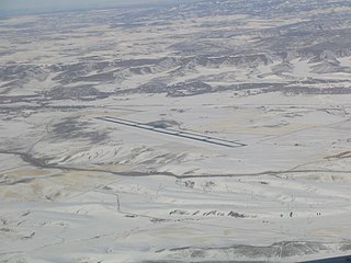
<span class="mw-page-title-main">Yampa Valley Airport</span> Airport in Colorado, United States of America

Yampa Valley Regional Airport is in Routt County, Colorado, United States, serving the communities of Steamboat Springs, Hayden, and Craig, Colorado. The airport is two miles southeast of Hayden, about 20 miles east of Craig and about 25 miles (40 km) west of Steamboat Springs. It has the only scheduled passenger flights in northwest Colorado. It is also used by larger business jets that cannot use the smaller Steamboat Springs Airport.

<span class="mw-page-title-main">Columbia Regional Airport</span> Airport in Missouri, United States of America

Columbia Regional Airport is a commercial passenger airport serving Columbia, Missouri. Located about 12 miles (19 km) southeast of Columbia in Boone County, Missouri, it is the only commercial airport in Mid-Missouri and also serves the state capital of Jefferson City. As of 2022, commercial passenger service is provided by American Airlines subsidiary American Eagle. The airport opened in 1968, replacing the Columbia Municipal Airport off of Interstate 70. It is frequently used for charter flights by college athletic teams visiting the University of Missouri and for MU team flights.

<span class="mw-page-title-main">Montgomery Regional Airport</span> Airport

Montgomery Regional Airport is a civil-military airport seven miles southwest of Montgomery, the capital of Alabama. Owned by the Montgomery Airport Authority, it is used for general aviation and military aviation, and sees two airlines.

<span class="mw-page-title-main">Pellston Regional Airport</span> Airport

Pellston Regional Airport, also known as Pellston Regional Airport of Emmet County, is a public airport located one mile (1.6 km) northwest of the central business district of Pellston, a village in Emmet County, Michigan, United States. It is included in the Federal Aviation Administration (FAA) National Plan of Integrated Airport Systems for 2017–2021, in which it is categorized as a non-hub primary commercial service facility.

East Texas Regional Airport is an airport located in an unincorporated area, in Gregg County, Texas, United States. The airport is just south of the city of Lakeport, and is 9 mi south of Longview. Its IATA identifier GGG comes from its prior name, Gregg County Airport. The airport is used for general aviation and military training; it has scheduled flights to Dallas/Fort Worth on American Airlines/American Eagle.

<span class="mw-page-title-main">Addison Airport</span> Public airport in Addison, Dallas County, Texas

Addison Airport is a public airport in Addison, in Dallas County, Texas, United States, 9 mi north of downtown Dallas. It opened in 1954 and was purchased by the town of Addison in 1976.

<span class="mw-page-title-main">Scholes International Airport at Galveston</span> Airport

Scholes International Airport at Galveston is three miles southwest of Galveston, in Galveston County, Texas, United States. The National Plan of Integrated Airport Systems for 2011–2015 categorized it as a reliever airport.

<span class="mw-page-title-main">Sherman Municipal Airport</span> Airport

Sherman Municipal Airport is a city-owned public airport located 1 mile (1.6 km) mile southeast of the central business district of Sherman, in Grayson County, Texas.

<span class="mw-page-title-main">Auburn University Regional Airport</span> Airport in Auburn, Alabama

Auburn University Regional Airport with the Robert G. Pitts Field is a public use airport located two nautical miles (4 km) east of the central business district of Auburn, a city in Lee County, Alabama, United States. The airport is owned by Auburn University and was formerly known as Auburn–Opelika Robert G. Pitts Airport. It is included in the National Plan of Integrated Airport Systems for 2011–2015, which categorized it as a general aviation facility.

<span class="mw-page-title-main">Davenport Municipal Airport (Iowa)</span> Airport

Davenport Municipal Airport is a general aviation airport located about 7 miles (11 km) north of downtown Davenport, a city in Scott County, Iowa, United States. The airport, which dates back to 1948, has been home to the Quad City Air Show since 1987.

Mesquite Metro Airport is a public use airport in Dallas County, Texas, 3 nautical miles (5.6 km) east of the central business district of Mesquite. The airport is west of the border of Dallas County and Kaufman County.

<span class="mw-page-title-main">Tokeen Seaplane Base</span> Airport

Tokeen Seaplane Base is a public use seaplane base located in Tokeen, in the Prince of Wales-Hyder Census Area in the U.S. state of Alaska.

<span class="mw-page-title-main">Northwest Florida Beaches International Airport</span> Airport serving Panama City, Florida, United States

Northwest Florida Beaches International Airport is a public airport 18 miles (29 km) northwest of Panama City, Florida, United States, in Bay County. The airport is owned by the Panama City-Bay County Airport & Industrial District, and is north of Panama City Beach, near West Bay. It replaced Panama City–Bay County International Airport, which was located in Panama City.

Aero Country Airport is a privately owned public airport 4 nautical miles (7.4 km) west of the central business district of McKinney, Texas, United States. The airport has no IATA or ICAO designation.

References

  1. 1 2 FAA Airport Form 5010 for TKI PDF , effective January 25, 2024.
  2. 1 2 3 Arnold, Kyle (November 8, 2019). "McKinney Airport gets $15 million to extend runway". The Dallas Morning News . Retrieved January 25, 2020.
  3. 1 2 "1997-2017 Update to FAA Historical Chronology: Civil Aviation and the Federal Government, 1926-1996 (Washington, DC: Federal Aviation Administration, 1998)" (PDF). Federal Aviation Administration. p. 193. Retrieved January 25, 2020.
  4. 1 2 "Historical Timeline". McKinney National Airport. Retrieved January 25, 2020.
  5. "City of McKinney Takes Over Operations at Collin County Regional Airport McKinney Air Center Begins Operations". AviationPros.com. November 1, 2013. Retrieved November 6, 2013.
  6. Davis, Emily (September 3, 2019). "Completion of new McKinney National Airport terminal rescheduled for January". Community Impact Newsletter. Retrieved January 25, 2020.
  7. "McKinney voters to decide on $200M airport bond to lure commercial air service". 8 February 2023.
  8. Henvey, Audrey (16 May 2023). "McKinney mayor outlines next steps after airport bond item fails". McKinney Courier-Gazette . Retrieved 2023-08-22.