Meenja

Last updated

Meenja
Village
India Kerala location map.svg
Red pog.svg
Meenja
Location in Kerala, India
India location map.svg
Red pog.svg
Meenja
Meenja (India)
Coordinates: 12°42′30″N74°57′0″E / 12.70833°N 74.95000°E / 12.70833; 74.95000
CountryFlag of India.svg  India
State Kerala
District Kasaragod
Taluk Manjeshwaram
Government
  BodyGram Panchayath
Area
  Total44.9 km2 (17.3 sq mi)
Population
 (2011)
  Total23,318
  Density520/km2 (1,300/sq mi)
Languages
  Official Malayalam, English [1]
Time zone UTC+5:30 (IST)
PIN
671323
Telephone code04998
Vehicle registration KL-14
Nearest cityUppala
Sex ratio 100-91 /
Literacy87.5 %
Lok Sabha constituencyKasaragod
Vidhan Sabha constituencyManjeshwaram

Meenja is a grama Panchayat in Manjeshwaram Taluk of Kasaragod district in the state of Kerala, India. It consists of 7 revenue villages. Kaliyoor, Koliyoor, Talakala, Meenja, Kadambar, Moodambail and [Kuloor]

Contents

Demographics

As of 2011 Census, Meenja village had a population of 4,144 with 2,044 males and 2,100 females. Meenja village has an area of 10.16 km (6.31 mi) with 826 families residing in it. In Meenja, 11.1% of the population was under 6 years of age. Average literacy of Meenja village was 86.6% higher than the national average of 74% and lower than state average of 94%: among which 92.1% were male literates and 81.2% were female literates.

Meenja Grama Panchayat had 23,318 population among which 11,406 are males and 11,912 are females. Total number of households is 4,527 in the panchayat limits. Overall literacy rate was 87.5% lower than state average of 94%. [2]

Transportation

You can reach Miyapadav from Hosangadi and Uppala through local bus transportation. Local roads have access to National Highway No.66 which connects to Mangalore in the north and Kasaragod in the south. The nearest railway station is Manjeshwar and Uppala railway station on Mangalore-Palakkad line. The nearest airport is at Mangalore.

Languages

This locality is an essentially multi-lingual region. The people speak Malayalam, Kannada, Tulu, Beary bashe and Konkani. Migrant workers also speak Hindi and Tamil languages.

Administration

This village is part of Manjeswaram assembly constituency which is again part of Kasaragod (Lok Sabha constituency)

Related Research Articles

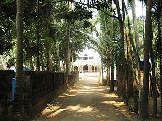
Padne is a village in the southernmost part of the Kasaragod district, state of Kerala, India.

<span class="mw-page-title-main">Udma</span> Census Town in Kerala, India

Udma is a census town in Kasaragod district in the Indian state of Kerala.

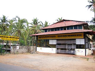
Kuttikole is a village and Gram Panchayat in the Kasaragod district in the Indian state of Kerala.

<span class="mw-page-title-main">Badiyadka</span> Town in Kerala, India

Badiyadka officially known as "Badiadka" is a town and gram panchayat in the Kasaragod district, state of Kerala, India.

Balal is a village and a Grama Panchayat in Kasaragod district in the state of Kerala, India.

<span class="mw-page-title-main">Bandadka</span> Small Town in Kerala, India

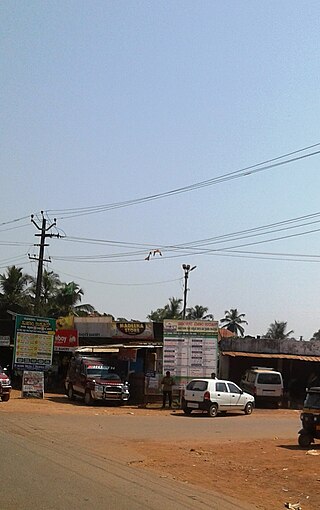
Bandadka is a small town in Kasaragod district in the state of Kerala, India. It is also called Kottakal because of Bandadka Fort. It comes under Kuttikole Grama Panchayat. It is located 38 km (24 mi) towards east from the District headquarters Kasaragod, 568 km (353 mi) away from the State capital Thiruvananthapuram, 5 km (3.1 mi) west of Karnataka border and 20 km (12 mi) away from Sullia. Bandadka's pin code is 671541 and it's postal head office is Chengala.

Bedakam is a village in Kasaragod district in the state of Kerala, India.

<span class="mw-page-title-main">Delampady</span> Village in Kerala, India

Delampady is a village and Grama Panchayat in Kasaragod district in the state of Kerala, India.

<span class="mw-page-title-main">Karadka</span> Village in Kerala, India

Karadka is a village, block panchayat and grama panchayat in Kasaragod district in the state of Kerala, India.

Karindalam is a village in Kasaragod district in the state of Kerala, India.

<span class="mw-page-title-main">Mangalpady</span> Panchayat in Kerala, India

Mangalpady is a Grama Panchayat in Kasaragod district, Kerala. Uppala is the major town in this panchayat.

<span class="mw-page-title-main">Paivalike</span> Village in Kerala, India

Paivalike is a village in Kasaragod district in the state of Kerala, India. Paivalike is 11 km (6.8 mi) east of Uppala town and 40 km (25 mi) south of Mangalore city.

<span class="mw-page-title-main">Vorkady</span> Gram Panchayat in Kerala, India

Vorkady is a Gram Panchayat in Kasaragod district in the state of Kerala, India.

Kadambar is a village in Kasaragod district in the state of Kerala, India.

<span class="mw-page-title-main">Pallikkara, Bekal</span> Village in Kerala, India

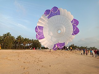
Pallikkara is a census town and a grama panchayat in Hosdurg Taluk of Kasargod district in the state of Kerala, India. This place was once famous for its Tobacco plants until the late 1980s and the Historical landmark Bekal Fort lies in this Village. A beach park near to the fort also attracts tourists to this place.

<span class="mw-page-title-main">Perla, Kasaragod</span> Town in Kerala, India

Perla is an administrative capital of Enmakaje Panchayat, which is in Kasaragod district, Kerala, India.

Adoor is a village in Kasaragod district in the Indian state of Kerala. Adoor is located 38 km east of Kasaragod town and 7 km away from State Highway 55 or Cherkala-Jalsoor road.

<span class="mw-page-title-main">Kallar (Kasaragod)</span> Village in Kerala, India

Kallar is a village in Kasaragod district in the Indian state of Kerala. Kallar is located on Kanhangad-Panathur road of 40 km south east of Kasaragod town and 27 km north east of Kanhangad.

Kolthur is a village in Kasaragod taluk of Kasaragod district in Indian state of Kerala.

Thimiri is a village in Hosdurg taluk of Kasaragod district in Kerala state, India. Thimiri is located 3 km east of Cheruvathur on Cheruvathur-Cheemeni road.

References

  1. "The Kerala Official Language (Legislation) Act, 1969" (PDF).
  2. Kerala, Directorate of Census Operations. District Census Handbook, Kasaragod (PDF). Thiruvananthapuram: Directorateof Census Operations,Kerala. p. 80,81,120,121. Retrieved 14 July 2020.