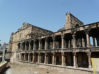
Jaunpur is a city and a municipal board in Jaunpur district in the Indian state of Uttar Pradesh. It is located 228 km southeast of state capital Lucknow. Demographically, Jaunpur resembles the rest of the Purvanchal area in which it is located.

Sultanpur district is a district in the Awadh region of the Indian state of Uttar Pradesh. This district is a part of Ayodhya division of the state. The administrative headquarters of the district is Sultanpur city. The total area of Sultanpur district is 2672.89 Sq. km.

Ambedkar Nagar is one of the 75 districts of the Indian state of Uttar Pradesh. This district is a part of Ayodhya division in the Awadh region of the state. This district was established on 29 September 1995 by carving out parts of the erstwhile Faizabad district. It was created by the then Chief Minister Mayawati and named in memory of B. R. Ambedkar, who worked for the advancement of the depressed classes. The total area of Ambedkar Nagar district is 2350 Sq. Km.

Jaunpur district is a district in the Varanasi Division of the Indian state of Uttar Pradesh. The district headquarters is the city of Jaunpur which is situated on the banks of the Gomti River. It is located 228 km southeast of the state capital Lucknow. 65 km northwest of Varanasi and 732 km southeast of New Delhi. The district has two Lok Sabha seats and nine Vidhan Sabha seats. According to the 2011 census, Jaunpur has a gender ratio of 1,018 females to 1,000 males, the highest in Uttar Pradesh. The most commonly spoken language in the district is Hindi.
Rath is a small town with a municipal board in Hamirpur district in the Indian state of Uttar Pradesh. Rath is a Tehsil of Hamirpur District. It is situated 506 km southeast of New Delhi.
Pilkichha is a village in Khutahan, Jaunpur district, Varanasi division, Uttar Pradesh, India.
Saraibeeru is a village in India, located near the Kerakat in the Jaunpur district in the state of Uttar Pradesh. The village is 30 km (19 mi) from Jaunpur.
Pataura is a village in Jaunpur, Uttar Pradesh, India. According to a 2011 census, the total population is 2513.
Behra is a village in Jaunpur, Uttar Pradesh, India.
Nigoh is a village located in the Jaunpur district of Uttar Pradesh, India.
Dataon is a village in Jaunpur, Uttar Pradesh, India.
Usraon (Mariyahu) is a town and nagar panchayat in Jaunpur district in the Indian state of Uttar Pradesh. It is one of the six tahsils of Jaunpur District; the others are Jaunpur City, Shahganj, Machalishahar, Badlapur and Kerakat.
Goshainganj, also known as Gosainganj, is a town and nagar panchayat in the Ayodhya district of the Indian state of Uttar Pradesh. Located 32 km from the district headquarters Ayodhya, Goshainganj has one of the oldest markets of the district.
Hardasipur is a village in Jaunpur district, Uttar Pradesh, India.
Huruhuri is a village about 2 km north from the Gomti River in the tehsil of Kerakat, Jaunpur, Uttar Pradesh, India. It belongs to the Varanasi Division. It is located 25 km east of the city of Jaunpur, 4 km west of Kerakat, and 274 km from Lucknow, the capital of Uttar Pradesh. Hurhuri's Postal Index Number is 222142 and the postal head office is situated in Kerakat and Branch Office is JaiGopalGanj. Huruhuri is situated Near State Highway 36.
Pasiyahi Kala is a village in Ram Nagar Block in Jaunpur District of Uttar Pradesh state, India. It belongs to Varanasi Division. It is located 25 kilometres (16 mi) south of the district headquarters at Jaunpur, 14 kilometres (8.7 mi) from Ram Nagar, and 267 kilometres (166 mi) from the state capital at Lucknow. The Postal Head office Jalalpur and B.o Pasiyahi Khurd.
Bhadon is a village and Gram Panchayat located in Martinganj tehsil of the Azamgarh District in the Indian state of Uttar Pradesh, near the border with Jaunpur District. It is 37.7 kilometres (23.4 mi) north-east of the district headquarters in Azamgarh and 229.9 kilometres (142.9 mi) from the state capital of Lucknow.

Bisauri is a village of the Jaunpur district, Uttar Pradesh, Northern India. Bisauri's Postal Index Number is 222129 and its post office is at Patrahi. The village is also a Gram Panchayat, comprising itself and the village of Tiwaripur.

Jalalpur Dhai is a village in Deenshah Gaura block of Rae Bareli district, Uttar Pradesh, India. It is located a short distance north of the Ganges, on the road from Dalmau to Mustafabad. As of 2011, it has a population of 5,520 people, in 966 households. It has one primary school and no healthcare facilities. Jalalpur Dhai hosts markets twice per week, on Wednesdays and Sundays, with cloth and vegetables being the main items traded.

Kalu Jalalpur is a village in Salon block of Rae Bareli district, Uttar Pradesh, India. It is located 38 km from Raebareli, the district headquarters. As of 2011, Kalu Jalalpur has a population of 1,653 people, in 269 households. It has one primary school and no healthcare facilities, as well as a sub post office. It does not host a permanent market or a periodic haat.


