
Ballia is a city with a municipal board in the Indian state of Uttar Pradesh. The eastern boundary of the city lies at the junction of two major rivers, the Ganges and the Ghaghara. The city is situated 140 km (87 mi) east of Varanasi and about 380 km from the state capital Lucknow. It is home to a protected area, the Jai Prakash Narayan bird sanctuary. Ballia is around 4 km (2.5 mi) from Bihar.
Azizpur is a census town in Agra district in the state of Uttar Pradesh, India.
Dhanuha is a census town in Jaunpur district in the state of Uttar Pradesh, India.
Dhanauli is a census town in Agra district in the Indian state of Uttar Pradesh, India.
Dostpur is a town and a nagar panchayat in Sultanpur district in the state of Uttar Pradesh, India. The town borders Sultanpur and Ambedkarnagar. Purvanchal Expressway passes near the town.
Jalalpur is a town, tehsil and a municipal board in Ambedkar Nagar district in the Indian state of Uttar Pradesh, India.
Jattari is a town. It comes under Khair Tehsil of Aligarh district in the Indian state of Uttar Pradesh. It lies on Aligarh–Palwal highway, 45 km ahead from Aligarh towards Palwal.
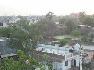
Kerakat or Kirakat is a town and nagar panchayat in Jaunpur district of the Indian state of Uttar Pradesh with a population of approximately 13,500. It is situated near the Gomati River, which helps the land around the town stay very fertile. Kerakat or Kirakat forms a part of Varanasi Division. It is located 30 km east of the city of Jaunpur and 279 km from Lucknow, the capital of Uttar Pradesh.
Kiraoli is a town and a nagar panchayat in Agra district in the Indian state of Uttar Pradesh.
Lal Gopalganj Nindaura is a town and a nagar panchayat in Prayagraj district in Indian state of Uttar Pradesh.
Mariahu (Mariyahu) is a town and a nagar panchayat in Jaunpur district in the Indian state of Uttar Pradesh. Its name Mariahu was given by Nanwag (Nandwak) king Naun Rao in 16th century on the name of Mandav Deo, the patreon deity of the Nanwag clan. The samadhi of Mandav dev is situated near to Chutka Devi temple which is in the east of tehsil. Mostly tehsil was ruled by Nanwag Rajputs who were the local rulers during 16th and 17th century. Baghi Sangram Singh a leader of the Nanwags revolted against the British East India company during the revolt of 1857 and defeated them on several occasions. It is one of the six tehsils of Jaunpur district, with the others being Jaunpur city, Shahganj, Machalishahar, Badlapur and Keraket.
Mehnagar is a town and a nagar panchayat in Azamgarh district in the Indian state of Uttar Pradesh.
Nainana Jat is a census town in Agra district in the Indian state of Uttar Pradesh.
Pinahat is a town and a nagar panchayat in Agra district in the Indian state of Uttar Pradesh and situated on the Bank of Chambal River. It is about 55 km from Agra. The distance between Pinahat and Chambal is only 2 km.
GIDA Sahjanwan is industrial area of Gorakhpur in the state of Uttar Pradesh. It is fast developing an industrial area abbreviated as GIDA with many factories, including IGL, Parle and ARP, as well as power looms, plywood and the only jute mill in Uttar Pradesh.
Shamsabad is a city and a municipal Corporation in Agra district in the Indian state of Uttar Pradesh.
Jafarabad is a town and nagar panchayat in Jaunpur district in the Indian state of Uttar Pradesh.
Akbarpur is a city, municipal corporation, tehsil, and the administrative headquarters of Ambedkar Nagar district in the state of Uttar Pradesh, India. It is a part of Ayodhya division.

Shahpur is a town and a notified area in Bhojpur district in the Indian state of Bihar.
Usraon (Mariyahu) is a town and nagar panchayat in Jaunpur district in the Indian state of Uttar Pradesh. It is one of the six tahsils of Jaunpur District; the others are Jaunpur City, Shahganj, Machalishahar, Badlapur and Kerakat.

