
Northumberland is a ceremonial county in North East England, bordering Scotland. It is bordered by the Scottish Borders to the north, the North Sea to the east, Tyne and Wear and County Durham to the south, and Cumbria to the west. The town of Blyth is the largest settlement. Northumberland is the northernmost county in England.
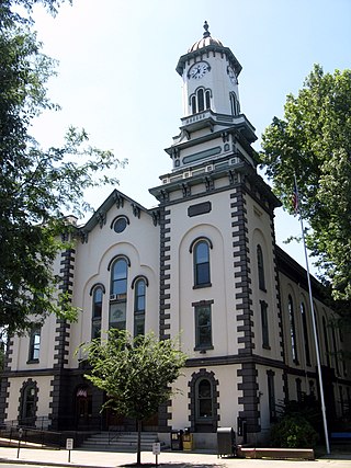
Northumberland County is a county in the Commonwealth of Pennsylvania. As of the 2020 census, the population was 91,647. Its county seat is Sunbury. The county is part of the Central Pennsylvania region of the state.

Northumberland County is located in northeastern New Brunswick, Canada.

Westmorland County is a county in New Brunswick, a province of Canada. It is in the south-eastern part of the province. It contains the fast-growing commercial centre of Moncton and its northern and eastern suburbs. Also located in the county are the university town of Sackville and the local tourist destination of Shediac.

Brighton is a town in Northumberland County, Ontario, Canada, approximately 150 kilometres (93 mi) east of Toronto and 100 km (62 mi) west of Kingston. It is traversed by both Highway 401 and the former Highway 2. The west end of the Murray Canal that leads east to the Bay of Quinte is at the east end of the town.

Northumberland County is an upper-tier municipality situated on the north shore of Lake Ontario, east of Toronto in Central Ontario. The Northumberland County headquarters are located in Cobourg.

Castle Morpeth was a local government district and borough in Northumberland, England. Its administrative centre was the town of Morpeth.
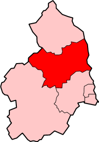
Alnwick was a local government district of Northumberland, England. Its council was based in the town of Alnwick and the district had a population of 31,029 according to the 2001 census.
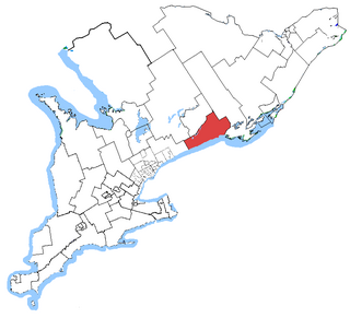
Northumberland—Quinte West was a federal electoral district in Ontario, Canada, that was represented in the House of Commons of Canada from 2004 to 2013. Its population in 2001 was 118,906. Following the Canadian federal electoral redistribution, 2012, the electoral district was dissolved into the ridings of Northumberland—Peterborough South and Bay of Quinte.

The Municipality of Trent Hills is a township municipality in Northumberland County in Central Ontario, Canada. It is on the Trent River and was created in 2001 through the amalgamation of the municipalities of Campbellford/Seymour, Percy Township and Hastings. Thereafter it was known in brief as Campbellford/Seymour, Percy, Hastings.

The Township of Alnwick/Haldimand is a township in central Ontario, Canada, in Northumberland County, situated between Lake Ontario and Rice Lake. It was formed in 2001 by the merger of Alnwick Township in the north and Haldimand Township in the south. Alderville First Nation is an autonomously governed First Nation contained within the township boundaries, in two non-contiguous sections along County Roads 45 and 18.

Ellingham is a civil parish in Northumberland, England. The population taken at the 2001 Census was 282, increasing slightly to 288 at the 2011 Census.

Georgetown is a community located within the municipality of Three Rivers in Kings County, Prince Edward Island, Canada. It is the Capital of Kings County. Previously incorporated as a town, it amalgamated with the town of Montague, the rural municipalities of Brudenell, Cardigan, Lorne Valley, Lower Montague, and Valleyfield, and portions of three adjacent unincorporated areas in 2018.

Meldon Park is a privately owned country mansion situated at Meldon, Northumberland. It is a Grade II* listed building.

Rock is a village and former civil parish, now in the parish of Rennington, in Northumberland, England about 5 miles (8 km) north of Alnwick. In 1951 the parish had a population of 162.

Meldon railway station was a stone built railway station with goods sidings in Northumberland on the Wansbeck Railway between Morpeth and Reedsmouth to the south of the village of Meldon.

Okehampton Hamlets is a civil parish in the Borough of West Devon and the English county of Devon, it runs independently from the Okehampton Town Council, meetings are held at the Meldon Village Hall.
Pigdon is a hamlet and former civil parish 3 miles (4.8 km) from Morpeth, now in the parish of Meldon, in the county of Northumberland, England. In 1951 the parish had a population of 52.
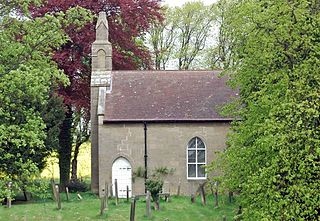
Hebron is a village and civil parish 2 miles (3.2 km) north of Morpeth, in the county of Northumberland, England. In 2011 the parish had a population of 422. The parish touches Longhirst, Meldon, Mitford, Morpeth, Netherwitton, Pegswood, Tritlington and West Chevington and Ulgham. Until April 2009 the parish was in Castle Morpeth district. The surname "Hebron" derives from Hebron.


