MetroCentre Interchange

Last updated

Metrocentre Interchange
DSC 5787 NCL.JPG
General information
LocationScotswood View
Metrocentre
Gateshead
Coordinates 54°57′29″N1°39′55″W / 54.9581°N 1.6654°W / 54.9581; -1.6654
Owned by Intu Properties
Operated by
Bus stands12
Connections MetroCentre National Rail logo.svg
Other information
Fare zone
History
Opened6 October 2004
Location
Tyne and Wear UK location map.svg
Red pog.svg
Metrocentre Interchange
Metrocentre Interchange in Tyne and Wear

Metrocentre Interchange serves the Metrocentre in Gateshead. The bus station was originally constructed in the late 1980s, opened in 1987. [1] In the early 2000s, the former bus station was demolished, with the current bus station opened in October 2004. [2] [3]

Contents

A footbridge connects Metrocentre Interchange with the railway station and coach park. Rail services from the station are operated by Northern Trains. [4]

Stands and services

Metrocentre Interchange is served by Go North East and Stagecoach in Newcastle's bus services, with frequent routes running in and around Gateshead and Newcastle upon Tyne, as well as County Durham, North Tyneside and Northumberland. The bus station has 12 departure stands (lettered A–M), each of which is fitted with seating, next bus information displays, and timetable posters.

As of September 2024, the stand allocation is:

StandRouteDestination
A/B
No services operate from this stand
C1 Metrocentre Retail Park
643
D6 Freeman Hospital
via Lemington, West Denton, Westerhope, Newbiggin Hall, Blakelaw, Kingston Park TWMetro logo no text.PNG , Fawdon TWMetro logo no text.PNG & Gosforth
7 Freeman Hospital
via Lemington, West Denton, Westerhope, Newbiggin Hall, Blakelaw, Kenton, Fawdon TWMetro logo no text.PNG & Gosforth
49 Winlaton BSicon BUS2.svg
via Swalwell & Blaydon BSicon BUS2.svg National Rail logo.svg
49A Winlaton BSicon BUS2.svg
via Swalwell & Parkhead Estate
941 CAV
via Lemington & Denton Burn
E [lower-alpha 1] 10 Hexham BSicon BUS2.svg National Rail logo.svg
via Blaydon BSicon BUS2.svg National Rail logo.svg , Ryton, Crawcrook, Prudhoe, Stocksfield National Rail logo.svg , Riding Mill National Rail logo.svg & Corbridge National Rail logo.svg
10A Blackhall Mill
via Blaydon BSicon BUS2.svg National Rail logo.svg , Ryton, Crawcrook, Greenside, [lower-alpha 2] High Spen & Chopwell
10B Low Prudhoe
via Blaydon BSicon BUS2.svg National Rail logo.svg , Ryton, Crawcrook & Prudhoe National Rail logo.svg
F47 Consett BSicon BUS2.svg
via Swalwell, Winlaton Mill, Rowlands Gill, Highfield, High Spen, Chopwell, Blackhall Mill, Ebchester, Shotley Bridge & Bridgehill
X45 Consett BSicon BUS2.svg
express via Swalwell, Winlaton Mill, Rowlands Gill, Hamsterley Mill, Ebchester, Shotley Bridge & Blackhill
G1 Whitley Bay TWMetro logo no text.PNG
via Dunston, Lobley Hill, Bensham, Gateshead BSicon BUS2.svg TWMetro logo no text.PNG , Newcastle BSicon BUS2.svg TWMetro logo no text.PNG , Byker TWMetro logo no text.PNG , Walkergate TWMetro logo no text.PNG , Wallsend BSicon BUS.svg TWMetro logo no text.PNG , North Shields BSicon BUS.svg TWMetro logo no text.PNG , Tynemouth TWMetro logo no text.PNG , Cullercoats TWMetro logo no text.PNG & Marden
6 Lanchester
via Teams, Metrocentre BSicon BUS2.svg National Rail logo.svg , Swalwell, Whickham, Sunniside, Crookgate, Burnopfield, Tantobie, Tanfield Lea, Stanley BSicon BUS2.svg , South Moor, Quaking Houses, [lower-alpha 3] Burnhope & Maiden Law
643 Sunniside
via Whickham
X73 Stanley BSicon BUS2.svg
express via Swalwell, Whickham, Crookgate, Tanfield, Tantobie, Flint Hill, Dipton, Catchgate & Annfield Plain
H67 Wardley
via Dunston, Teams, Bensham, Deckham, QE Hospital, Felling & Leam Lane
90 Team Valley
941
JX66 Gateshead BSicon BUS2.svg TWMetro logo no text.PNG
express via Teams
K [lower-alpha 4] 49 Gateshead BSicon BUS2.svg TWMetro logo no text.PNG
via Dunston National Rail logo.svg & Teams
49A
96 Gateshead BSicon BUS2.svg TWMetro logo no text.PNG
via Dunston National Rail logo.svg , Lobley Hill & Bensham
L6 Eldon Square BSicon BUS2.svg TWMetro logo no text.PNG
via Central Station National Rail logo.svg TWMetro logo no text.PNG
10
10A
10B
47
X45
X73
M
No services operate from this stand

See also

Notes

  1. Service 1 (towards Whitley Bay), 6 (towards Lanchester) and 47 & X45 (towards Consett) depart from this stand after 18:30 daily.
  2. Journeys terminating at Greenside, Rockwood Hill Estate omit Woodside Lane.
  3. Evening (weekday & Saturday) journeys serve Quaking Houses.
  4. Service 6, 10, 10A, 10B, 47 & X45 (towards Newcastle) and 67 (towards Queen Elizabeth Hospital) depart from this stand after 18:30 daily.

Related Research Articles

<span class="mw-page-title-main">Tyne and Wear Metro</span> Rapid-transit rail network in north-east England

The Tyne and Wear Metro is an overground and underground light rail rapid transit system serving Newcastle upon Tyne, Gateshead, North Tyneside, South Tyneside, and the City of Sunderland. It has been described as the "first modern light rail system in the United Kingdom". The system is currently both owned and operated by the Tyne and Wear Passenger Transport Executive (Nexus), thus is fully under public ownership and operation.

<span class="mw-page-title-main">MetroCentre (shopping centre)</span> Shopping centre in Gateshead, Tyne & Wear

Metrocentre is a shopping centre and entertainment complex in the Dunston area of Gateshead. It is located on the former site of Dunston Power Station, near to the River Tyne.

<span class="mw-page-title-main">Leeds railway station</span> Mainline railway station in Leeds, West Yorkshire, England

Leeds railway station is the mainline railway station serving the city centre of Leeds in West Yorkshire, England. It is located on New Station Street to the south of City Square, at the foot of Park Row, behind the landmark Queens Hotel. It is one of 20 stations managed by Network Rail. As of December 2023, it was the busiest station in West Yorkshire, as well as in Yorkshire & the Humber, and the entirety of Northern England. It is the second busiest station in the UK outside of London, after Birmingham New Street.

Bill Quay is a residential area in Gateshead, located around 4 miles (6.4 km) from Newcastle upon Tyne, 12 miles (19 km) from Sunderland, and 17 miles (27 km) from Durham. In 2011, Census data for the Gateshead Metropolitan Borough Council ward of Heworth and Pelaw recorded a total population of 9,100.

<span class="mw-page-title-main">Newcastle railway station</span> Mainline railway station in Newcastle upon Tyne, England

Newcastle station is a railway station in Newcastle, Tyne and Wear, England, United Kingdom. It is located on the East Coast Main Line, around 268 miles (432 km) north of London King's Cross. It is the primary national rail station serving Newcastle upon Tyne and is an interchange for local services provided by the Tyne and Wear Metro network whose Central Station is situated beneath the national rail station. It is the busiest station in Tyne & Wear, as well as the busiest in North East England.

<span class="mw-page-title-main">Meadowhall Interchange</span> Transport interchange serving Meadowhall shopping centre in Sheffield, South Yorkshire, England

Meadowhall Interchange is a transport interchange located in north-east Sheffield, consisting of a combined heavy rail station, tram stop and bus and coach station. The second-busiest heavy rail station in the city in terms of passenger numbers, Meadowhall Interchange provides connections between National Rail services, the Sheffield Supertram light rail network, intercity coach services and the city bus network.

<span class="mw-page-title-main">MetroCentre railway station</span> Railway station in Tyne and Wear, England

MetroCentre is a railway station on the Tyne Valley Line, which runs between Newcastle and Carlisle via Hexham. The station, situated 3 miles 39 chains west of Newcastle, serves Metrocentre, Gateshead in Tyne and Wear, England. It is owned by Network Rail and managed by Northern Trains.

<span class="mw-page-title-main">Heworth Interchange</span> Tyne and Wear Metro and railway station in Gateshead

Heworth Interchange consists of a National Rail, Tyne and Wear Metro and bus station. It is located in the suburb of Heworth, Gateshead in Tyne and Wear, England, and opened on 5 November 1979 for rail and bus services. The station joined the Tyne and Wear Metro network around two years later, on 15 November 1981.

<span class="mw-page-title-main">Four Lane Ends Interchange</span> Tyne and Wear Metro station and bus interchange in North Tyneside

Four Lane Ends is a Tyne and Wear Metro station and bus interchange in the borough of North Tyneside in the English metropolitan county of Tyne and Wear. The station opened on 11 August 1980, but it is situated on the site of a previous station that opened in 1864, closed in 1871, and was variously called Benton, Long Benton and Longbenton.

Pelaw is a residential area in Gateshead, located around 3.5 miles (5.6 km) from Newcastle upon Tyne, 11 miles (18 km) from Sunderland, and 17 miles (27 km) from Durham. In 2011, Census data for the Gateshead Metropolitan Borough Council ward of Heworth and Pelaw recorded a total population of 9,100.

<span class="mw-page-title-main">Gateshead Interchange</span> Tyne and Wear Metro station in Gateshead

Gateshead Interchange is a Tyne and Wear Metro station, serving the town of Gateshead in Tyne and Wear, England. It joined the network on 15 November 1981, following the opening of the third phase of the network, between Haymarket and Heworth.

<span class="mw-page-title-main">South Shields Interchange</span> Tyne and Wear Metro and bus interchange in South Tyneside

South Shields Interchange is Tyne and Wear Passenger Transport Executive's transport hub in the coastal town of South Shields, South Tyneside in Tyne and Wear, England.

<span class="mw-page-title-main">Regent Centre Interchange</span> Tyne and Wear Metro station in Newcastle upon Tyne

Regent Centre is a Tyne and Wear Metro station in Zone B, serving the suburb of Gosforth, Newcastle upon Tyne. It joined the network on 10 May 1981, following the opening of the second phase of the network, between South Gosforth and Bank Foot.

<span class="mw-page-title-main">Felling Metro station</span> Tyne and Wear Metro station in Gateshead

Felling is a Tyne and Wear Metro station, serving the suburb of Felling, Gateshead in Tyne and Wear, England. It joined the network on 15 November 1981, following the opening of the third phase of the network, between Haymarket and Heworth.

<span class="mw-page-title-main">Springwell Village</span> Human settlement in England

Springwell Village is a village in the City of Sunderland, bordering Gateshead, approximately 7.6 miles (12.2 km) from Newcastle upon Tyne, 9 miles (14 km) from Sunderland, and 13 miles (21 km) from Durham. In 2011, Census data for the City of Sunderland ward of Washington West recorded a total population of 11,833.

<span class="mw-page-title-main">Heworth, Tyne and Wear</span> Human settlement in England

Heworth is a residential area in Gateshead, in the county of Tyne and Wear, England. It is located around 3 miles (4.8 km) from Newcastle upon Tyne, 11 miles (18 km) from Sunderland, and 17 miles (27 km) from Durham. In 2011, Census data for the Gateshead Metropolitan Borough Council ward of Heworth and Pelaw recorded a total population of 9,100. Until 1974 it was in County Durham.

<span class="mw-page-title-main">Newcastle City Centre</span> City centre of Newcastle upon Tyne, England

Newcastle City Centre is the city centre district of Newcastle upon Tyne, England. It is the historical heart of the city and serves as the main cultural and commercial centre of the North East England region. The city centre forms the core of the Tyneside conurbation.

<span class="mw-page-title-main">Transport in Tyne and Wear</span> Overview of transport in Tyne and Wear

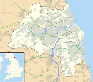
Tyne and Wear is a metropolitan area covering the cities of Newcastle upon Tyne and Sunderland, as well as North and South Tyneside, Gateshead and Washington.

Wardley is a residential area in Gateshead, located around 4 miles (6.4 km) from Newcastle upon Tyne, 10 miles (16 km) from Sunderland, and 15 miles (24 km) from Durham. In 2011, Census data for the Gateshead Metropolitan Borough Council ward of Wardley and Leam Lane recorded a total population of 8,327.

<span class="mw-page-title-main">Leam Lane Estate</span> Human settlement in England

Leam Lane Estate is a housing estate in Gateshead, built in the 1950s and early 60's. Originally made up solely of council-built accommodation and housing association houses. Most of the properties are now privately owned. The estate is located around 4 miles (6.4 km) from Newcastle upon Tyne, 10.5 miles (16.9 km) from Sunderland, and 15.5 miles (24.9 km) from Durham. In 2011, Census data for the Gateshead Metropolitan Borough Council ward of Wardley and Leam Lane recorded a total population of 8,327.

References

  1. Morton, David (28 December 2017). "A busy Metrocentre, Gateshead, 30 years ago". ChronicleLive. Retrieved 7 June 2020.
  2. "Vintage vehicles celebrate opening". The Northern Echo. 25 October 2004. Retrieved 7 June 2020.
  3. "New mall right on schedule". ChronicleLive. 8 August 2003. Retrieved 7 June 2020.
  4. "MetroCentre Station Information". Northern Trains. Retrieved 15 March 2020.