Metro Cuatro Caminos

Last updated
Cuatro Caminos
STC rapid transit
Andenes de la estacion Cuatro Caminos del Metro de la Ciudad de Mexico - panoramio.jpg
View of the platforms
Other namesToreo
Location Naucalpan, State of Mexico
Mexico
Coordinates 19°27′35″N99°12′57″W / 19.459592°N 99.215899°W / 19.459592; -99.215899 Coordinates: 19°27′35″N99°12′57″W / 19.459592°N 99.215899°W / 19.459592; -99.215899
Platforms2 island platforms
Tracks3
Construction
Structure typeUnderground
Disabled accessYes
History
Opened22 August 1984
Traffic
Passengers (2018)39,886,917 [1]
Rank3/195 [1]
Services
Preceding station Mexico City Metro.svg STC Following station
Terminus Line 2 Panteones
toward Tasqueña
Route map
BSicon utKBHFa.svg
Cuatro Caminos
BSicon utSTR+GRZq.svg
BSicon utBHF.svg
Panteones
BSicon utINT.svg
Tacuba
MetroDF Linea 7.svg
BSicon utBHF.svg
Cuitláhuac
BSicon utBHF.svg
Popotla
BSicon utBHF.svg
Colegio Militar
BSicon utBHF.svg
Normal
BSicon utBHF.svg
San Cosme
BSicon utBHF.svg
Revolución
BSicon utINT.svg
Hidalgo
MetroDF Linea 3.svg
BSicon utINT.svg
Bellas Artes
MetroDF Linea 8.svg
BSicon utBHF.svg
Allende
BSicon utBHF.svg
Zócalo
BSicon PORTALe.svg
BSicon utINT.svg
Pino Suárez
MetroDF Linea 1.svg
BSicon uBHF.svg
San Antonio Abad
BSicon uINT.svg
Chabacano
MetroDF Linea 8.svg MetroDF Linea 9.svg
BSicon uBHF.svg
Viaducto
BSicon uBHF.svg
Xola
BSicon uBHF.svg
Villa de Cortés
BSicon uBHF.svg
Nativitas
BSicon uBHF.svg
Portales
BSicon uINT.svg
Ermita
MetroDF Linea 12.svg
BSicon uBHF.svg
General Anaya
BSicon uINT.svg
Tasqueña
DFGGH.JPG
BSicon uYRDa.svg
Tasqueña yard
Location
Location map Mexico City.png
Red pog.svg
Cuatro Caminos
Location within Greater Mexico City

Metro Cuatro Caminos (translated from Spanish the name literally means "Four Roads") is a station of the Mexico City metro network. [2] [3] Coloquially known as "Metro Toreo", [4] [5] it is the current north terminus of Line 2 and serves as a hub for regional transport from and into the State of Mexico. [2] [6] In 2019, the station had an average ridership of 114,947 passengers per day, making it the third busiest station in the network. [7]

Contents

As of 14 September 1970 Line 2 originally terminated at Metro Tacuba, but on 22 August 1984 the line was extended an additional two stations to reach the municipality of Naucalpan. [6] The station sits on the dividing line between the Mexico City and the neighboring State of Mexico and as such was the first station of the network to be built outside the limits of the Federal District.

General information

The station logo is a large geodesic dome depicting the former nearby Toreo de Cuatro Caminos bull fighting ring, which the station takes its name from, [2] however the bullring was torn down in 2008. [8] The station's surroundings (popularly known as the paradero), are the main public transport hub to Toluca and northwestern municipalities in the State of Mexico, such as Naucalpan, Atizapán, Tlalnepantla or Huixquilucan, as well as a major connection point to several destinations within the Mexico City proper and it also serves as the housing of a large street market, which is known largely because of its poor general conditions. [9] Officially, no private vehicles are allowed in the area.

Upon leaving the station, there are two main corridors, labeled "North" and "South". North corridor (denoted by the exits A to K), is mainly used for transportation to State of Mexico, while the "South" corridor is mainly aimed at passengers going to the city (denoted by exit letters J to Z), though this is not strictly the case.

The South corridor (if walked) leads to the Anillo Periférico, the Pericentro shopping mall, and many military facilities, while the North corridor leads to the industrial complex of Naucalpan.

In 2003, the Mexican popular music group Café Tacuba produced an album with the title "Cuatro Caminos" in homage to this part of the city. [10]

Exits

See also

Related Research Articles

Metro Insurgentes Mexico City metro station

Insurgentes is a station on the Line 1 of Mexico City Metro. It is located within the Glorieta de los Insurgentes at the intersection of Avenida de los Insurgentes and Avenida Chapultepec in Mexico City's Cuauhtémoc borough, close to the Zona Rosa shopping and entertainment district and the Colonia Roma, two of the most iconic neighborhoods in the city. In 2019, the station had an average ridership of 65,134 passengers per day, making it the 12th busiest station in the network.

Metro Pantitlán Mexico City metro station

Metro Pantitlán is a station on the Mexico City Metro. It is located in the Iztacalco borough, to the east of downtown Mexico City. The architects were Aurelio Nuño Morales and Isaac Broid. In 2019, the station had an average ridership of 397,777 passengers per day, making it the busiest station in the entire network.

Metro Talismán Mexico City metro station

Talismán is a station along Line 4 of the Mexico City Metro, located in Gustavo A. Madero borough.

Metro Tacuba Mexico City metro station

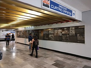
Metro Tacuba is a station of the Mexico City Metro. It is located in the Tacuba district of the Miguel Hidalgo borough, to the west of downtown Mexico City. It lies along Lines 2 and 7.

Metro Cuitláhuac Mexico City metro station

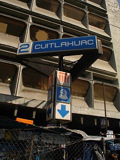
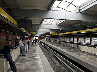
Metro Cuitláhuac is a station on the Mexico City Metro. It is located in the Colonia Popotla and Colonia San Álvaro districts in the Miguel Hidalgo municipality of Mexico City, to the northwest of the city centre. It lies along Line 2. In 2019 the station had an average ridership of 18,616 passengers per day.

Metro Popotla Mexico City metro station

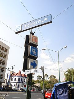
Metro Popotla is a station on Line 2 of the Mexico City Metro system. It is located in the Colonia Popotla neighborhood of the Miguel Hidalgo municipality of Mexico City, northwest of the city centre, on the Calzada México-Tacuba. In 2019 the station had an average ridership of 10,001 passengers per day, making it the least used station on Line 2.

Metro Colegio Militar Mexico City metro station

Metro Colegio Militar is a station on Line 2 of the Mexico City Metro system. It is located in the Miguel Hidalgo municipality of Mexico City, northwest of the city centre, on Calzada México-Tacuba. In 2019 the station had an average ridership of 15,275 passengers per day.

Metro Normal Mexico City metro station

Metro Normal is a station on Line 2 of the Mexico City Metro system. It is located in the Miguel Hidalgo municipality of Mexico City, northwest of the city centre, near the Calzada México-Tacuba. In 2019, the station had an average ridership of 35,261 passengers per day.

Metro San Cosme Mexico City metro station

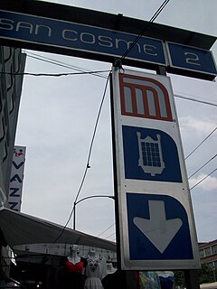
San Cosme is a station on Line 2 of the Mexico City Metro system. It is located in the Cuauhtémoc municipality of Mexico City, northwest of the city centre, on Avenue Ribera de San Cosme a few blocks before it becomes Calzada México-Tacuba. The southern exit leads to Colonia San Rafael while the Northern one leads to Colonia Santa María la Ribera. It is two blocks from the Mercado de San Cosme. In 2019, the station had an average ridership of 22,892 passengers per day.

Metro Allende Mexico City metro station

Metro Allende is a station on Line 2 of the Mexico City Metro system. It is located in the Colonia Centro district of the Cuauhtémoc municipality of Mexico City, on Tacuba street west of the main square in downtown. In 2019 the station had an average ridership of 28,873 passengers per day.

Metro Bondojito Mexico City metro station

Metro Bondojito is a metro station along Line 4 of the Mexico City Metro. It is located in the Gustavo A. Madero borough of Mexico City.

Metro Fray Servando Mexico City metro station

Metro Fray Servando is a metro station along Line 4 of the Mexico City Metro. It is located in the Venustiano Carranza borough of Mexico City.

Metro Instituto del Petróleo Mexico City metro station

Metro Instituto del Petróleo is a station along Line 5 and Line 6 of the metro of Mexico City serving the Colonia Valle del Tepeyac, Colonia San Bartolo Atepehuapan, and Colonia Nueva Industrial neighborhoods of the Gustavo A. Madero municipality of Mexico City. In 2019, the station had an average ridership of 4,584 passengers per day.

Metro Chilpancingo Mexico City metro station

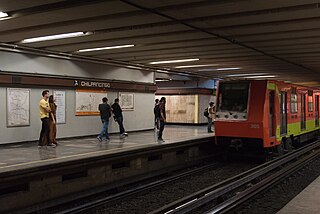
Metro Chilpancingo is an underground metro station along Line 9 of the Mexico City Metro. It is located in the Cuauhtémoc borough of Mexico City. It is very close to Metrobús station of the same name. In 2019, the station had an average ridership of 49,122 passengers per day, making it the busiest station in Line 9 and the 17th busiest station in the network.

Metro Tezozómoc Mexico City metro station

Metro Tezozómoc is a metro station on Mexico's Line 6. It is located in the Azcapotzalco municipality. In 2019, the station had an average ridership of 5,738 passengers per day.

Metro Refinería Mexico City metro station

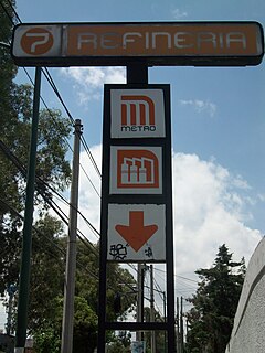
Metro Refinería is a station along Line 7 of the metro of Mexico City. The station is located close to the Pemex 18 de marzo refinery in the Colonia Ángel Zimbrón neighborhood of the Azcapotzalco borough northwest of the city center, between the stations of Camarones and Tacuba. Its logo represents three containers of the Pemex refinery.

Metro Velódromo Mexico City metro station

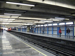
Metro Velódromo is a metro station located on Line 9 of the Mexico City Metro. It is named after the nearby Agustín Melgar Olympic Velodrome, or bicycle-racing venue, built for the 1968 Summer Olympics that were held in Mexico City.

Metro Agrícola Oriental Mexico City metro station

Metro Agrícola Oriental is a metro station on Line A of the Mexico City Metro system. It is located in the Iztacalco municipality. In 2019, the station had an average ridership of 11,317 passengers per day, making it the least used station in Line A.

Metro Olímpica Mexico City metro station

Olímpica is a station on Line B of the Mexico City Metro system. The station is located at Avenida Central and Avenida Valle de Santiago in the Colonia Jardines de Aragón neighborhood and Avenida Grecia in the Colonia La Olimpica II neighborhood in Ecatepec, State of Mexico, adjacent to Mexico City.

Mexico City Metro Line 2 Metro line in Mexico City

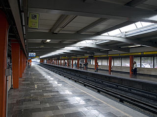
Line 2 is one of the 12 lines of the Mexico City Metro.

References

  1. 1 2 "Afluencia de estación por línea 2018" (in Spanish). Sistema Transporte Colectivo Metro. 2019. Archived from the original on 6 June 2019. Retrieved 7 April 2020.
  2. 1 2 3 "Cuatro Caminos" (in Spanish). Archived from the original on 27 September 2011. Retrieved 16 August 2011.
  3. Archambault, Richard. "Cuatro Caminos » Mexico City Metro System" . Retrieved 16 August 2011.
  4. Tomasini, Carlos (14 June 2017). "Estaciones del Metro con nombres de lugares que ya no existen". Chilango (in Spanish). Retrieved 2 June 2020.
  5. "Se inunda estación del Metro Toreo". Milenio (in Spanish). 26 May 2014. Retrieved 2 June 2020.
  6. 1 2 Monroy, Marco. Schwandl, Robert (ed.). "Opening Dates for Mexico City's Subway" . Retrieved 15 August 2011.
  7. "Estaciones de mayor afluencia 2019" (in Spanish). Metro CDMX. Retrieved 29 March 2020.
  8. Chávez, Silvia (6 September 2008). "Inicia demolición del Toreo de Cuatro Caminos". La Jornada . Retrieved 19 August 2011.
  9. "Califican de 'bomba de tiempo' al paradero de Cuatro Caminos" . Retrieved October 18, 2010.
  10. Jurek, Thom. "Cuatro Caminos - Café Tacuba". AllMusic. Retrieved 19 August 2011.