
Midland is a census-designated place (CDP) in Pierce County, Washington. The population was 9,962 at the time of the 2020 census.

Oakland is the academic and healthcare center of Pittsburgh and one of the city's major cultural centers. Home to three universities, museums, hospitals, shopping venues, restaurants, and recreational activities, this section of the city also includes two city-designated historic districts: the mostly residential Schenley Farms Historic District and the predominantly institutional Oakland Civic Center Historic District, as well as the locally-designated Oakland Square Historic District.
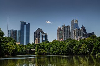
Midtown Atlanta, or Midtown, is a high-density commercial and residential neighborhood of Atlanta, Georgia. The exact geographical extent of the area is ill-defined due to differing definitions used by the city, residents, and local business groups. However, the commercial core of the area is anchored by a series of high-rise office buildings, condominiums, hotels, and high-end retail along Peachtree Street between North Avenue and 17th Street. Midtown, situated between Downtown to the south and Buckhead to the north, is the second-largest business district in Metro Atlanta. In 2011, Midtown had a resident population of 41,681 and a business population of 81,418.

Telegraph Avenue is a street that begins, at its southernmost point, in the midst of the historic downtown district of Oakland, California, and ends, at its northernmost point, at the southern edge of the University of California, Berkeley campus in Berkeley, California. It is approximately 4.5 miles (7 km) in length.
East Atlanta is a neighborhood on the east side of Atlanta, Georgia, United States. The name East Atlanta Village primarily refers to the neighborhood's commercial district.

Grant Park refers to the oldest city park in Atlanta, Georgia, United States, as well as the Victorian neighborhood surrounding it.
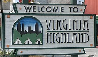
Virginia–Highland is an affluent neighborhood of Atlanta, Georgia, founded in the early 20th century as a streetcar suburb. It is named after the intersection of Virginia Avenue and North Highland Avenue, the heart of its trendy retail district at the center of the neighborhood. The neighborhood is famous for its bungalows and other historic houses from the 1910s to the 1930s. It has become a destination for people across Atlanta with its eclectic mix of restaurants, bars, and shops as well as for the Summerfest festival, annual Tour of Homes and other events.
From its incorporation in 1847, the municipal boundaries of Atlanta, Georgia, United States, were extended repeatedly from a small area around its railroad station to today's city covering 131.7 square miles (341 km2).

The Fairlie–Poplar Historic District is part of the central business district in downtown Atlanta. It is named for the two streets that cross at its center, northeast-only Fairlie and southeast-only Poplar. Fairlie–Poplar is immediately north of Five Points, the definitive center point and longtime commercial heart of Atlanta. It is roughly bounded on the southwest by Marietta Street, on the southeast by Peachtree Street or Park Place, on the northeast by Luckie Street or Williams Street, and on the northwest by Cone Street or Spring Street. It has smaller city blocks than the rest of the city, and the streets run at a 40° diagonal.

The Old Fourth Ward, often abbreviated O4W, is an intown neighborhood on the eastside of Atlanta, Georgia, United States. The neighborhood is best known as the location of the Martin Luther King Jr. historic site.
Capitol View is a historic in-town southwest Atlanta neighborhood 2.5 miles from downtown Atlanta, Georgia that was named for its view of the Georgia State Capitol building. Its boundaries include Metropolitan Parkway to the east, Lee Street to the west, and the Beltline to the north. On the south, the border follows Arden Street, Deckner Avenue, and Perkerson Park.
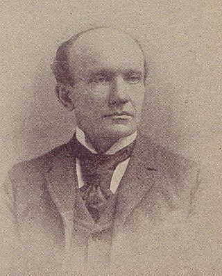
Godfrey Leonard Norrman, was an important architect in the southeastern United States. A number of his commissions are now listed on the National Register of Historic Places, and in 1897 he was made a Fellow of the American Institute of Architects.
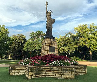
Strengthen the Arm of Liberty is the theme of the Boy Scouts of America's fortieth anniversary celebration in 1950. The campaign was inaugurated in February with a dramatic ceremony held at the base of the Statue of Liberty. Approximately 200 BSA Statue of Liberty replicas were installed across the United States.

Boulevard is a street in and, as a corridor, a subdistrict, of the Old Fourth Ward neighborhood of Atlanta, Georgia. The street runs east of, and parallel to, Atlanta's Downtown Connector. It begins at Ponce de Leon Avenue in the north, passing through the Old Fourth Ward, Cabbagetown, and Grant Park, and forming the border between Chosewood Park on the west and Boulevard Heights and Benteen Park to the east. It ends at McDonough Boulevard in the south, at the Federal Penitentiary.

The Nine-Mile Circle was a streetcar line of the Atlanta Street Railway, later the Atlanta Consolidated Street Railway which went from downtown Atlanta to today's Virginia-Highland neighborhood as follows:
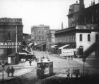
Streetcars originally operated in Atlanta downtown and into the surrounding areas from 1871 until the final line's closure in 1949.
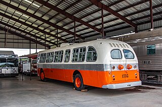
In Atlanta, Georgia, trolleybuses, generally called trackless trolleys there, were a major component of the public transportation system in the middle decades of the 20th century, carrying some 80 percent of all transit riders during the period when the system was at its maximum size. At the end of 1949 Atlanta had a fleet of 453 trolleybuses, the largest in the United States, and it retained this distinction until 1952, when it was surpassed by Chicago.

Edgewood Avenue is a street in Atlanta, Georgia, United States which runs from Five Points in Downtown Atlanta, eastward through the Old Fourth Ward. The avenue runs in the direction of the Edgewood neighborhood, and stops just short of it in Inman Park. Edgewood Avenue was first important as the route of a streetcar line to Inman Park, Atlanta's first garden suburb and home to many of its most prominent citizens. Today, the avenue is known for its restaurants and nightlife around its intersection with Boulevard.


