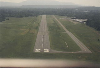
Clarion Municipal Airport is a city-owned public-use airport located one nautical mile (1.85 km) northwest of the central business district of Clarion, a city in Wright County, Iowa, United States. This airport is included in the FAA's National Plan of Integrated Airport Systems for 2009–2013, which categorized it as a general aviation facility.
Sedalia Regional Airport is two miles east of Sedalia, in Pettis County, Missouri. It was formerly Sedalia Memorial Airport. The National Plan of Integrated Airport Systems for 2011–2015 categorized it as a general aviation facility.
Lamar Municipal Airport is a public airport located two miles southwest of the town of Lamar, in Barton County, Missouri, United States.

Sylacauga Municipal Airport, also known as Merkel Field, is a city-owned public-use airport located three nautical miles west of the central business district of Sylacauga, a city in Talladega County, Alabama, United States. It is included in the FAA's National Plan of Integrated Airport Systems for 2011–2015, which categorized it as a general aviation facility.

Walnut Ridge Regional Airport is a city-owned public-use airport located four nautical miles (7 km) northeast of the central business district of Walnut Ridge, a city in Lawrence County, Arkansas, United States. According to the FAA's National Plan of Integrated Airport Systems for 2009–2013, its FAA airport category is general aviation.
Lee's Summit Municipal Airport is a public use airport in Jackson County, Missouri, United States. It is owned by the City of Lee's Summit and is located three nautical miles (6 km) north of its central business district. This facility is included in the National Plan of Integrated Airport Systems, which categorized it as a general aviation reliever airport.
Kennett Memorial Airport is a city-owned, public-use airport located one nautical mile (1.85 km) southeast of the central business district of Kennett, a city in Dunklin County, Missouri, United States. This airport is included in the National Plan of Integrated Airport Systems, which categorized it as a general aviation facility.

Russellville Regional Airport is a city-owned public-use airport located two nautical miles (3.7 km) southeast of the central business district of Russellville, a city in Pope County, Arkansas, United States. According to the FAA's National Plan of Integrated Airport Systems for 2009–2013, it is categorized as a general aviation facility. It was formerly known as Russellville Municipal Airport.
Madison Municipal Airport is a city-owned public use airport located one nautical mile northeast of the central business district of Madison, a city in Lake County, South Dakota, United States. This airport is included in the FAA's National Plan of Integrated Airport Systems for 2009–2013, which categorized it as a general aviation facility.

Driggs–Reed Memorial Airport is a city-owned public-use airport located one nautical mile (1.85 km) north of the central business district of Driggs, a city in Teton County, Idaho, United States. This airport is included in the FAA's National Plan of Integrated Airport Systems for 2009–2013, which categorized it as a general aviation facility.

Indianola Municipal Airport is a public use airport in Sunflower County, Mississippi, United States. The airport is owned by the City of Indianola and located two nautical miles (4 km) northwest of the central business district.
Beech River Regional Airport is a public-use airport in Henderson County, Tennessee, United States. It is located five nautical miles northwest of the central business district of Parsons, a city in Decatur County.
Edgar County Airport is a public use airport in Edgar County, Illinois, United States. It is located five nautical miles north of the central business district of Paris, Illinois. The airport is included in the FAA's National Plan of Integrated Airport Systems for 2017–2021, which categorized it as a general aviation facility.
Port Meadville Airport is a public use airport located three nautical miles west of the central business district of Meadville, in Crawford County, Pennsylvania, United States. It is included in the FAA's National Plan of Integrated Airport Systems for 2011–2015, which categorized it as a general aviation facility.
Grant Municipal Airport is a city-owned, public-use airport located two nautical miles (4 km) north of the central business district of Grant, a city in Perkins County, Nebraska, United States. It is included in the National Plan of Integrated Airport Systems for 2011–2015, which categorized it as a general aviation airport.
Lawrence Smith Memorial Airport is a city-owned, public-use airport located three nautical miles (6 km) south of the central business district of Harrisonville, a city in Cass County, Missouri, United States. It is included in the National Plan of Integrated Airport Systems for 2011–2015, which categorized it as a general aviation facility.
James G. Whiting Memorial Field is a city-owned public-use airport located one nautical mile (2 km) north of the central business district of Mapleton, a city in Monona County, Iowa, United States. It is included in the National Plan of Integrated Airport Systems for 2011–2015, which categorized it as a general aviation facility.

Marshall Memorial Municipal Airport is a city-owned, public-use airport located two nautical miles (4 km) south of the central business district of Marshall, a city in Saline County, Missouri, United States. It is included in the National Plan of Integrated Airport Systems for 2011–2015, which categorized it as a general aviation facility.
Cameron Memorial Airport is a public use airport in Clinton County, Missouri, United States. It is owned by the city of Cameron and located two nautical miles (4 km) southwest of its central business district. This airport is included in the National Plan of Integrated Airport Systems, which categorized it as a general aviation facility.
Sullivan Regional Airport is a public use airport in Franklin County, Missouri, United States. It is owned by the city of Sullivan and located one nautical mile (2 km) north of its central business district. This airport is included in the National Plan of Integrated Airport Systems, which categorized it as a general aviation facility.


