Mikhaylovsk, Sverdlovsk Oblast

Last updated • 1 min readFrom Wikipedia, The Free Encyclopedia

Mikhaylovsk
Михайловск
Flag of Mikhailovsk (Sverdlovsk oblast).png
Coat of Arms of Mikhailovsk (Sverdlovsk oblast).png
Location of Mikhaylovsk
Mikhaylovsk, Sverdlovsk Oblast
Russia administrative location map.svg
Red pog.svg
Mikhaylovsk
Location of Mikhaylovsk
Sverdlovskaya-pozkarta.png
Red pog.svg
Mikhaylovsk
Mikhaylovsk (Sverdlovsk Oblast)
Coordinates: 56°27′N59°08′E / 56.450°N 59.133°E / 56.450; 59.133
Country Russia
Federal subject Sverdlovsk Oblast [1]
Administrative district Nizhneserginsky District [1]
Town Mikhaylovsk [1]
Founded1805;219 years ago (1805)
Town status since1961;63 years ago (1961)
Elevation
250 m (820 ft)
Population
  Total9,852
  Estimate 
(2018) [3]
8,921 (−9.4%)
   Capital oftown of Mikhaylovsk [4]
   Municipal district Nizhneserginsky Municipal District [5]
  Urban settlementMikhaylovskoye Urban Settlement [5]
   Capital ofMikhaylovskoye Urban Settlement [6]
Time zone UTC+5 (MSK+2   OOjs UI icon edit-ltr-progressive.svg [7] )
Postal code(s) [8]
623080, 623082
OKTMO ID65628104001
Website михайловскоемо.рф

Mikhaylovsk (Russian : Миха́йловск) is a town in Nizhneserginsky District of Sverdlovsk Oblast, Russia, located on the shores of Mikhaylovsky Pond, 163 kilometers (101 mi) southwest of Yekaterinburg, the administrative center of the oblast. Population: 9,852(2010 Census); [2] 10,538(2002 Census); [9] 12,943(1989 Census). [10]

Contents

History

It was founded in 1805 as Mikhaylovsky Zavod (Russian : Миха́йловский Заво́д).[ citation needed ] It was granted town status and given its present name in 1961.[ citation needed ]

Administrative and municipal status

Within the framework of the administrative divisions, it is, together with one rural locality (the settlement of Mikhaylovsky Zavod), incorporated within Nizhneserginsky District as the Town of Mikhaylovsk. [1] As a municipal division, the Town of Mikhaylovsk, together with ten rural localities in Nizhneserginsky District, is incorporated within Nizhneserginsky Municipal District as Mikhaylovskoye Urban Settlement. [5] [1]

Related Research Articles

<span class="mw-page-title-main">Nizhniye Sergi</span> Town in Sverdlovsk Oblast, Russia

Nizhniye Sergi is a town and the administrative center of Nizhneserginsky District in Sverdlovsk Oblast, Russia, located on a rolling plain surrounded by the Ural Mountains, on the Serga River 120 kilometers (75 mi) from Yekaterinburg, the administrative center of the oblast. Population: 10,336 (2010 Census); 12,567 (2002 Census); 14,938 (1989 Census).

<span class="mw-page-title-main">Lesnoy, Sverdlovsk Oblast</span> Closed town in Sverdlovsk Oblast, Russia

Lesnoy is a closed town in Sverdlovsk Oblast, Russia, located 254 kilometers (158 mi) north of Yekaterinburg on the banks of the Tura River. Population: 50,363 (2010 Census); 53,195 (2002 Census).

<span class="mw-page-title-main">Kirovgrad</span> Town in Sverdlovsk Oblast, Russia

Kirovgrad is a town in Sverdlovsk Oblast, Russia. Population: 21,035 (2010 Census); 23,197 (2002 Census); 25,598 (1989 Census).

<span class="mw-page-title-main">Kachkanar</span> Town in Sverdlovsk Oblast, Russia

Kachkanar is a town in Sverdlovsk Oblast, Russia, located between the Isa and Vyya Rivers in the Tura River's basin, 205 kilometers (127 mi) north of Yekaterinburg, the administrative center of the oblast. Population: 41,426 (2010 Census); 44,664 (2002 Census); 48,251 (1989 Census).

<span class="mw-page-title-main">Degtyarsk</span> Town in Sverdlovsk Oblast, Russia

Degtyarsk is a town under the administrative jurisdiction of the Town of Revda in Sverdlovsk Oblast, Russia, located on the Vyazovka River, 35 kilometers (22 mi) west of Yekaterinburg, the administrative center of the oblast. Population: 15,522 (2010 Census); 15,869 (2002 Census); 18,394 (1989 Census).

<span class="mw-page-title-main">Severouralsk</span> Town in Sverdlovsk Oblast, Russia

Severouralsk is a town in Sverdlovsk Oblast, Russia, located on the Vagran River at its confluence with the Kolonga River, 512 kilometers (318 mi) north of Yekaterinburg, the administrative center of the oblast. As of the 2010 Census, its population was 29,263.

<span class="mw-page-title-main">Beryozovsky, Sverdlovsk Oblast</span> Town in Sverdlovsk Oblast, Russia

Beryozovsky is a town in Sverdlovsk Oblast, Russia, located on the Beryozovka River, 13 kilometers (8.1 mi) northeast of Yekaterinburg, the administrative center of the oblast. Population: 59,698 (2021 Census); 51,651 (2010 Census); 46,744 (2002 Census); 47,944 (1989 Census).

<span class="mw-page-title-main">Novaya Lyalya</span> Town in Sverdlovsk Oblast, Russia

Novaya Lyalya is a town and the administrative center of Novolyalinsky District in Sverdlovsk Oblast, Russia, located on the Lyalya River, 306 kilometers (190 mi) north of Yekaterinburg, the administrative center of the oblast. Population: 12,734 (2010 Census); 14,584 (2002 Census); 15,681 (1989 Census).

<span class="mw-page-title-main">Alapayevsky District</span> District in Sverdlovsk Oblast, Russia

Alapayevsky District is an administrative district (raion), one of the thirty in Sverdlovsk Oblast, Russia. As a municipal division, it is incorporated as Alapayevskoye Urban Okrug. It is located in the center of the oblast. Its administrative center is the town of Alapayevsk. Population: 33,613 ; 40,522 (2002 Census); 49,491 (1989 Census).

<span class="mw-page-title-main">Baykalovsky District</span> District in Sverdlovsk Oblast, Russia

Baykalovsky District is an administrative district (raion), one of the thirty in Sverdlovsk Oblast, Russia. As a municipal division, it is incorporated as Baykalovsky Municipal District. The area of the district is 2,293.7 square kilometers (885.6 sq mi). Its administrative center is the rural locality of Baykalovo. Population: 16,294 ; 19,048 (2002 Census); 21,569 (1989 Census). The population of Baykalovo accounts for 35.5% of the district's total population.

<span class="mw-page-title-main">Kamyshlovsky District</span> District in Sverdlovsk Oblast, Russia

Kamyshlovsky District is an administrative district (raion), one of the thirty in Sverdlovsk Oblast, Russia. As a municipal division, it is incorporated as Kamyshlovsky Municipal District. The area of the district is 2,216.6 square kilometers (855.8 sq mi). Its administrative center is the town of Kamyshlov. Population: 28,162 ; 29,048 (2002 Census); 21,051 (1989 Census).

<span class="mw-page-title-main">Krasnoufimsky District</span> District in Sverdlovsk Oblast, Russia

Krasnoufimsky District is an administrative district (raion), one of the thirty in Sverdlovsk Oblast, Russia. As a municipal division, it is incorporated as Krasnoufimsky Urban Okrug. Its administrative center is the town of Krasnoufimsk. Population: 28,077 ; 31,581 (2002 Census); 36,286 (1989 Census).

<span class="mw-page-title-main">Prigorodny District, Sverdlovsk Oblast</span> District in Sverdlovsk Oblast, Russia

Prigorodny District is an administrative district (raion), one of the thirty in Sverdlovsk Oblast, Russia. As a municipal division, it is incorporated as Gornouralsky Urban Okrug. The area of the district is 3,513 square kilometers (1,356 sq mi). Its administrative center is the city of Nizhny Tagil. Population: 38,527 ; 43,488 (2002 Census); 52,651 (1989 Census).

<span class="mw-page-title-main">Shalinsky District, Sverdlovsk Oblast</span> District in Sverdlovsk Oblast, Russia

Shalinsky District is an administrative district (raion), one of the thirty in Sverdlovsk Oblast, Russia. The area of the district is 4,852 square kilometers (1,873 sq mi). Its administrative center is the urban locality of Shalya. Population: 23,834 ; 26,019 (2002 Census); 31,384 (1989 Census). The population of Shalya accounts for 27.0% of the district's total population.

<span class="mw-page-title-main">Taborinsky District</span> District in Sverdlovsk Oblast, Russia

Taborinsky District is an administrative district (raion), one of the thirty in Sverdlovsk Oblast, Russia. As a municipal division, it is incorporated as Taborinsky Municipal District. The area of the district is 11,367 square kilometers (4,389 sq mi). Its administrative center is the rural locality of Tabory. Population: 3,574 ; 5,089 (2002 Census); 7,121 (1989 Census). The population of Tabory accounts for 52.7% of the district's total population.

<span class="mw-page-title-main">Shalya (urban-type settlement)</span> Work settlement in Sverdlovsk Oblast, Russia

Shalya is an urban locality and the administrative center of Shalinsky District of Sverdlovsk Oblast, Russia. Population: 6,433 (2010 Census); 6,801 (2002 Census); 7,123 (1989 Census).

<span class="mw-page-title-main">Uralsky, Sverdlovsk Oblast</span> Closed settlement in Sverdlovsk Oblast, Russia

Uralsky is a closed urban locality in Sverdlovsk Oblast, Russia, located 32 kilometers (20 mi) southeast of Yekaterinburg. Population: 2,444 (2010 Census); 2,311 (2002 Census).

<span class="mw-page-title-main">Bisert</span> Work settlement in Sverdlovsk Oblast, Russia

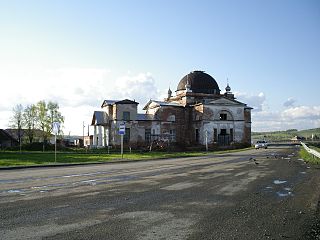
Bisert is an urban locality in Nizhneserginsky District of Sverdlovsk Oblast, Russia. Population: 10,233 (2010 Census); 11,262 (2002 Census); 12,646 (1989 Census).

<span class="mw-page-title-main">Malysheva, Sverdlovsk Oblast</span> Work settlement in Sverdlovsk Oblast, Russia

Malysheva is an urban locality under the administrative jurisdiction of the Town of Asbest in Sverdlovsk Oblast, Russia. Population: 9,544 (2010 Census); 10,121 (2002 Census); 12,668 (1989 Census).

<span class="mw-page-title-main">Atig</span> Work settlement in Sverdlovsk Oblast, Russia

Atig is an urban locality in Nizhneserginsky District of Sverdlovsk Oblast, Russia. Population: 3,405 (2010 Census); 3,906 (2002 Census); 4,499 (1989 Census).

References

Notes

  1. 1 2 3 4 5 6 Order #120-P
  2. 1 2 Russian Federal State Statistics Service (2011). Всероссийская перепись населения 2010 года. Том 1 [2010 All-Russian Population Census, vol. 1]. Всероссийская перепись населения 2010 года [2010 All-Russia Population Census] (in Russian). Federal State Statistics Service.
  3. "26. Численность постоянного населения Российской Федерации по муниципальным образованиям на 1 января 2018 года". Federal State Statistics Service. Retrieved January 23, 2019.
  4. Государственный комитет Российской Федерации по статистике. Комитет Российской Федерации по стандартизации, метрологии и сертификации. №ОК 019-95 1 января 1997 г. «Общероссийский классификатор объектов административно-территориального деления. Код 65 228 504», в ред. изменения №278/2015 от 1 января 2016 г.. (State Statistics Committee of the Russian Federation. Committee of the Russian Federation on Standardization, Metrology, and Certification. #OK 019-95 January 1, 1997 Russian Classification of Objects of Administrative Division (OKATO). Code 65 228 504 , as amended by the Amendment #278/2015 of January 1, 2016. ).
  5. 1 2 3 Law #85-OZ
  6. Федеральная служба государственной статистики. Федеральное агентство по технологическому регулированию и метрологии. №ОК 033-2013 1 января 2014 г. «Общероссийский классификатор территорий муниципальных образований. Код 65 628 104». (Federal State Statistics Service. Federal Agency on Technological Regulation and Metrology. #OK 033-2013 January 1, 2014 Russian Classification of Territories of Municipal Formations. Code 65 628 104. ).
  7. "Об исчислении времени". Официальный интернет-портал правовой информации (in Russian). June 3, 2011. Retrieved January 19, 2019.
  8. Почта России. Информационно-вычислительный центр ОАСУ РПО. (Russian Post). Поиск объектов почтовой связи (Postal Objects Search) (in Russian)
  9. Russian Federal State Statistics Service (May 21, 2004). Численность населения России, субъектов Российской Федерации в составе федеральных округов, районов, городских поселений, сельских населённых пунктов – районных центров и сельских населённых пунктов с населением 3 тысячи и более человек [Population of Russia, Its Federal Districts, Federal Subjects, Districts, Urban Localities, Rural Localities—Administrative Centers, and Rural Localities with Population of Over 3,000](XLS). Всероссийская перепись населения 2002 года [All-Russia Population Census of 2002] (in Russian).
  10. Всесоюзная перепись населения 1989 г. Численность наличного населения союзных и автономных республик, автономных областей и округов, краёв, областей, районов, городских поселений и сёл-райцентров [All Union Population Census of 1989: Present Population of Union and Autonomous Republics, Autonomous Oblasts and Okrugs, Krais, Oblasts, Districts, Urban Settlements, and Villages Serving as District Administrative Centers]. Всесоюзная перепись населения 1989 года [All-Union Population Census of 1989] (in Russian). Институт демографии Национального исследовательского университета: Высшая школа экономики [Institute of Demography at the National Research University: Higher School of Economics]. 1989 via Demoscope Weekly.

Sources