
Kirovgrad is a town in Sverdlovsk Oblast, Russia. Population: 21,035 (2010 Census); 23,197 (2002 Census); 25,598 (1989 Soviet census).
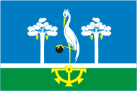
Sysert is a town and the administrative center of Sysertsky District of Sverdlovsk Oblast, Russia, located on the Sysert River, 50 kilometers (31 mi) south of Yekaterinburg. Population: 20,465 (2010 Census); 22,152 (2002 Census); 22,462 (1989 Soviet census).

Pelym is an urban locality under the administrative jurisdiction of the Town of Ivdel in Sverdlovsk Oblast, Russia. Population: 3,376 (2010 Census); 3,708 (2002 Census).

Achitsky District is an administrative district (raion), one of the thirty in Sverdlovsk Oblast, Russia. As a municipal division, it is incorporated as Achitsky Urban Okrug. The area of the district is 2,071.6 square kilometers (799.8 sq mi). Its administrative center is the urban locality of Achit. Population: 16,807 ; 19,132 (2002 Census); 23,348 (1989 Soviet census). The population of Achit accounts for 29.4% of the district's total population.

Alapayevsky District is an administrative district (raion), one of the thirty in Sverdlovsk Oblast, Russia. As a municipal division, it is incorporated as Alapayevskoye Urban Okrug. It is located in the center of the oblast. Its administrative center is the town of Alapayevsk. Population: 33,613 ; 40,522 (2002 Census); 49,491 (1989 Soviet census).

Baykalovsky District is an administrative district (raion), one of the thirty in Sverdlovsk Oblast, Russia. As a municipal division, it is incorporated as Baykalovsky Municipal District. The area of the district is 2,293.7 square kilometers (885.6 sq mi). Its administrative center is the rural locality of Baykalovo. Population: 16,294 ; 19,048 (2002 Census); 21,569 (1989 Soviet census). The population of Baykalovo accounts for 35.5% of the district's total population.

Beloyarsky District is an administrative district (raion), one of the thirty in Sverdlovsk Oblast, Russia. Its administrative center is the urban locality of Beloyarsky. Population: 39,374 ; 39,312 (2002 Census); 69,251 (1989 Soviet census). The population of the administrative center accounts for 32.0% of the district's total population.
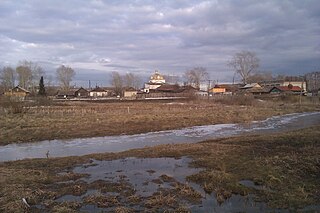
Bogdanovichsky District is an administrative district (raion), one of the thirty in Sverdlovsk Oblast, Russia. As a municipal division, it is incorporated as Bogdanovich Urban Okrug. Its administrative center is the town of Bogdanovich. Population : 16,357 ; 18,042 (2002 Census); 18,569 (1989 Soviet census).
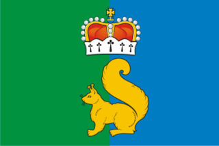
Garinsky District is an administrative district (raion), one of the thirty in Sverdlovsk Oblast, Russia. As a municipal division, it is incorporated as Garinsky Urban Okrug. The area of the district is 16,770 square kilometers (6,470 sq mi). Its administrative center is the urban locality of Gari. Population: 4,904 ; 7,832 (2002 Census); 9,381 (1989 Soviet census). The population of Gari accounts for 50.4% of the district's total population. The main point of historical interest is the former town of Pelym, which was one of the first Russian settlements east of the Urals, marking the eastern terminus of the Cherdyn Road from Europe to Siberia.

Irbitsky District is an administrative district (raion), one of the thirty in Sverdlovsk Oblast, Russia. As a municipal division, it is incorporated as Irbitskoye Urban Okrug. Its administrative center is the town of Irbit. Population: 30,331 ; 33,350 (2002 Census); 35,056 (1989 Soviet census).

Krasnoufimsky District is an administrative district (raion), one of the thirty in Sverdlovsk Oblast, Russia. As a municipal division, it is incorporated as Krasnoufimsky Urban Okrug. Its administrative center is the town of Krasnoufimsk. Population: 28,077 ; 31,581 (2002 Census); 36,286 (1989 Soviet census).
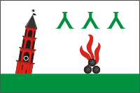
Nevyansky District is an administrative district (raion), one of the thirty in Sverdlovsk Oblast, Russia. The area of the district is 1,967 square kilometers (759 sq mi). Its administrative center is the town of Nevyansk. Population : 22,833 ; 24,516 (2002 Census); 31,345 (1989 Soviet census).

Pyshminsky District is an administrative district (raion), one of the thirty in Sverdlovsk Oblast, Russia. As a municipal division, it is incorporated as Pyshminsky Urban Okrug. The area of the district is 1,899 square kilometers (733 sq mi). Its administrative center is the urban locality of Pyshma. Population: 20,614 ; 22,519 (2002 Census); 25,277 (1989 Soviet census). The population of Pyshma accounts for 47.6% of the district's total population.
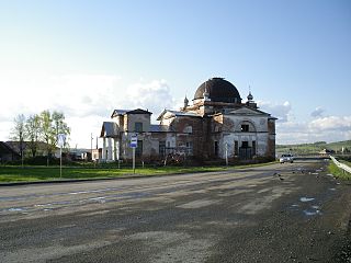
Shalinsky District is an administrative district (raion), one of the thirty in Sverdlovsk Oblast, Russia. The area of the district is 4,852 square kilometers (1,873 sq mi). Its administrative center is the urban locality of Shalya. Population: 23,834 ; 26,019 (2002 Census); 31,384 (1989 Soviet census). The population of Shalya accounts for 27.0% of the district's total population.

Tavdinsky District is an administrative district (raion), one of the thirty in Sverdlovsk Oblast, Russia. As a municipal division, it is incorporated as Tavdinsky Urban Okrug. The area of the district is 6,560 square kilometers (2,530 sq mi). Its administrative center is the town of Tavda. Population : 6,885 ; 9,592 (2002 Census); 11,392 (1989 Soviet census).

Verkhnesaldinsky District is an administrative district (raion), one of the thirty in Sverdlovsk Oblast, Russia. As a municipal division, it is incorporated as Verkhnesaldinsky Urban Okrug. Its administrative center is the town of Verkhnyaya Salda. Population : 3,306 ; 3,669 (2002 Census); 26,470 (1989 Soviet census).

Verkhotursky District is an administrative district (raion), one of the thirty in Sverdlovsk Oblast, Russia. As a municipal division, it is incorporated as Verkhotursky Urban Okrug. Its administrative center is the town of Verkhoturye. Population: 16,802 ; 19,153 (2002 Census); 21,277 (1989 Soviet census). The population of Verkhoturye accounts for 52.5% of the district's total population.

Svobodny is a closed urban locality in Sverdlovsk Oblast, Russia, located 185 kilometers (115 mi) from Yekaterinburg. Population: 8,198 (2010 Census); 9,667 (2002 Census).

Reftinsky is an urban locality under the administrative jurisdiction of the Town of Asbest in Sverdlovsk Oblast, Russia. Population: 16,496 (2010 Census); 17,968 (2002 Census); 17,134 (1989 Soviet census).
Strelka is an urban locality under the administrative jurisdiction of the Town of Lesosibirsk in Krasnoyarsk Krai, Russia. Population: 5,040 (2010 Census); 5,767 (2002 Census); 7,187 (1989 Soviet census)..


