Related Research Articles

The Oregon Trail was a 2,170-mile (3,490 km) east–west, large-wheeled wagon route and emigrant trail in the United States that connected the Missouri River to valleys in Oregon Territory. The eastern part of the Oregon Trail crossed what is now the states of Kansas, Nebraska, and Wyoming. The western half crossed the current states of Idaho and Oregon.

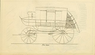
A stagecoach is a four-wheeled public transport coach used to carry paying passengers and light packages on journeys long enough to need a change of horses. It is strongly sprung and generally drawn by four horses although some versions are drawn by six horses.

The California Trail was an emigrant trail of about 1,600 mi (2,600 km) across the western half of the North American continent from Missouri River towns to what is now the state of California. After it was established, the first half of the California Trail followed the same corridor of networked river valley trails as the Oregon Trail and the Mormon Trail, namely the valleys of the Platte, North Platte, and Sweetwater rivers to Wyoming. The trail has several splits and cutoffs for alternative routes around major landforms and to different destinations, with a combined length of over 5,000 mi (8,000 km).
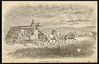
Butterfield Overland Mail was a stagecoach service in the United States operating from 1858 to 1861. It carried passengers and U.S. Mail from two eastern termini, Memphis, Tennessee, and St. Louis, Missouri, to San Francisco, California. The routes from each eastern terminus met at Fort Smith, Arkansas, and then continued through Indian Territory (Oklahoma), Texas, New Mexico, Arizona, Mexico, and California ending in San Francisco. On March 3, 1857, Congress authorized the U.S. postmaster general, at that time Aaron V. Brown, to contract for delivery of the U.S. mail from St. Louis to San Francisco. Prior to this, U.S. Mail bound for the Far West had been delivered by the San Antonio and San Diego Mail Line since June 1857.

The Santa Susana Pass, originally Simi Pass, is a low mountain pass in the Simi Hills of Southern California, connecting the San Fernando Valley and Los Angeles neighborhood of Chatsworth, to the city of Simi Valley and eponymous valley.

Fort Ridgely was a frontier United States Army outpost from 1851 to 1867, built 1853–1854 in Minnesota Territory. The Sioux called it Esa Tonka. It was located overlooking the Minnesota River southwest of Fairfax, Minnesota. Half of the fort's land was part of the south reservation in the Minnesota river valley for the Mdewakanton and Wahpekute tribes. Fort Ridgely had no defensive wall, palisade, or guard towers. The Army referred to the fort as the "New Post on the Upper Minnesota" until it was named for two Maryland Army Officers named Ridgely, who died during the Mexican–American War.

The Central Overland California and Pike's Peak Express Company was a stagecoach line that operated in the American West in the early 1860s, but it is most well known as the parent company of the Pony Express. It was formed as a subsidiary of the freighting company Russell, Majors, and Waddell, after the latter two partners bought out Russell's stage line, the Leavenworth and Pikes Peak Express Company. The stage line had made its first journey from Westport, Missouri, to Denver on March 9, 1859.

Fort Abercrombie, in North Dakota, was a United States Army fort established by authority of an Act of Congress, March 3, 1857. The act allocated twenty-five square miles of land on the Red River of the North in Dakota Territory to be used for a military outpost, but the exact location was left to the discretion of Lieutenant Colonel John J. Abercrombie. The fort was constructed in the year 1858. It was the first permanent military installation in what became North Dakota, and is thus known as "The Gateway to the Dakotas". Abercrombie selected a site right on the river. Spring flooding was a problem and the fort was abandoned. However, in 1860 the Army returned, moving the fort to higher ground.
The Central Overland Route was a transportation route from Salt Lake City, Utah south of the Great Salt Lake through the mountains of central Nevada to Carson City, Nevada. For a decade after 1859, until the first Transcontinental Railroad was completed in 1869, it served a vital role in the transport of emigrants, mail, freight, and passengers between California, Nevada, and Utah.
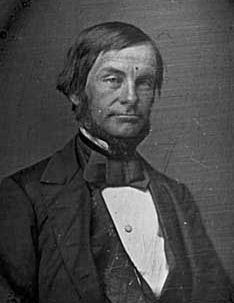
James Hervey Simpson (1813–1883) was an officer in the U.S. Army and a member of the United States Corps of Topographical Engineers.
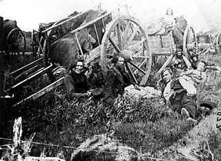
The Red River Trails were a network of ox cart routes connecting the Red River Colony and Fort Garry in British North America with the head of navigation on the Mississippi River in the United States. These trade routes ran from the location of present-day Winnipeg in the Canadian province of Manitoba across the Canada–United States border, and thence by a variety of routes through what is now the eastern part of the Dakotas and across western and central Minnesota to Mendota and Saint Paul, Minnesota on the Mississippi.
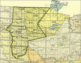
The Pembina and Red Lake bands of Chippewa ceded to the United States the Red River Valley of the north in two treaties. Both were named for the treaty site, "Old Crossing" and the year, Treaty of Old Crossing (1863) and the Treaty of Old Crossing (1864). In Minnesota, the ceded territory included all land west of a line running generally southwest from the Lake of the Woods to Thief Lake, about 30 miles (48 km) west of Red Lake, and then angling southeast to the headwaters of the Wild Rice River near the divide separating the watersheds of the Red River of the North and the Mississippi River. In North Dakota, the ceded territory was all of the Red River Valley north of the Sheyenne River. In size, the area was roughly 127 miles (204 km) east-west and 188 miles (303 km) north-south, making it nearly 11,000,000 acres (45,000 km2) of prairie and forest.

The Old Santa Susana Stage Road, or Santa Susana Wagon Road, is a route taken by early travelers between the San Fernando Valley and Simi Valley near Chatsworth, California, via the Santa Susana Pass. The main route climbs through what is now the Santa Susana Pass State Historic Park, with a branch in Chatsworth Park South.
The Overland Trail was a Klondike Gold Rush-era transportation route between Whitehorse, Yukon and Dawson City in Yukon, Canada. It was built in 1902 at a cost of CDN$129,000 after the White Pass and Yukon Route railroad won a contract to deliver mail to the Dawson City gold fields from the Canadian government. The trail consisted of a 330 miles (531 km)-long, 12 feet (4 m) wide graded surface with culverts in some locations. Before its construction, transportation to Dawson City required a steamboat trip on the Yukon River during the brief subarctic summer, or dog sleds after the rivers had frozen.

The Montana Trail was a wagon road that served gold rush towns such as Bannack, Virginia City and later Helena during the Montana gold rush era of the 1860s and 1870s. Miners and settlers all traveled the trail to try to find better lives in Montana. The trail was also utilized for freighting and shipping supplies and food goods to Montana from Utah. American Indians, as well as the weather, were major risks to traveling on the Montana Trail.
The Overland Trail was a stagecoach and wagon trail in the American West during the 19th century. While portions of the route had been used by explorers and trappers since the 1820s, the Overland Trail was most heavily used in the 1860s as a route alternative to the Oregon, California, and Mormon trails through central Wyoming. The Overland Trail was famously used by the Overland Stage Company owned by Ben Holladay to run mail and passengers to Salt Lake City, Utah, via stagecoaches in the early 1860s. Starting from Atchison, Kansas, the trail descended into Colorado before looping back up to southern Wyoming and rejoining the Oregon Trail at Fort Bridger. The stage line operated until 1869 when the completion of the First transcontinental railroad eliminated the need for mail service via stagecoach.
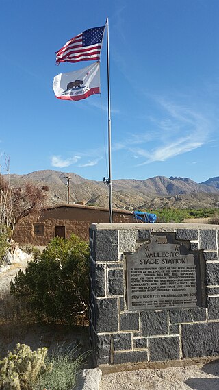
Vallecito, in San Diego County, California, is an oasis of cienegas and salt grass along Vallecito Creek and a former Kumeyaay settlement on the edge of the Colorado Desert in the Vallecito Valley. Its Spanish name is translated as "little valley". Vallecito was located at the apex of the gap in the Carrizo Badlands created by Carrizo Creek and its wash in its lower reach, to which Vallecito Creek is a tributary. The springs of Vallecito, like many in the vicinity, are a product of the faults that run along the base of the Peninsular Ranges to the west.
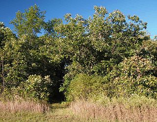
The Saint Cloud and Red River Valley Stage Road–Kandota Section is a preserved fragment of a stagecoach road in Kandota Township, Minnesota, United States. It was part of a long route established in 1859 that ran from St. Cloud, Minnesota, to the Red River Valley on the border of Minnesota, North Dakota, and Manitoba. The 250-yard-long (230 m) road fragment was listed on the National Register of Historic Places in 1991 for having state-level significance in the theme of transportation. It was nominated for being a remnant of one of Minnesota's most important stagecoach roads, and a reminder of the stagecoach companies' founding role in establishing the state's overland travel routes.
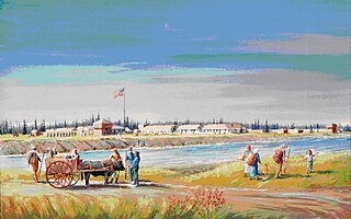
Fort Ripley was a United States Army outpost on the upper Mississippi River, in mid-central Minnesota from 1848 to 1877. It was situated a few miles from the Indian agencies for the Ho-Chunk and Ojibwe in Iowa Territory and then the Minnesota Territory. Its presence spurred immigration into the area and the pioneer settlement of Crow Wing developed approximately 6.75 miles (10.86 km) north of the fort. The post was initially named Fort Marcy. It then was renamed Fort Gaines and in 1850 was renamed again for distinguished Brigadier General Eleazer Wheelock Ripley of the War of 1812. It was the second major military reservation established in what would become Minnesota.

The Lake City and Rochester Stage Road was an early road between Lake City and Rochester, Minnesota, United States. It was blazed in 1858 to carry stagecoach traffic between the Mississippi River port and a major inland town in southeast Minnesota.
References
-
 This article incorporates text from MNopedia, which is licensed under the Creative Commons Attribution-ShareAlike 3.0 Unported License.
- 1 2 3 4 5 6 7 8 9 10 Goetz, Kathryn R. (2015-02-08). "Minnesota Stage Company". MNopedia. Minnesota Historical Society. Retrieved 2018-01-27.
- ↑ "National Register Information System". National Register of Historic Places . National Park Service. July 9, 2010.