
Route 265 is a highway in southwestern Missouri. Its northern terminus is at Interstate 44 in Mount Vernon; its southern terminus is at U.S. Route 65 south of Branson. Much of the highway is concurrent with other routes. It is also known as the Ozark Mountain Parkway.

Route 83 is a state highway in western Missouri. Its northern terminus is at U.S. Route 65/Route 7 at Warsaw; its southern terminus is at Route 13 in Bolivar. It is a two-lane highway its entire length.

Route 142 is a highway in southern Missouri. Its eastern terminus is at Route 53 in southern Poplar Bluff; its western terminus is at Route 101 in Bakersfield. Route 142 is the southernmost east–west highway in the south-central part of the state. Despite its length, there are relatively few towns on the route.
Route 19 is a long state highway in Missouri. Its northern terminus is at U.S. Route 61 in New London and its southern terminus is at U.S. Route 63 on the north side of Thayer. Route 19 is one of Missouri's original 1922 highways, though it initially had a northern terminus at Route 14 in Cuba and was later extended north.

Route 116 is a highway in northwestern Missouri. Its eastern terminus is at Route A in Braymer; its western terminus is at U.S. Route 59 in Rushville.
Route 133 is a highway in central Missouri. Its northern terminus is at U.S. Route 63 near Westphalia; its southern terminus is at Interstate 44 about fourteen miles (21 km) west of Waynesville.

Route 34 is a highway in southeastern Missouri. Its eastern terminus is at the Illinois state line on the Mississippi River at Cape Girardeau where it overlaps Route 74. Its western terminus is at U.S. Route 60 near Van Buren. The road continues into Illinois as Illinois Route 146.

Route 77 is a highway in southeastern Missouri. Its northern terminus is at Route 25 about four miles (6 km) south of Dutchtown; its southern terminus is at the Mississippi River in southeastern Mississippi County. The Dorena–Hickman Ferry connects the road with Kentucky Route 1354 in Kentucky.

Route 58 is a highway in western Missouri. Its eastern terminus is at U.S. Route 50 west of Warrensburg; its western terminus is at Route D west of Belton, Missouri. It is one of only a very few highways to end at a state supplemental route.
Route 153 is a highway in southeastern Missouri, United States. Its northern terminus is at U.S. Route 60 midway between Sikeston and Dexter. Its southern terminus is at Route 25 north of Kennett.

Route 139 is a highway in northern and central Missouri. Its northern terminus is at the Iowa state line where it continues as Wayne County Route S40; its southern terminus is at U.S. Route 24 east of Carrollton.

Route 41 is a highway in central Missouri. Its northern terminus is at U.S. Route 24 in southern Carroll County; its southern terminus is at Interstate 70/U.S. Route 40 west of Boonville, where the road continues south as Route 135.

Route 151 is a highway in the U.S. state of Missouri. Its northern terminus is at Route 15/Route 156 about 13 miles (21 km) south of Edina; its southern terminus is at Route 22/Route 124 in Centralia.
Route 106 is a highway in the southern part of the US State of Missouri. Its eastern terminus is at Route 21 at Ellington; its western terminus is at Route 17 in Summersville. Route 106 runs through the eastern, mountainous Ozarks and through two sections of the Ozark National Scenic Riverways.

Route 33 is a highway in western Missouri. Its northern terminus is at Route 6 in Maysville; its southern terminus is at U.S. Route 69 in Liberty.
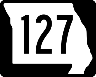
Route 127 is a highway in central Missouri. Its northern terminus is at U.S. Route 65 west of Malta Bend; its southern terminus is at Route 52 southwest of Sedalia.

Route 154 is a highway in northeastern Missouri. Its eastern terminus is at U.S. Route 54 north of Vandalia; its western terminus is at U.S. Route 24) west of Paris, where Business US 24 also has its western terminus. Route 154 passes through Mark Twain State Park and over Mark Twain Lake.

Route 190 is a highway in northern Missouri. Its eastern terminus is at U.S. Route 65 north of Chillicothe; its western terminus is at Route 146 west of Trenton.

Route 185 is a highway in eastern Missouri. Its northern terminus is at Route 100 west of Washington; its southern terminus is at Route 8 in Potosi. A spur of Highway 185 goes into Meramec State Park, Miramiguoa Park, and Meramec Conservation Area.

Route 131 is a highway located in Lafayette and Johnson counties in western Missouri. Its northern terminus is at Route 224 in downtown Wellington and its southern terminus is on Route 2 south of Medford.

