Moddergat | |
|---|---|
| Coordinates: 26°07′52″S30°56′02″E / 26.131°S 30.934°E Coordinates: 26°07′52″S30°56′02″E / 26.131°S 30.934°E | |
| Country | South Africa |
| Province | Mpumalanga |
| District | Gert Sibande |
| Municipality | Albert Luthuli |
| Area | |
| • Total | 36.60 km2 (14.13 sq mi) |
| Population (2001) [1] | |
| • Total | 592 |
| • Density | 16/km2 (42/sq mi) |
| Time zone | UTC+2 (SAST) |
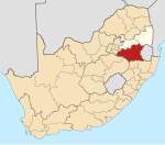
Moddergat is a village in Gert Sibande District Municipality in the Mpumalanga province of South Africa.

Gert Sibande is one of the 3 districts of Mpumalanga province of South Africa. The seat of Gert Sibande is Ermelo. The majority of its 900 007 people speak IsiZulu. The district code is DC30. On 15 October 2004, the municipality changed its name from the "Eastvaal" to "Gert Sibande" District Municipality. The district is named after the ANC activist Gert Sibande.

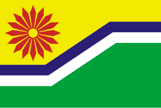
Mpumalanga is a province of South Africa. The name means "east", or literally "the place where the sun rises" in the Swazi, Xhosa, Ndebele and Zulu languages. Mpumalanga lies in eastern South Africa, bordering Swaziland and Mozambique. It constitutes 6.5% of South Africa's land area. It shares borders with the South African provinces of Limpopo to the north, Gauteng to the west, the Free State to the southwest, and KwaZulu-Natal to the south. The capital is Mbombela (Nelspruit).

South Africa, officially the Republic of South Africa (RSA), is the southernmost country in Africa. It is bounded to the south by 2,798 kilometres (1,739 mi) of coastline of Southern Africa stretching along the South Atlantic and Indian Oceans; to the north by the neighbouring countries of Namibia, Botswana, and Zimbabwe; and to the east and northeast by Mozambique and Eswatini (Swaziland); and it surrounds the enclaved country of Lesotho. South Africa is the largest country in Southern Africa and the 25th-largest country in the world by land area and, with over 57 million people, is the world's 24th-most populous nation. It is the southernmost country on the mainland of the Old World or the Eastern Hemisphere. About 80 percent of South Africans are of Sub-Saharan African ancestry, divided among a variety of ethnic groups speaking different African languages, nine of which have official status. The remaining population consists of Africa's largest communities of European (White), Asian (Indian), and multiracial (Coloured) ancestry.


