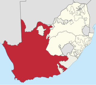
The Province of the Cape of Good Hope, commonly referred to as the Cape Province and colloquially as The Cape, was a province in the Union of South Africa and subsequently the Republic of South Africa. It encompassed the old Cape Colony, as well as Walvis Bay, and had Cape Town as its capital. In 1994, the Cape Province was divided into the new Eastern Cape, Northern Cape and Western Cape provinces, along with part of the North West.
The South African Geographical Names Council (SAGNC) is the official government body of South Africa that advises the executive branch of the central government on new geographical names as well as the changing of existing geographical names. The Council also receives recommendations from provincial geographical names committees, such as the Western Cape Provincial Geographical Names Committee.
Regional routes are the third category of road in the South African route numbering scheme. They are designated with the letter "R" followed by a three-digit number. They serve as feeders connecting smaller towns to the national and provincial routes. Designation as a regional road does not necessarily imply any particular size of road; they range from gravel roads to multi-lane freeways.

The R56 is a provincial route in South Africa that connects Middelburg with Pietermaritzburg via Molteno, Maclear and Kokstad. It is co-signed with the N2 between Kokstad and Stafford's Post for 39 kilometres.

South Africa switched to a closed numbering system effective 16 January 2007. At that time, it became mandatory to dial the full 10-digit telephone number, including the zero in the three-digit area code, for local calls. Area codes within the system are generally organized geographically. All telephone numbers are 9 digits long, except for certain Telkom special services. When dialed from another country, the "0" is omitted and replaced with the appropriate international access code and the country code +27.
Samuel Esson Jonah is a Ghanaian businessman and the current chancellor of the University of Cape Coast. He is the executive chairman of Jonah Capital, an equity fund based in Johannesburg, South Africa. Jonah was previously president of AngloGold Ashanti and shared the strategic leadership of the company with its CEO, Bobby Godsell.
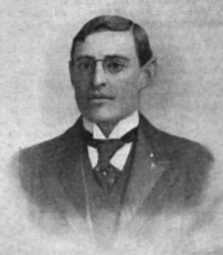
Major Charles Sydney Goldman was a British businessman, author, and journalist who served as a Member of Parliament (MP) from 1910 until 1918.

Cooktown is a coastal town and locality in the Shire of Cook, Queensland, Australia. Cooktown is at the mouth of the Endeavour River, on Cape York Peninsula in Far North Queensland where James Cook beached his ship, the Endeavour, for repairs in 1770. Both the town and Mount Cook which rises up behind the town were named after James Cook.

Burgersdorp is a medium-sized town in Walter Sisulu in the Joe Gqabi District Municipality of the Eastern Cape province of South Africa.
Sterkstroom is a settlement in Enoch Mgijima Local Municipality of the Chris Hani District in the Eastern Cape province of South Africa.

Elsburg is a town in Ekurhuleni in the Gauteng province of South Africa. It is a town some 6 km south-east of Germiston.
Steynsburg Hospital is a Provincial government funded hospital for the Joe Gqabi District Municipality area in Steynsburg, Eastern Cape in South Africa.
Teebus is a village some 18 km south-west of Steynsburg and 35 km north-north-west of Hofmeyr. Afrikaans for 'tea-caddy', this name is taken from that of a pointed hill; to the north of this hill is Koffiebus, 'coffee-caddy'.
Rosmead is a village 12 km east of Middelburg and 75 km west-south-west of Steynsburg. It was founded in 1880 and at first named Middelburg Road, but renamed in 1883 after Sir Hercules George Robinson, Lord Rosmead (1824–1897), who was Governor of the Cape Colony from 1880 to 1889.

Provincial routes are the second category of road in the South African route-numbering scheme. They are designated with the letter "R" followed by a number from 21 to 82, formerly with the letter "P" followed by a number from 66. They serve as feeders to the national routes and as trunk roads in areas where there is no national route.
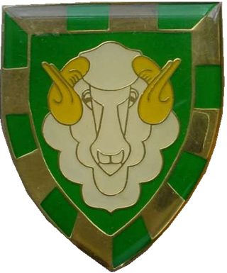
Regiment Groot Karoo was an infantry battalion of the South African Army. As a reserve force unit, it had a status roughly equivalent to that of a British Army Reserve or United States Army National Guard unit.
Siphokazi Mani-Lusithi is a South African politician, currently a member of the Eastern Cape Provincial Legislature for the African National Congress, and the current Member of the Executive Council (MEC) responsible for Public Works and Human Settlements in the Eastern Cape provincial government. Mani-Lusithi previously served as the MEC for the Social Development and Human Settlements portfolios.

The Steynsburg Reformed Church is the oldest congregation of the Reformed Churches in South Africa in the North Eastern Cape town of Steynsburg, which was founded by the church council and after elder A.P.J. Steyn was named because he took the lead in founding the congregation. Because of the congregation's zeal for education, it took an important place in the Reformed church association, especially during the first almost 80 years of its existence until around 1950. A school with 100 learners was opened here in 1875 and in 1905 a school for Christian national education from which a teaching college developed.


