Leslie, Mpumalanga

Last updated
Leslie

Lebohang
South Africa Mpumalanga location map.svg
Red pog.svg
Leslie
South Africa adm location map.svg
Red pog.svg
Leslie
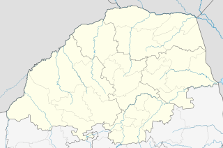
Coordinates: 26°21′58″S28°55′01″E / 26.366°S 28.917°E / -26.366; 28.917 Coordinates: 26°21′58″S28°55′01″E / 26.366°S 28.917°E / -26.366; 28.917
Country South Africa
Province Mpumalanga
District Gert Sibande
Municipality Govan Mbeki
Main Place Leandra, Mpumalanga
Area
[1]
  Total2.19 km2 (0.85 sq mi)
Population
(2011) [1]
  Total190
  Density87/km2 (220/sq mi)
Racial makeup (2011)
[1]
   Black African 71.1%
   Indian/Asian 4.2%
   White 23.2%
  Other1.6%
First languages (2011)
[1]
   Zulu 41.9%
   Afrikaans 31.6%
   English 10.3%
   Southern Ndebele 6.6%
  Other9.6%
Time zone UTC+2 (SAST)
Postal code (street)
2265
PO box
2265
Area code 017

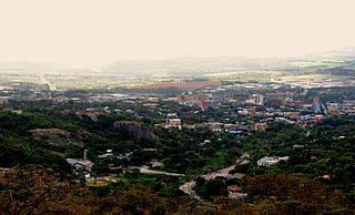
Leslie is a town in Gert Sibande District Municipality in the Mpumalanga province of South Africa. It is part of Leandra. The village is 63 km west of Bethal, Mpumalanga and 56 km east-south-east of Springs, Gauteng. Administered by a village council, it was laid out on the farm Brakkefontein and proclaimed in December 1939, an extension being proclaimed in December 1957. The village is thought to be named after Leslie in Fife, Scotland. [2]

Gert Sibande District Municipality District municipality in Mpumalanga, South Africa

Gert Sibande is one of the 3 districts of Mpumalanga province of South Africa. The seat of Gert Sibande is Ermelo. The majority of its 900 007 people speak IsiZulu. The district code is DC30. On 15 October 2004, the municipality changed its name from the "Eastvaal" to "Gert Sibande" District Municipality. The district is named after the ANC activist Gert Sibande.
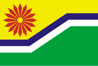
Mpumalanga Province of South Africa

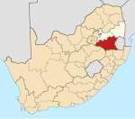
Mpumalanga is a province of South Africa. The name means "east", or literally "the place where the sun rises" in the Swazi, Xhosa, Ndebele and Zulu languages. Mpumalanga lies in eastern South Africa, bordering Swaziland and Mozambique. It constitutes 6.5% of South Africa's land area. It shares borders with the South African provinces of Limpopo to the north, Gauteng to the west, the Free State to the southwest, and KwaZulu-Natal to the south. The capital is Mbombela (Nelspruit).

South Africa Republic in the southernmost part of Africa

South Africa, officially the Republic of South Africa (RSA), is the southernmost country in Africa. It is bounded to the south by 2,798 kilometres (1,739 mi) of coastline of Southern Africa stretching along the South Atlantic and Indian Oceans; to the north by the neighbouring countries of Namibia, Botswana, and Zimbabwe; and to the east and northeast by Mozambique and Eswatini (Swaziland); and it surrounds the enclaved country of Lesotho. South Africa is the largest country in Southern Africa and the 25th-largest country in the world by land area and, with over 57 million people, is the world's 24th-most populous nation. It is the southernmost country on the mainland of the Old World or the Eastern Hemisphere. About 80 percent of South Africans are of Sub-Saharan African ancestry, divided among a variety of ethnic groups speaking different African languages, nine of which have official status. The remaining population consists of Africa's largest communities of European (White), Asian (Indian), and multiracial (Coloured) ancestry.

Related Research Articles

Mbombela Place in Mpumalanga, South Africa

Mbombela is a city in northeastern South Africa. It is the capital of the Mpumalanga province. Located on the Crocodile River, Mbombela lies about 110 kilometres (68 mi) by road west of the Mozambique border, 330 kilometres (210 mi) east of Johannesburg and about 82 kilometres (51 mi) North of the Swaziland border.

Graskop Place in Mpumalanga, South Africa

Graskop is a small town in Mpumalanga province, South Africa. It was set up in the 1880s as a gold mining camp but it now serves as a tourist destination and the timber industry. The name is Afrikaans for grassy hillock. “God’s Window”, a scenic view from the escarpment of the Lowveld below, is located outside the town.

Amsterdam, Mpumalanga Place in Mpumalanga, South Africa

Amsterdam is a small town which consists of a below average working class population located in Mkhondo circuit in Mpumalanga South Africa and encompasses a large swati population as a result of the Swaziland border which is relatively close to this area. The town is located some 77 km east of Ermelo. There are large plantations of gum, pine and wattle trees in the area. The town also boast of a peaceful community with rich culture and heritage.

Ermelo, Mpumalanga Place in Mpumalanga, South Africa

Ermelo is the educational, industrial and commercial centre of the 7,750 km² Gert Sibande District Municipality in Mpumalanga province, Republic of South Africa. It is both a mixed agriculture and mining region. Its is found 210 km east of Johannesburg.

Balfour, Mpumalanga Place in Mpumalanga, South Africa

Balfour is a small gold mining and maize farming town in Mpumalanga, South Africa.

Morgenzon Place in Mpumalanga, South Africa

Morgenzon(Dutch for morning sun) is a small farming town situated on the banks of the Osspruit River (Ox Stream) with an important agricultural school in Mpumalanga province, South Africa. The town is 45 km south-west of Ermelo and 35 km south-east of Bethal.

Perdekop Place in Mpumalanga, South Africa

Perdekop,, is a small town situated on top of a 1,889 m peak in the Mpumalanga province, in South Africa. It is a village 38 km north of Volksrust and 47 km south of Standerton.

Wakkerstroom Place in Mpumalanga, South Africa

Wakkerstroom,, is the second oldest town in Mpumalanga province, South Africa. The town is on the KwaZulu-Natal border, 27 km east of Volksrust and 56 km south-east of Amersfoort.

Delmas, Mpumalanga Place in Mpumalanga, South Africa

Delmas is a small maize farming town situated east of Johannesburg in Mpumalanga, South Africa. The town is located some 19 km north-east of Springs and 73 km south-east of Pretoria.

Kinross, Mpumalanga Place in Mpumalanga, South Africa

Kinross is a small gold mining town in Mpumalanga, South Africa with four gold mines in the region. Village on the watershed between the Atlantic and Indian Oceans, between Devon and Trichardt, 42 km west of Bethal, 19 km east of Leslie and about 70 km north-north-east of Standerton.

Marble Hall Place in Limpopo, South Africa

Marble Hall is a town in the south of the Limpopo province of South Africa. It was formerly in Mpumalanga province.

Emjejane Place in Mpumalanga, South Africa

Emjejane is a small farming town situated between Kaapmuiden and Komatipoort on a southern tributary of the Crocodile River in Mpumalanga, South Africa. The farms in the region produce sugarcane, subtropical fruit and vegetables. The stream is named after a dog belonging to S de Kock, chief surveyor of the Pretoria - Delagoa Bay railway line.

Komatipoort Place in Mpumalanga, South Africa

Komatipoort is a town situated at the confluence of the Crocodile and Komati Rivers in Mpumalanga province, South Africa. The town is 8 km from the Crocodile Bridge Gate into the Kruger Park, and just 5 km from the Mozambique border and 65 km from the Eswatini border.

Postmasburg Place in Northern Cape, South Africa

Postmasburg is a town in the Northern Cape province of South Africa, located approximately 170 km east of Upington.

Bushbuckridge Local Municipality Local municipality in Mpumalanga, South Africa

Bushbuckridge Local Municipality is a third-level administrative division in the Ehlanzeni District of Mpumalanga in South Africa. Tobacco, cotton and vegetables are farmed in the municipality's countryside. The municipality includes part of Kruger National Park. Bushbuckridge is the biggest local municipality in Mpumalanga, in terms of land mass and by population.

Hendrina Place in Mpumalanga, South Africa

Hendrina is a settlement in Nkangala District Municipality in the Mpumalanga province of South Africa. Town is 53km north-west of Ermelo, 40km west-south-west of Carolina and 53km south-east of Middelburg.

Trichardt Place in Mpumalanga, South Africa

Trichardt is a town in Gert Sibande District Municipality in the Mpumalanga province of South Africa. The village 34km west of Bethal and 32km west-south-west of Leandra, next door to Secunda.

Charl Cilliers, Mpumalanga Place in Mpumalanga, South Africa

Charl Cilliers is a settlement in Gert Sibande District Municipality in the Mpumalanga province of South Africa. The village is some 32km north of Standerton.

Leandra, Mpumalanga Place in Mpumalanga, South Africa

Leandra is a town in Gert Sibande District Municipality in the Mpumalanga province of South Africa.

Mpumalanga, KwaZulu-Natal Place in KwaZulu-Natal, South Africa

Mpumalanga is a town in eThekwini in the KwaZulu-Natal province of South Africa. It is a township about 10 km south-south-east of Cato Ridge and some 40 km west of Durban. Derived from Zulu, the name means 'sunrise', 'the sun comes out'.

References

  1. 1 2 3 4 "Sub Place Leslie". Census 2011.
  2. "Dictionary of Southern African Place Names (Public Domain)". Human Science Research Council. p. 277.