Monkey's Eyebrow, Kentucky

Last updated

Monkey's Eyebrow
USA Kentucky location map.svg
Red pog.svg
Monkey's Eyebrow
Location within the state of Kentucky
Usa edcp location map.svg
Red pog.svg
Monkey's Eyebrow
Monkey's Eyebrow (the United States)
Coordinates: 37°11′12″N88°59′16″W / 37.18667°N 88.98778°W / 37.18667; -88.98778
Country United States
State Kentucky
County Ballard
Elevation
361 ft (110 m)
Time zone UTC-6 (Central (CST))
  Summer (DST) UTC-5 (CST)
GNIS feature ID508626 [1]

Monkey's Eyebrow is a rural unincorporated community in Ballard County, Kentucky, United States. [2] It is generally the northwesternmost community in the Jackson Purchase area of western Kentucky that is identified on the highway maps distributed by the Kentucky Transportation Cabinet. The community is part of the Paducah, KY-IL Metropolitan Statistical Area. A few different theories exist regarding the origin of the community's unique name.

Contents

Overview

There were originally two Monkey's Eyebrows, commonly known as Old Monkey and New Monkey. One was at the top of a small hill, the other at the bottom. There were stores at both locations. Today, there are no stores. According to an article nearly 30 years ago in the county newspaper, the Advance Yeoman, the area acquired its unique name around the turn of the 20th century. A nearby attraction is the state-controlled Ballard County Wildlife Management Area. Goose hunting is a winter activity in Monkey's Eyebrow. [3]

A common joke in the region is to provide directions to the city of Paducah by saying "it's halfway between Monkey's Eyebrow and Possum Trot (a tiny community in Marshall County)." [3]

The community was formerly frequently mentioned in the sign-off message of WPSD-TV in nearby Paducah, as the location of its 1,638-foot-tall (499 m) broadcast transmitter. [4]

Etymology

Monkey's Eyebrow has been frequently noted for its unusual place name. [5]

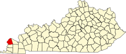
One theory on the origin of this unique name is that when looking at it from the air, [6] or on a map of Ballard County, it resembles a monkey's head. [4] Monkey's Eyebrow is located where the monkey's eyebrow would be located. [7] It has also been said that, when viewed from a nearby hill, the shape of the town resembles a monkey's eyebrow. [8]

Yet another theory of the town's naming is that sometime before 1900, a community resident would go to nearby Needmore to get supplies, instead of going to the local general store and blacksmith shop built and owned by John and Dodge Ray, as the man didn't like his neighbors. [6] [9] It has been stated that the man considered the store to be "only fit for a bunch of monkeys", and that he considered both of its owners to be monkey-like, even having eyebrows resembling those of a monkey. [6] It has also been stated that the man viewed the brush on Beeler Hill above the store as resembling monkey eyebrows. [6] [4]

Notable people

Related Research Articles

<span class="mw-page-title-main">McCracken County, Kentucky</span> County in Kentucky, United States

McCracken County is a county located in the far west portion of U.S. state of Kentucky. As of the 2020 census, the population was 67,875. The county seat and only municipality is Paducah. McCracken County was the 78th county formed in the state, having been created in 1825. It is part of the historic Jackson Purchase, territory sold by the Chickasaw people to General Andrew Jackson and Governor Isaac Shelby; this territory was located at the extreme western end of Kentucky.

<span class="mw-page-title-main">Ballard County, Kentucky</span> County in Kentucky, United States

Ballard County is a county located in the west portion of the U.S. state of Kentucky. As of the 2020 census, the population was 7,728. Its county seat is Wickliffe and its largest city is LaCenter. The county was created by the Kentucky State Legislature in 1842 and is named for Captain Bland Ballard, a soldier, statesman, and member of the Kentucky General Assembly. Ballard County is part of the Paducah, KY-IL Metropolitan Statistical Area.

<span class="mw-page-title-main">Kevil, Kentucky</span> City in Kentucky, United States

Kevil is a home rule-class city in Ballard County, Kentucky, United States. The population was 595 as of the 2020 census, It is part of the Paducah KY-IL Metropolitan Statistical Area.

<span class="mw-page-title-main">WPSD-TV</span> NBC affiliate in Paducah, Kentucky

WPSD-TV is a television station licensed to Paducah, Kentucky, United States, serving as the NBC affiliate for Western Kentucky's Jackson Purchase region, Southern Illinois, the Missouri Bootheel, and northwest Tennessee. Owned by locally based Paxton Media Group, the station maintains studios on Television Lane in Paducah, and its transmitter is located at Monkey's Eyebrow, Kentucky.

Rosine is an unincorporated community in Ohio County, Kentucky, United States. Bill Monroe, The Father of Bluegrass, is buried in the Rosine Cemetery and memorialized with a bronze cast disk affixed to the barn where his music remains alive. The community was named for the pen name of Jennie Taylor McHenry, poet and wife of founder Henry D. McHenry. The ZIP Code is 42370 and the area code is 270. The nearest communities are Horse Branch, and Beaver Dam; and the nearest major cities are Owensboro and Bowling Green. The community sits at an elevation of 429 feet. At one time, Rosine was a thriving community with several stores, a school, a pickle factory, and a bat mill that milled bats for the Louisville Slugger bat factory.

<span class="mw-page-title-main">Rabbit Hash, Kentucky</span> Unincorporated community in Kentucky, United States

Rabbit Hash is an unincorporated community and census-designated place (CDP) in Boone County, Kentucky, United States. The population was 254 at the 2020 census. It is listed on the National Register of Historic Places. The town is notable for its name, its string of canine mayors, and its historic general store which was largely destroyed by fire in 2016.

<span class="mw-page-title-main">West Kentucky Community and Technical College</span> Community college in Paducah, Kentucky, U.S.

West Kentucky Community and Technical College (WKCTC) is a public community college in Paducah, Kentucky. It is part of the Kentucky Community and Technical College System (KCTCS) and was formed by the 2003 consolidation of Paducah Community College and West Kentucky Technical College. WKCTC is accredited by the Southern Association of Colleges and Schools, Commission on Colleges (SACSCOC).

Harlan Hubbard was an American artist and writer, known for his simple lifestyle.

Possum Trot is an unincorporated community in Marshall County, Kentucky, United States. Possum Trot is located on U.S. Route 62 between Paducah and Calvert City in the Jackson Purchase region of Western Kentucky.

<span class="mw-page-title-main">Williamstown Lake</span> Reservoir in Grant County, Kentucky

Williamstown Lake is a public 365-acre (1.48 km2) recreational lake and water reservoir in Grant County, Kentucky. It was created in 1955 by impounding the South Fork of Grassy Creek in order to supply the community with water as the existing reservoir, now the centerpiece of nearby JB Miller Park was unable to keep up with demand. The lake officially opened for boating, fishing and swimming in 1957 by utilizing one access point adjacent the City of Dry Ridge and one adjacent to the City of Williamstown. With more than 365 surface acres of water including seasonable accessible tributaries, just over 7 miles from end to end and 28 miles of shoreline, the lake has attracted well over 300 summer cottages and year-round homes which line nearly every originally available plot on the lake.

<span class="mw-page-title-main">Geography of Kentucky</span> Overview of the Geography of Kentucky

Kentucky is situated in the Upland South region of the United States. A significant portion of eastern Kentucky is part of Appalachia.

<span class="mw-page-title-main">Kentucky Route 338</span> State highway in Kentucky, United States

Kentucky Route 338 (KY 338) is a 32.228-mile-long (51.866 km) state highway in Kentucky. It begins at KY 20 in Northern Boone County. It goes through Burlington, Kentucky where it intersects with KY 18. It then goes to a small town called Rabbit Hash, Kentucky where it intersects with KY 536 and again with KY 18. After it leaves Rabbit Hash, it runs by Big Bone Lick State Park before intersecting with U.S. Route 42 and US 127 near Union. It turns left onto US 42 and US 127, and then leaves the concurrency about mile north. KY 338 then travels to Richwood, where it has access to Interstate 75 (I-75) and I-71 it ends about 1/4 mile east of the interstate at US 25.

<span class="mw-page-title-main">Paducah micropolitan area</span> Metropolitan Area in Western Kentucky

The Paducah, KY–IL Metropolitan Statistical Area, as defined by the United States Census Bureau, is an area consisting of five counties – three in the Jackson Purchase region of Kentucky, a fourth Kentucky county bordering the Purchase, and one in Southern Illinois – anchored by the city of Paducah, Kentucky. The Paducah KY-IL Micropolitan Statistical Area was upgraded to Metropolitan Statistical Area (MSA) status on July 21, 2023, by the Office of Management and Budget.. Carlisle County, Kentucky, was added to the area following the 2020 Census of the Population. The total MSA population from the 2020 United States Census was 103,486.

Sugartit is a rural community in Boone County, Kentucky, United States. It was located at the intersection of U.S. Route 42 and Kentucky Route 237 between the cities of Florence and Union. Sugartit has been noted for its unusual place name.

Needmore, formerly named Ogden, is an unincorporated community located in Ballard County, Kentucky, United States.

New York is an unincorporated community located in Ballard County, Kentucky, United States. It has a population of 10, and is about 19 miles away from the city of Paducah.

Nobob is an unincorporated community in Barren County, Kentucky, United States.

Wax is an unincorporated community in Grayson County, Kentucky, United States.

<span class="mw-page-title-main">Kentucky Route 358</span> State highway in the U.S. state of Kentucky.

Kentucky Route 358 (KY 358) is a 29.590-mile-long (47.620 km) state highway in the U.S. state of Kentucky. The highway connects mostly rural areas of Ballard and McCracken counties with LaCenter.

<span class="mw-page-title-main">Kelsey Waldon</span> American country singer and songwriter

Kelsey Waldon is an American country singer and songwriter. She has released four EPs and six full albums, the most recent being "No Regular Dog" released on August 12, 2022.

References

  1. U.S. Geological Survey Geographic Names Information System: Monkey's Eyebrow, Kentucky
  2. Klotter, J.C.; Klotter, F.C. (2008). A Concise History of Kentucky. University Press of Kentucky. pp. 53–54. ISBN   978-0-8131-9192-8 . Retrieved September 21, 2018.
  3. 1 2 Hillinger, Charles (September 4, 1987). "Life in Colorful Kentucky Towns : It's All in the Name: Monkey's Eyebrow to Rabbit Hash". Los Angeles Times . Retrieved September 21, 2018.
  4. 1 2 3 Stinnett, Chuck (November 5, 2014). "STINNETT: Some town names still raise eyebrows". Evansville Courier & Press. Retrieved September 22, 2018.
  5. "Get the scoop on all of Northern Kentucky's weird town names, from Rabbit Hash to Sugartit". WCPO-TV. April 2, 2017. Retrieved July 7, 2019.
  6. 1 2 3 4 Rennick, R.M. (2013). From Red Hot to Monkey's Eyebrows: Unusual Kentucky Place Names. University Press of Kentucky. pp. 39–40. ISBN   978-0-8131-2779-8 . Retrieved September 21, 2018.
  7. "Monkey's Eyebrow.org". Archived from the original on October 28, 2016. Retrieved September 23, 2007.
  8. Wertheimer, Linda (June 23, 2007). "How Monkey's Eyebrow, Ky., Got Its Name". NPR . Retrieved April 21, 2017.
  9. Kleber, J.E. (2015). The Kentucky Encyclopedia. University Press of Kentucky. p. 642. ISBN   978-0-8131-5901-0 . Retrieved September 22, 2018.
  10. "Kelsey Waldon Recognized by Hometown of Monkey's Eyebrow/". Saving Country Music. January 28, 2020. Retrieved October 5, 2021.

Further reading