Bandana, Kentucky | |
---|---|
Coordinates: 37°8′40″N88°56′32″W / 37.14444°N 88.94222°W Coordinates: 37°8′40″N88°56′32″W / 37.14444°N 88.94222°W | |
Country | United States |
State | Kentucky |
County | Ballard |
Area | |
• Total | 1.89 sq mi (4.89 km2) |
• Land | 1.89 sq mi (4.89 km2) |
• Water | 0.00 sq mi (0.01 km2) |
Elevation | 358 ft (109 m) |
Population (2020) | |
• Total | 177 |
• Density | 93.80/sq mi (36.21/km2) |
Time zone | UTC-6 (Central (CST)) |
• Summer (DST) | UTC-5 (CDT) |
ZIP code | 42022 |
Area codes | 270 & 364 |
FIPS code | 21-03412 |
GNIS feature ID | 2629569 [2] |
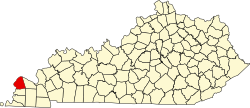
Bandana is a census-designated place (CDP) in Ballard County, Kentucky, United States. As of the 2020 census it had a population of 177. [3]
A post office has been in operation at Bandana since 1880. [4] Some say the community was so named for a traveling salesman who carried his goods in a bandana sack, while others believe the name marks an incident when a bandana was lost by a group of pioneers near the site. [5]
Bandana is located in northern Ballard County at the intersection of Kentucky Route 358 (Bandana Road) and Kentucky Route 473 (Needmore Road / Woodville Road). It is 5 miles (8 km) south of the Ohio River and 22 miles (35 km) west of Paducah.
Historical population | |||
---|---|---|---|
Census | Pop. | %± | |
2020 | 177 | — | |
U.S. Decennial Census [6] |
As of the census [7] of 2010, there were 203 people, 77 households, and 63 families residing in the CDP. The population density was 212.34 per square mile (81.98/km2). There were 101 housing units at an average density of 105.65 per square mile (40.79/km2). The racial makeup of the CDP was 97.0% White, 2.5% African American, and 0.5% from two or more races.
There were 77 households, out of which 23.4% had children under the age of 18 living with them, 70.1% were married couples living together, 10.4% had a female householder with no husband present, and 18.2% were non-families. 11.7% of all households were made up of individuals living alone, and 9.1% had someone living alone who was 65 years of age or older. The average household size was 2.64 and the average family size was 2.87.
In the CDP, the population was spread out, with 21.7% under 18, 3.9% from 20 to 24, 22.1% from 25 to 44, 30.6% from 45 to 64, and 19.3% who were 65 or older. The median age was 44.9 years. For every 100 females, there were 95.2 males. For every 100 females age 18 and over, there were 91.6 males.
The median income for a household in the CDP was $88,906, and the median income for a family was $88,906. The per capita income for the CDP was $40,536.
Ballard County is a county located in the U.S. state of Kentucky. As of the 2020 census, the population was 7,728. Its county seat is Wickliffe. The county was created by the Kentucky State Legislature in 1842 and is named for Captain Bland Ballard, a soldier, statesman, and member of the Kentucky General Assembly. Ballard County is part of the Paducah, KY-IL Micropolitan Statistical Area.
Madera Acres is a census-designated place (CDP) in Madera County, California, United States. It is part of the Madera–Chowchilla Metropolitan Statistical Area. The population was 9,163 at the 2010 census, up from 7,741 at the 2000 census.
Coyne Center is a census-designated place (CDP) in Rock Island County, Illinois, United States. The population was 827 at the 2010 census.
Burlington is a census-designated place (CDP) in and the county seat of Boone County, Kentucky, United States. The population was 15,926 at the 2010 census.
South Wallins is an unincorporated community and census-designated place (CDP) in Harlan County, Kentucky, United States. The population was 859 at the 2010 census, down from 996 at the 2000 census.
Whitley City is a census-designated place (CDP) in McCreary County, Kentucky, United States. The population was 1,170 at the 2010 census. Despite its name, it is not an incorporated city; however, it is the county seat of McCreary County. Whitley City is one of two non-city county seats in Kentucky. This is due to McCreary County not having any cities. With a 2013-2017 Annual Median Household income of $9,234, Whitley City is the poorest place in the United States with a population greater than 1,000.
Phelps is a census-designated place (CDP) in Pike County, Kentucky, United States. The population was 1,053 at the 2000 census. It is the easternmost census-designated community in Kentucky.
Fallston is a census-designated place (CDP) in Harford County, Maryland, United States. The population was 8,958 at the 2010 census, up from 8,427 in 2000. Fallston is a semi-rural community consisting mostly of farms and suburban-like developments.
Kicking Horse is a census-designated place (CDP) in Lake County, Montana, United States. The population was 286 at the 2010 census, up from 80 in 2000.
Cuartelez is a census-designated place (CDP) in Santa Fe County, New Mexico, United States. It is part of the Santa Fe, New Mexico Metropolitan Statistical Area. The population was 469 at the 2010 census.
Mountain Home is an unincorporated community and census-designated place (CDP) in Henderson County, North Carolina, United States. The population was 3,622 at the 2010 census, up from 2,169 in 2000. It is part of the Asheville Metropolitan Statistical Area.
Blanchard is a census-designated place (CDP) in Centre County, Pennsylvania, United States. It is part of the State College, Pennsylvania Metropolitan Statistical Area. The population was 740 at the 2010 census.
Chesterbrook is a census-designated place (CDP) in Chester County, Pennsylvania, United States, within the Philadelphia metropolitan area and just south of Valley Forge National Historical Park. The population was 4,589 at the 2010 census.
Eyers Grove is a census-designated place in Columbia County, Pennsylvania, United States. The population was 105 at the 2010 census. It is part of the Bloomsburg–Berwick Micropolitan Statistical Area.
Hartstown is a census-designated place (CDP) in Crawford County, Pennsylvania, United States. The population was 201 at the 2010 census, down from 246 in 2000.
Baidland is a census-designated place (CDP) in Washington County, Pennsylvania, United States. The population was 1,563 at the 2010 census.
Rosebud also Sicanġu is a census-designated place (CDP) in Todd County, South Dakota, United States. The population was 1,455 at the 2020 census.
Keokee is an unincorporated community and census-designated place (CDP) in Lee County, Virginia, United States. The population was 416 at the 2010 census.
Lake Wisconsin is a census-designated place (CDP) in Columbia and Sauk counties, in the towns of Lodi and Merrimac, in Wisconsin, United States. The population was 4,189 at the 2010 census.
Milford is a census-designated place (CDP) consisting of the main area of settlement within the town of Milford in Penobscot County, Maine, United States. The population was 2,233 at the 2010 census.