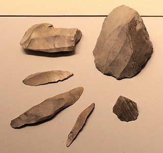
A microlith is a small stone tool usually made of flint or chert and typically a centimetre or so in length and half a centimetre wide. They were made by humans from around 35,000 to 3,000 years ago, across Europe, Africa, Asia and Australia. The microliths were used in spear points and arrowheads.
Monmouth is a town and community in Wales. It is situated where the River Monnow joins the River Wye, 2 miles (3.2 km) from the Wales–England border. Monmouth is 30 miles (48 km) northeast of Cardiff, and 113 miles (182 km) west of London. It is within the Monmouthshire local authority, and the parliamentary constituency of Monmouth. The population in the 2011 census was 10,508, rising from 8,877 in 2001. Monmouth is the historic county town of Monmouthshire although Abergavenny is now the county town.

Trellech is a village and parish in Monmouthshire, south-east Wales. Located 5 miles (8 km) south of Monmouth and 4 miles (6.4 km) north-north-west of Tintern, Trellech lies on a plateau above the Wye Valley on the southern fringes of 320 acres (130 ha) of woodland in an Area of Outstanding Natural Beauty. Three Bronze Age standing stones are situated in the village, known as Harold's Stones, which overlook the historic church of St Nicholas, a Grade I listed building.

Star Carr is a Mesolithic archaeological site in North Yorkshire, England. It is around five miles (8 km) south of Scarborough. It is generally regarded as the most important and informative Mesolithic site in Great Britain. It is as important to the Mesolithic period as Stonehenge is to the Neolithic period or Scandinavian York is to understanding Viking Age Britain.
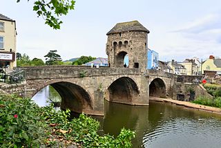
Monnow Bridge, in Monmouth, Wales, is the only remaining fortified river bridge in Great Britain with its gate tower standing on the bridge. Such bridge towers were common across Europe from medieval times, but many were destroyed due to urban expansion, diminishing defensive requirements and the increasing demands of traffic and trade. The historical and architectural importance of the bridge and its rarity are reflected in its status as a scheduled monument and a Grade I listed building. The bridge crosses the River Monnow 500 metres (1,600 ft) above its confluence with the River Wye.
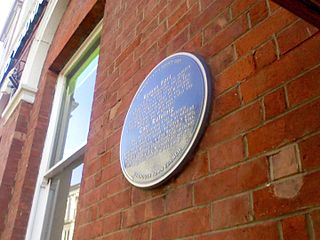
Blestium was a small fort and iron working centre in the Roman province of Britannia Superior, part of Roman Britain. It has been identified with the site of the later town of Monmouth in south east Wales, located adjoining the confluence of the River Monnow with the River Wye. A plaque on the local bank records its position.

The Wye Valley Area of Outstanding Natural Beauty is an internationally important protected landscape straddling the border between England and Wales.
The prehistory of the County of Norfolk, England is broken into specific time periods, these being Palaeolithic, Mesolithic and Neolithic.
Bouldnor Cliff is a submerged prehistoric settlement site in the Solent. The site dates from the Mesolithic era and is in approximately 11 metres of water just offshore of the village of Bouldnor on the Isle of Wight in the United Kingdom. The preservation of organic materials from this era that do not normally survive on dry land has made Bouldnor important to the understanding of Mesolithic Britain, and the BBC Radio 4's Making History programme described it "probably Europe's most important Mesolithic site" albeit concealed under water.
The Monmouth Archaeological Society is a society of amateur and professional archaeologists who encourage the preservation of archaeological artifacts and sites, publish, and carry out archaeological studies in and around Monmouth, Wales.
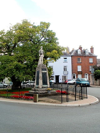
St James Square in Monmouth, Monmouthshire, Wales is the site of a historic Indian Bean Tree. The Catalpa bignonioides, a native of the southeastern United States, was planted in the square in about 1900. It was joined by the Monmouth War Memorial in 1921. After more than one hundred years of presiding over the square, the tree became the focus of controversy when it was condemned by the Monmouthshire County Council in 2005. The decision was met with fierce community opposition. The parties involved resolved their differences in 2006, and the tree received treatment, albeit some of it unauthorized. By 2011, the Indian Bean Tree in St James Square was flourishing.
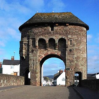
The Monmouth town walls and defences comprise the defensive system of town walls and gates built in Monmouth, Wales between 1297 and the early part of the following century. Wye Bridge Gate, East Gate, Monk's Gate, and Monnow Bridge Gate were access points to the town. West Gate, across Monnow Street, also provided access. Only the Monnow Bridge Gatehouse survives intact, albeit in a substantially modified version from the original.
33 Whitecross Street is a grade II listed building in Monmouth, Wales in the area of St James Square. The property was the site of an archaeological excavation in 2009, which found evidence of Neolithic (prehistoric), Roman, and Medieval activity. The following year, archaeological excavation in the square discovered the first evidence of Mesolithic human settlement in Monmouth.

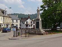
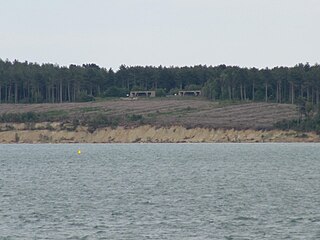
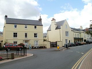
St James Square is a historic square in the town centre of Monmouth, Monmouthshire, Wales. It is located at the eastern end of Whitecross Street, within the medieval town walls. The area features the Monmouth War Memorial and the controversial, historic Indian Bean Tree. In addition, in 2010, the square was the site of discovery of the first Mesolithic artefacts in Monmouth. St James Square is lined with numerous listed buildings. It is also home to the Monmouth Catalpa Tree.
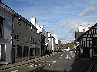
St James Street is a historic street in the town centre of Monmouth, Monmouthshire, Wales. It appears as a segment of Whitecross Street on the 1610 map of the town by cartographer John Speed and is within the medieval town walls. On more recent maps, it extends from St James Square southwest to Almshouse Street. In 2010, the street was the site of discovery of Mesolithic era artefacts. St James Street is lined with numerous listed buildings.

St James House is a grade II listed building in Monmouth, Monmouthshire, Wales. It is in the historic St James Square neighbourhood, within the Medieval town walls. While the house currently has an attractive, 18th-century facade, it originated as a burgage tenement. In addition, behind the house, evidence of a kiln has been unearthed, with both Medieval and Post-medieval pottery. In 2010, archaeological excavation in the square revealed the first evidence of Mesolithic human settlement in Monmouth. Recent residents of St James House have included boarding students from Monmouth School.

Culverwell Mesolithic Site is a Mesolithic settlement, located on the Isle of Portland, Dorset, England. It is found in the local area known as Culverwell, along the Portland Bill Road. It is within an area of unspoiled countryside, with no past quarrying. The site is maintained by the Association for Portland Archaeology – a small group dedicated to researching, investigating and excavating on Portland.
Chopanimando is an important archaeological site, which indicates transition of humans from food gathering society to food production society. It is situated in Belan river valley in modern Allahabad district of Uttar Pradesh state, India. A three phase sequence of palaeolithic, Mesolithic, and Neolithic is attributed by archaeologists. Circular and oval settlement with hearths, hand-made cord-impressed pottery, and microliths, chalcedony are found here during excavation.
Aigyr-Zhal 2 is a historical site in Naryn city on the territory of University of Central Asia (UCA), Kyrgyzstan. It is a part of a bigger and more complex site Aigyr-Zhal. It is dated between Mesolithic time and Middle Ages. Aigyr-Zhal is the only site in the Tian-Shan that has evidence of human occupation from Mesolithic time till the Turkic period . It was first was discovered in 1953 by Akhmat Kibirov. However, during the Soviet time the site was partially destroyed, therefore it was impossible to research the site for a long time. Only in 2012 it was first researched by Kubat Tabaldiev's archaeological team. The length of Aigyr-Zhal 2 is 300 metres, while the width is 100 metres, and the heigh of the site is 2026 metres above the sea level. Since 2002 the whole Aigyr-Zhal complex is in the list of National importance of Kyrgyzstan.
Osmantəpə is an early Neolithic settlement near Kükü village in the Şahbuz district in the Nakhchivan Autonomous Republic.