
The Mesolithic or Middle Stone Age is the Old World archaeological period between the Upper Paleolithic and the Neolithic. The term Epipaleolithic is often used synonymously, especially for outside northern Europe, and for the corresponding period in the Levant and Caucasus. The Mesolithic has different time spans in different parts of Eurasia. It refers to the final period of hunter-gatherer cultures in Europe and Western Asia, between the end of the Last Glacial Maximum and the Neolithic Revolution. In Europe it spans roughly 15,000 to 5,000 BP; in Southwest Asia roughly 20,000 to 10,000 BP. The term is less used of areas farther east, and not at all beyond Eurasia and North Africa.
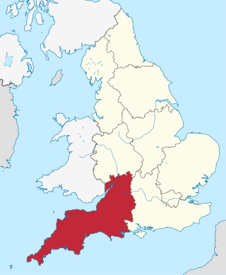
South West England, or the South West of England, is one of nine official regions of England. It consists of the counties of Bristol, Cornwall, Dorset, Devon, Gloucestershire, Somerset and Wiltshire. Cities and large towns in the region include Bath, Bristol, Bournemouth, Cheltenham, Exeter, Gloucester, Plymouth and Swindon. It is geographically the largest of the nine regions of England covering 9,200 square miles (23,800 km2), but the third-least populous, with approximately five million residents.

In ancient Celtic religion, Maponos or Maponus is a god of youth known mainly in northern Britain but also in Gaul. In Roman Britain, he was equated with Apollo.

Maiden Castle is an Iron Age hillfort 1.6 mi (2.6 km) southwest of Dorchester, in the English county of Dorset. Hill forts were fortified hill-top settlements constructed across Britain during the Iron Age.

The British Agricultural Revolution, or Second Agricultural Revolution, was an unprecedented increase in agricultural production in Britain arising from increases in labour and land productivity between the mid-17th and late 19th centuries. Agricultural output grew faster than the population over the hundred-year period ending in 1770, and thereafter productivity remained among the highest in the world. This increase in the food supply contributed to the rapid growth of population in England and Wales, from 5.5 million in 1700 to over 9 million by 1801, though domestic production gave way increasingly to food imports in the 19th century as the population more than tripled to over 35 million. Using 1700 as a base year (=100), agricultural output per agricultural worker in Britain steadily increased from about 50 in 1500, to around 65 in 1550, to 90 in 1600, to over 100 by 1650, to over 150 by 1750, rapidly increasing to over 250 by 1850. The rise in productivity accelerated the decline of the agricultural share of the labour force, adding to the urban workforce on which industrialization depended: the Agricultural Revolution has therefore been cited as a cause of the Industrial Revolution.

Enclosure or Inclosure is a term, used in English landownership, that refers to the appropriation of "waste" or "common land" enclosing it and by doing so depriving commoners of their rights of access and privilege. Agreements to enclose land could be either through a formal or informal process. The process could normally be accomplished in three ways. First there was the creation of "closes", taken out of larger common fields by their owners. Secondly, there was enclosure by proprietors, owners who acted together, usually small farmers or squires, leading to the enclosure of whole parishes. Finally there were enclosures by Acts of Parliament.
The Vale of White Horse is a local government district of Oxfordshire in England. It was historically a north-west projection of Berkshire. The area is commonly referred to as the 'Vale of the White Horse'. It is crossed by the Ridgeway National Trail in its far south, across the North Wessex Downs AONB at the junction of four counties. The northern boundary is defined by the River Thames. The name refers to Uffington White Horse, a prehistoric hill figure.

West Country English is a group of English language varieties and accents used by much of the native population of South West England, the area sometimes popularly known as the West Country.

The Durotriges were one of the Celtic tribes living in Britain prior to the Roman invasion. The tribe lived in modern Dorset, south Wiltshire, south Somerset and Devon east of the River Axe and the discovery of an Iron Age hoard in 2009 at Shalfleet, Isle of Wight gives evidence that they may also have lived in the western half of the island. After the Roman conquest, their main civitates, or settlement-centred administrative units, were Durnovaria and Lindinis. Their territory was bordered to the west by the Dumnonii; and to the east by the Belgae.

A paddy field is a flooded field of arable land used for growing semiaquatic crops, most notably rice and taro. It originates from the Neolithic rice-farming cultures of the Yangtze River basin in southern China, associated with pre-Austronesian and Hmong-Mien cultures. It was spread in prehistoric times by the expansion of Austronesian peoples to Island Southeast Asia, Southeast Asia including Northeastern India, Madagascar, Melanesia, Micronesia, and Polynesia. The technology was also acquired by other cultures in mainland Asia for rice farming, spreading to East Asia, Mainland Southeast Asia, and South Asia.

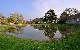
Puddletown is a village and civil parish in Dorset, England. It is situated by the River Piddle, from which it derives its name, about 4.5 miles (7 km) northeast of the county town Dorchester. Its earlier name Piddletown fell out of favour, probably because of connotations of the word "piddle". The name Puddletown was officially sanctioned in the late 1950s. Puddletown's civil parish covers 2,908 hectares and extends to the River Frome to the south. In 2013 the estimated population of the civil parish was 1450.

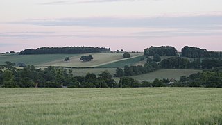
Dorset is a rural county in south west England. Its archaeology documents much of the history of southern England.
Cranborne Chase is an area of central southern England, straddling the counties Dorset, Hampshire and Wiltshire. It is part of the Cranborne Chase and West Wiltshire Downs Area of Outstanding Natural Beauty (AONB).

The British Iron Age is a conventional name used in the archaeology of Great Britain, referring to the prehistoric and protohistoric phases of the Iron Age culture of the main island and the smaller islands, typically excluding prehistoric Ireland, which had an independent Iron Age culture of its own. The parallel phase of Irish archaeology is termed the Irish Iron Age. The Iron Age is not an archaeological horizon of common artefacts but is rather a locally-diverse cultural phase.

Run rig, or runrig, also known as rig-a-rendal, was a system of land tenure practised in Scotland, particularly in the Highlands and Islands. It was used on open fields for arable farming.
The National Museum of Rural Life, previously known as the Museum of Scottish Country Life, is based at Wester Kittochside farm, lying between East Kilbride in South Lanarkshire and Carmunnock in Glasgow. It is run by National Museums Scotland.

Agriculture in Scotland includes all land use for arable, horticultural or pastoral activity in Scotland, or around its coasts. The first permanent settlements and farming date from the Neolithic period, from around 6,000 years ago. From the beginning of the Bronze Age, about 2000 BCE, arable land spread at the expense of forest. From the Iron Age, beginning in the seventh century BCE, there was use of cultivation ridges and terraces. During the period of Roman occupation there was a reduction in agriculture and the early Middle Ages were a period of climate deterioration resulting in more unproductive land. Most farms had to produce a self-sufficient diet, supplemented by hunter-gathering. More oats and barley were grown, and cattle were the most important domesticated animal. From c. 1150 to 1300, the Medieval Warm Period allowed cultivation at greater heights and made land more productive. The system of infield and outfield agriculture may have been introduced with feudalism from the twelfth century. The rural economy boomed in the thirteenth century, but by the 1360s there was a severe falling off in incomes to be followed by a slow recovery in the fifteenth century.

The history of agriculture in Scotland includes all forms of farm production in the modern boundaries of Scotland, from the prehistoric era to the present day.

Agriculture in Scotland in the Middle Ages includes all forms of farm production in the modern boundaries of Scotland, between the departure of the Romans from Britain in the fifth century and the establishment of the Renaissance in the early sixteenth century. Scotland has between a fifth and a sixth of the amount of the arable or good pastoral land of England and Wales, mostly located in the south and east. Heavy rainfall encouraged the spread of acidic blanket peat bog, which with wind and salt spray, made most of the western islands treeless. The existence of hills, mountains, quicksands and marshes made internal communication and agriculture difficult. Most farms had to produce a self-sufficient diet of meat, dairy products and cereals, supplemented by hunter-gathering. The early Middle Ages were a period of climate deterioration resulting in more land unproductive. Farming was based around a single homestead or a small cluster of three or four homes cheese

Agriculture in prehistoric Scotland includes all forms of farm production in the modern boundaries of Scotland before the beginning of the early historic era. Scotland has between a fifth and a sixth of the arable or good pastoral land of England and Wales, mostly in the south and east. Heavy rainfall encouraged the spread of acidic blanket peat bog, which with wind and salt spray, made most of the western islands treeless. Hills, mountains, quicksands and marshes made internal communication and agriculture difficult.
