The Independent Belgian Brigade was a Belgian and Luxembourgish military unit in the Free Belgian forces during World War II, commonly known as the Piron Brigade after its commanding officer Jean-Baptiste Piron. It saw action in Western Europe and participated in the Battle of Normandy, the Liberation of Belgium, and fighting in the Netherlands over 1944-1945.

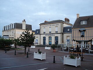
Bernières-sur-Mer, in the arrondissement of Caen, is a commune in the Calvados department of Normandy, in northwestern France. It is part of the canton of Courseulles-sur-Mer. It lies on the English Channel coast, 3 km east of Courseulles-sur-Mer, and 17 km north of Caen.

Courseulles-sur-Mer, commonly known as Courseulles, is a commune in the Calvados department, Normandy, northwestern France. Until 1957, the town's name was simply Courseulles. It lies 3 km west of Bernières-sur-Mer and 18 km north of Caen.

Douvres-la-Délivrande is a commune in the Calvados department in the Normandy region in northwestern France. The name was simply Douvres until 1961, when it was expanded to refer to the basilica Notre-Dame de la Délivrande, located in the town, a site of pilgrimage.

Grandcamp-Maisy is a commune in the Calvados department in the Normandy region in northwestern France.

Graye-sur-Mer is a commune in the Calvados department in the Normandy region, in northwestern France. It lies 1 km west of Courseulles-sur-Mer, and 18 km east of Bayeux.

Gold, commonly known as Gold Beach, was the code name for one of the five areas of the Allied invasion of German-occupied France in the Normandy landings on 6 June 1944, during the Second World War. Gold, the central of the five areas, was located between Port-en-Bessin on the west and the Lieu-dit La Rivière in Ver-sur-Mer on the east. High cliffs at the western end of the zone meant that the landings took place on the flat section between Le Hamel and La Rivière, in the sectors code-named Jig and King. Taking Gold was to be the responsibility of the British Army, with sea transport, mine sweeping, and a naval bombardment force provided by the Royal Navy as well as elements from the Dutch, Polish and other Allied navies.

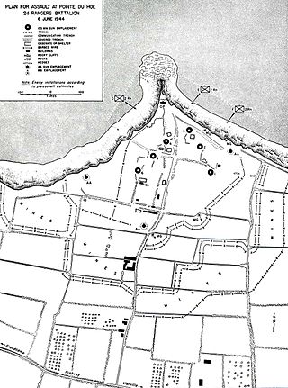
La Pointe du Hoc is a promontory with a 35-metre (110 ft) cliff overlooking the English Channel on the northwestern coast of Normandy in the Calvados department, France.
Ouvrage Mont Agel is a work of the Maginot Line's Alpine extension, the Alpine Line, also called the Little Maginot Line. The 1930s ouvrage was built in and around the earlier mountaintop Fortress of Mont Agel. The ouvrage forms a backup to the main curtain of Alpine Line forts, and was not initially planned as part of the Alpine Line proper. Its intended function was primarily to provide heavy, long-range artillery support from a location well to the rear of the line. However, the planned 145mm heavy guns were never installed. Its site on Mont Agel, at an altitude of 1,118 metres (3,668 ft), is the highest point in the vicinity of Nice and Menton and commands the entire coastline, as well as the approaches from Sospel to the north. The site is now occupied by Base Aérienne 943 of the French Air Force and functions as an air defense control station.

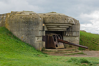
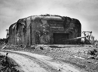
The Longues-sur-Mer battery is a World War II German coastal artillery battery approximately 1 km (0.62 mi) north of the village of Longues-sur-Mer in Normandy, France. The battery is sited on a 60 m (200 ft) cliff overlooking the Baie de Seine and formed a part of Germany's Atlantic Wall coastal fortifications, between the Allied landing sectors of Gold Beach and Omaha Beach.

The Crisbecq Battery was a German World War II artillery battery constructed by the Todt Organization near the French village of Saint-Marcouf in the department of Manche in the north-east of Cotentin peninsula in Normandy. It formed a part of Nazi Germany's Atlantic Wall coastal fortifications. The main armament were three Czech 21 cm Kanone 39 canons, two of which housed in heavily fortified casemates up to 10 feet thick of concrete. The battery, with a range of 27–33 kilometers, could cover the beaches between Saint-Vaast-la-Hougue and Pointe du Hoc.

Fort du Mont Bart is located to the south of Montbéliard, France. It was built between November 1874 and July 1877 as part of the Séré de Rivières system of fortifications. The fort overlooks the valleys of the Doubs and the Allan at an elevation of 497 metres (1,631 ft), standing to the south and rear of the fortified region of Belfort and in control of the road to Besançon. The fort was intended to augment the Belfort fortifications and to prevent an enemy from bypassing them. The most striking feature of the Fort du Mont Bart is its "interior street", originally constructed in the open air as a sunken court, then covered before World War I with reinforced concrete.

The Todt Battery, also known as Batterie Todt, was a battery of coastal artillery built by Nazi Germany during World War II, located in the hamlet of Haringzelles, Audinghen, near Cape Gris-Nez, Pas de Calais, France.

Battery Moltke is an uncompleted World War II former coastal artillery battery in St Ouen in north-west Jersey. It was constructed by Organisation Todt for the Wehrmacht during the occupation of the Channel Islands.

The Maisy Battery is a group of World War II artillery batteries that was constructed in secret by the German Wehrmacht near the French village of Grandcamp-Maisy in Normandy.

The Hillman Fortress was a German bunker complex and command post built during the Second World War and located near Colleville-Montgomery in Normandy, France. The bunker complex, designated as Hill 61 and codenamed Hillman by the British, was attacked on 6 June 1944 by the Suffolk Regiment and the fortress finally surrendered the following morning. The delay in taking the bunker complex has been cited as a reason for the Allies not completing their major D-Day objective of taking Caen.
The Houlgate battery was a World War II German artillery battery constructed close to the French village of Houlgate in the Calvados department in the Lower Normandy region. Built into the top of a 300 ft (91 m) cliff, the bunker complex was created to protect the western bank of the mouth of the River Seine and was 10 mi (16 km) east of the Normandy landing beach Sword which it shelled. The former fire control post has been turned into an orientation table. The battery is 8 km west of the Mont Canisy battery.

The Azeville battery was a World War II German artillery battery constructed close to the French village of Azeville in the Manche department in the Normandy region in northwestern France. It formed a part of Germany's Atlantic Wall coastal fortifications and was involved in the Normandy landings and shelled the US landing beach UTAH for three days after D-Day, 6 June 1944. The battery was heavily bombed on 9 June 1944 and fell to the Americans the same day. The site is owned by the local council and one of the battery's gun casemates now houses a museum.
Amfreville battery was a World War II German artillery battery constructed close to the French village of Querqueville, 5 km (3.1 mi) west of Cherbourg Naval Base, in northwestern France. It formed part of Germany's Atlantic Wall coastal fortifications and protected the western entrance to the port of Cherbourg. The battery engaged British and US ships towards the end of June 1944 before the battery fell to advancing US forces on 26 June 1944.


