Monte Mongioie

Last updated
Monte Mongioie
Monte Mongioie da Pian Ballaur.png
View of the mountain from Pian Ballaur (West)
Highest point
Elevation 2,631 m (8,632 ft) [1]
Listing Alpine mountains 2500-2999 m
Coordinates 44°10′27″N7°47′07″E / 44.1741286°N 7.7852760°E / 44.1741286; 7.7852760 Coordinates: 44°10′27″N7°47′07″E / 44.1741286°N 7.7852760°E / 44.1741286; 7.7852760
Geography
Alps location map.png
Red triangle with thick white border.svg
Monte Mongioie
Location in the Alps
Location Piemonte, Italy
Parent range Ligurian Alps
Geology
Type of rock limestone, dolomite and schists. [2]
Climbing
Easiest route waymarked hiking route

The Monte Mongioie is a mountain of the Ligurian Alps located in Piedmont (NW Italy).

Contents

Toponymy

The mountain was once known also as Cima Rascaira, and appears with this name in the official map of the Regno di Sardegna printed in 1852. [3] It is also referenced as Raschera, which is the name of a lake, of alpine pasture at the foot of the mountain and of the typical cheese of the area. [4] Due to its isolation the summit offers a very good view on a wide stretch of the Western Alps. [3]

Geography

View of the mountain from the Pizzo d'Ormea (East) Monte Mongioie da Est.JPG
View of the mountain from the Pizzo d'Ormea (East)

The mountain is the tripoint where the valleys of Tanaro (south), Ellero (NW) and Corsaglia (NE) meet. [5] Westwards the north water divide of Tanaro Valley continues heading to the Cima delle Saline, while eastwards it connects Monte Mongioie with Monte Rotondo and Pizzo d'Ormea through a pass named Bocchino dell’Aseo (2,295 m). The Corsaglia/Ellero ridge branching out from Monte Mongioie heads North towards the Po Plain.

SOIUSA classification

According to the SOIUSA (International Standardized Mountain Subdivision of the Alps) the mountain can be classified in the following way: [6]

Geology

Monte Mongioie summit and western slopes are made of tabular, marmoreal limestone, dating back to Jurassic; on its eastern part also emerge Triassic layers of dolomitic limestone, located in a belt oriented from North to South passing through the Bocchino dell'Aseo. On the sub-vertical cliffs near the summit and on the SW ridge of MOnte Mongioie can be noticed blackish schistose limestones, fine-grained grey dolomite and red and yellow schists. [2]

Access to the summit

Monte Mongioie as seen from Tanaro valley, on the left the ''Canale delle Scaglie'' Mongioie. Canale delle Scaglie.jpg
Monte Mongioie as seen from Tanaro valley, on the left the ‘’Canale delle Scaglie’’

Summer

The normal route to the Mongioie requires some hiking experience but not alpinistic skills. [3] The summit can be accessed by a waymarked itinerary from Viozene (in the comune of Ormea) passing through a mountain hut named Rifugio Mongioie (1.555 m), and then following by a large foothpath up to Pian dell'Olio. From there a gully called Canale delle Scaglie leads to the Bocchino dell'Aseo, a mountain pass on the Tanaro-Corsaglia water divide. The last part of the ascensin runs up the western ridge of the mountain. [3]

Winter

The mountain is also accessible in winter by ski mountaineers from Viozene [7] or Artesina. [8]

Mountain huts

Maps

Related Research Articles

Monte Frontè

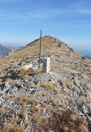
Monte Frontè is a mountain in Liguria, northern Italy, part of the Alps. It is located in the province of province of Imperia. It lies at an altitude of 2,152 metres. After Monte Saccarello it is the second highest peak in the Ligurian region.

Monte Saccarello

Monte Saccarello (Italian) or Mont Saccarel (French) is a mountain located on the French-Italian border between Liguria, Piedmont and Provence-Alpes-Côte d'Azur.

Cima Garlenda Mountain in Italy

Cima Garlenda is a 2,141 m (7,024 ft) mountain of the Ligurian Alps, in Italy. After Monte Saccarello and Monte Frontè it is the third Ligurian summit.

Monte Politri Mountain in Italy

Monte Politri or Bric Rosso is a 3,026 m a.s.l. mountain of the Cottian Alps, located in Italy.

Cima di Pertegà

Cima di Pertegà (Italian) or Cime de la Pertègue (French) is a mountain located on the French-Italian border between Piemonte and Provence-Alpes-Côte d'Azur.

Cime de Capoves

The Cime de Capoves (French) or Cima Capoves (Italian) is a mountain of the Ligurian Alps located in the French region of Provence-Alpes-Côte d'Azur, close to the French-Italian border.

Monte Monega Mountain in Italy

Monte Monega is a 1,882-metre (6,175 ft) mountain of the Ligurian Alps, in Italy.

Carmo di Brocchi Mountain in Italy

Carmo di Brocchi is a 1,610-metre (5,282 ft) mountain of the Ligurian Alps, in Italy.

Monte Spinarda Mountain in Italy

Monte Spinarda is a 1,357-metre (4,452 ft) mountain of the Ligurian Alps in Italy.

Monte Bertrand

Monte Bertrand (Italian) or Mont Bertrand (French) is a mountain located on the French-Italian border between Piemonte and Provence-Alpes-Côte d'Azur.

Cime de Missun

The Cime de Mussun (French) or Cima Missun (Italian) is a mountain of the Ligurian Alps.

Bric Costa Rossa Mountain in Italy

The Bric Costa Rossa is a mountain of the Ligurian Alps located in Piedmont.

Cima della Fascia Mountain in Italy

The Cima della Fascia is a mountain of the Ligurian Alps located in Piedmont.

Monte Antoroto Mountain in Italy

The Monte Antoroto is a mountain of the Ligurian Alps located in Piedmont.

Cima delle Saline Mountain in Italy

The Cima delle Saline is a mountain of the Ligurian Alps located in Piedmont.

Punta Cornour Mountain in Italy

The Punta Cornour is a 2,868 metres high mountain on the Italian side of the Cottian Alps.

Punta Mirauda Mountain in Italy

The Punta Mirauda is a mountain of the Ligurian Alps located in Piedmont.

Monte Cianea Mountain in Italy

Monte Cianea is a 1,226-metre (4,022 ft) mountain of the Ligurian Alps, in Italy.

Cima Cars Mountain in Italy

The Cima Cars is a mountain of the Ligurian Alps located in Piedmont.

Monte Fantino Mountain in Italy

The Monte Fantino is a mountain of the Ligurian Alps located in Piedmont.

References

  1. 1:25.000 map nr.16 "Val Vermenagna Valle Pesio Alta val Ellero Parco naturale del Marguareis" (Map). Ciriè: Fraternali.
  2. 1 2 "Carta Geologica d'Italia scala 1:100.000 - foglio 91 - Boves". Apat.gov.it (in Italian). Archived from the original on 2012-03-14.
  3. 1 2 3 4 "Provincia di Cuneo - monte Mongioie" (in Italian). Archived from the original on 2007-02-23. Retrieved 2008-11-04.
  4. Donnelly, Catherine (2016). "Raschera". The Oxford Companion to Cheese. Oxford University Press. p. 606. ISBN   9780199330898 . Retrieved 2020-01-01.
  5. Carta in scala 1:50.000 n. 8 Alpi Marittime e Liguri (Map). Torino: Istituto Geografico Centrale.
  6. Marazzi, Sergio (2005). Atlante Orografico delle Alpi. SOIUSA (in Italian). Priuli & Verlucca. pp. 62–63. ISBN   978-88-8068-273-8.
  7. "Mongioie (Monte) da Viozene" (in Italian). Gulliver.it. 2010-04-28. Retrieved 2020-01-01.
  8. "Mongioie (Monte) da Artesina" (in Italian). Gulliver.it. 2011-04-13. Retrieved 2020-01-01.

Commons-logo.svg Media related to Monte Mongioie at Wikimedia Commons