Archaeology
The deed of 1278 mentioned above provides the best documentary evidence for the location of Montfichet's Tower. It makes it clear that the tower was between Ludgate and the river, inside the line of the city walls. [9] Baynard's Castle lay to the south, adjacent to St. Andrew-by-the-Wardrobe. A 1980s study of the topography of medieval London suggested a location bounded by Ludgate Hill and Carter Lane to the north and south, and St Paul's deanery and the city wall to the east and west respectively. [14] Redevelopment gave the Department of Urban Archaeology of the Museum of London the opportunity to excavate the area, between 1986 and 1990. [2]
They found two ditches running east–west on the north side of Carter Lane, between 52–66, interpreted as the southern defences of the tower. [2] There was 10 metres (33 ft) of an earlier ditch, estimated at 2 metres (6.6 ft) deep originally, and 41 metres (135 ft) of a later, V-shaped ditch that was about 16 metres (52 ft) wide and 5 metres (16 ft) deep originally. [2] Another ditch was found on Ludgate Hill, some 30 metres (98 ft) north of the southern ditches. It was estimated at 6.8 metres (22 ft) wide and 3 metres (10 ft) deep originally. [2] Pits and a well were found between the ditches, interpreted as the bailey of the castle, but no sign of a keep or other masonry. [2] Watson suggests that a motte and keep may have existed to the east of the Ludgate Hill entrance of Ludgate Square. [2]

The London Wall is a defensive wall first built by the Romans around the strategically important port town of Londinium in c. AD 200, as well as the name of a modern street in the City of London, England.

Ludgate Hill is a street and surrounding area, on a small hill in the City of London, England. The street passes through the former site of Ludgate, a city gate that was demolished – along with a gaol attached to it – in 1760.

St Andrew-by-the-Wardrobe is a Church of England church located on Queen Victoria Street, London in the City of London, near Blackfriars station.
Blackfriars is in central London, specifically the south-west corner of the City of London.

Stansted Mountfitchet is an English village and civil parish in Uttlesford district, Essex, near the Hertfordshire border, 35 miles (56 km) north of London. According to the 2001 census it had a population of 5,533, increasing to 6,011 at the 2011 census. By the 2021 census it had increased to 8,621. The village is served by Stansted Mountfitchet railway station.

Baynard's Castle refers to buildings on two neighbouring sites in the City of London, between where Blackfriars station and St Paul's Cathedral now stand. The first was a Norman fortification constructed by Ralph Baynard, 1st feudal baron of Little Dunmow in Essex, and was demolished by King John in 1213. The second was a medieval palace built a short distance to the south-east and later extended, but mostly destroyed in the Great Fire of London in 1666. According to Sir Walter Besant, "There was no house in [London] more interesting than this".
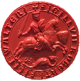
Robert Fitzwalter was one of the leaders of the baronial opposition against King John, and one of the twenty-five sureties of Magna Carta. He was feudal baron of Little Dunmow, Essex and constable of Baynard's Castle, in London, to which was annexed the hereditary office of castellan and chief knight banneret of the City of London. Part of the official aristocracy created by Henry I and Henry II, he served John in the wars in Normandy, in which he was taken prisoner by King Philip II of France and forced to pay a heavy ransom.

Pevensey Castle is a medieval castle and former Roman Saxon Shore fort at Pevensey in the English county of East Sussex. The site is a scheduled monument in the care of English Heritage and is open to visitors. Built around 290 AD and known to the Romans as Anderitum, the fort appears to have been the base for a fleet called the Classis Anderidaensis. The reasons for its construction are unclear; long thought to have been part of a Roman defensive system to guard the British and Gallic coasts against Saxon pirates, it has more recently been suggested that Anderitum and the other Saxon Shore forts were built by a usurper in an ultimately unsuccessful attempt to prevent Rome from reimposing its control over Britain.
Buckton Castle was a medieval enclosure castle near Carrbrook in Stalybridge, Greater Manchester, England. It was surrounded by a 2.8-metre-wide (9 ft) stone curtain wall and a ditch 10 metres (33 ft) wide by 6 metres (20 ft) deep. Buckton is one of the earliest stone castles in North West England and only survives as buried remains overgrown with heather and peat. It was most likely built and demolished in the 12th century. The earliest surviving record of the site dates from 1360, by which time it was lying derelict. The few finds retrieved during archaeological investigations indicate that Buckton Castle may not have been completed.

The fortifications of London are extensive and mostly well maintained, though many of the City of London's fortifications and defences were dismantled in the 17th and 18th century. Many of those that remain are tourist attractions, most notably the Tower of London.

Hen Domen Welsh, meaning "old mound", is the site of a medieval timber motte-and-bailey castle in Powys, Wales. It is the site of the original Montgomery Castle, and was built by Roger de Montgomery in 1070. From 1105 the castle was the home of the de Boulers (Bowdler) family, and it is from Baldwin de Boulers that Montgomery gets its Welsh name, Trefaldwyn "The Town of Baldwin". When the castle was rebuilt in stone (1223–1234), it was decided to rebuild it on a rocky promontory a mile to the southeast—the location of the current town of Montgomery, Powys. The Hen Domen site has been extensively excavated.
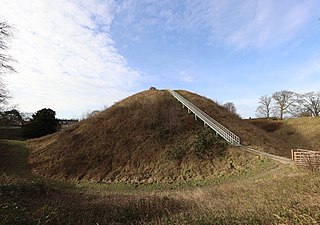
Thetford Castle is a medieval motte and bailey castle in the market town of Thetford in the Breckland area of Norfolk, England. The first castle in Thetford, a probable 11th-century Norman ringwork called Red Castle, was replaced in the 12th century by a much larger motte and bailey castle on the other side of the town. This new castle was largely destroyed in 1173 by Henry II, although the huge motte, the second largest man-made mound in England, remained intact. The motte, recognised as a scheduled monument, now forms part of a local park, and the remains are known variously as Castle Hill, Castle Mound and Military Parade.

Pilsbury Castle was a Norman castle in Derbyshire near the present-day village of Pilsbury, overlooking the River Dove.

A ringwork is a form of fortified defensive structure, usually circular or oval in shape. Ringworks are essentially motte-and-bailey castles without the motte. Defences were usually earthworks in the form of a ditch and bank surrounding the site.
The castles displayed on each map are those listed in the List of castles in England for the corresponding county. Click on the red or green dot to display a detailed map showing the location of the castle. Green dots represent for the most part castles of which substantial remains survive, red dots represent castles of which only earthworks or vestiges survive, or in a few cases castles of which there are no visible remains.

Canterbury city walls are a sequence of defensive walls built around the city of Canterbury in Kent, England. The first city walls were built by the Romans, probably between 270 and 280 AD. These walls were constructed from stone on top of an earth bank, and protected by a ditch and wall towers. At least five gates were placed into the walls, linked to the network of Roman roads across the region. With the collapse of Roman Britain, Canterbury went into decline but the walls remained, and may have influenced the decision of Augustine to settle in the city at the end of the 6th century. The Anglo-Saxons retained the defensive walls, building chapels over most of the gates and using them to defend Canterbury against Viking incursions.

The Marshal of the Army of God and the Holy Church was the title displayed from 1215 by Robert Fitzwalter, the leader of the baronial opposition against John, King of England and one of the twenty-five sureties of Magna Carta. He was feudal baron of Little Dunmow, Essex and constable of Baynard's Castle, in London, to which was annexed the hereditary office of castellain and chief banneret of the City of London. He was elected by his fellow barons, and held the title at least from when the rebels armed themselves in Lincolnshire and formally defied King John. He retained the title at least until he received back the custody of Hertford castle in June. He died on 9 December 1235, and is buried in the Priory Church in Little Dunmow.
The de Montfitchet family were of Norman origin, probably from the town of Montfiquet. Robert Gernon received manorial lands in Essex in reward for his service prior to publication of the Domesday Book in 1086, and his family were subsequently based there, initially in the castle at Stansted Mountfitchet. They lasted for five generations before becoming extinct when Richard de Montfichet died without issue in 1258. Other early attested spellings include Munfichet, Muntfichet, Montefixo, and Mufchet; while later variants include Mountfiquit and Montfiket.
An urban castle is a castle that is located within a medieval town or city or is integrated into its fortifications.

Snodhill Castle is a ruined motte-and-bailey castle, about 1 mi (1.6 km) south of the village of Dorstone in west Herefordshire, England. It is recognized as one of the major castles of the Welsh Marches. It was built in the 11th century to secure the border between Norman England and the Welsh Princes. Archaeological excavations show that it was one of the first Norman castles in England to have stone-built fortifications, with more sophisticated defenses being added in later centuries.
