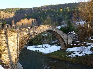
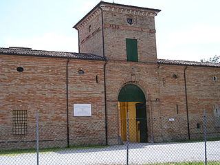
Borghi is a comune (municipality) in the Province of Forlì-Cesena, Emilia-Romagna, Italy. It is located about 100 kilometres (62 mi) southeast of Bologna and about 35 kilometres (22 mi) southeast of Forlì.

Castrocaro Terme e Terra del Sole is a comune (municipality) in the Province of Forlì-Cesena in the Italian region Emilia-Romagna, located about 60 kilometres (37 mi) southeast of Bologna and about 10 kilometres (6 mi) southwest of Forlì.

Civitella di Romagna is a comune (municipality) in the Province of Forlì-Cesena in the Italian region Emilia-Romagna, located about 70 kilometres (43 mi) southeast of Bologna and about 30 kilometres (19 mi) southwest of Forlì.

Dovadola is a comune (municipality) in the Province of Forlì-Cesena in the Italian region Emilia-Romagna, located about 60 kilometres (37 mi) southeast of Bologna and about 20 kilometres (12 mi) southwest of Forlì, on the road leading to Florence.

Galeata is a comune (municipality) in the Province of Forlì-Cesena in the Italian region Emilia-Romagna, located about 70 kilometres (43 mi) southeast of Bologna and about 30 kilometres (19 mi) southwest of Forlì.
Gambettola is a comune (municipality) in the Province of Forlì-Cesena in the Italian region Emilia-Romagna, located about 90 kilometres (56 mi) southeast of Bologna and about 25 kilometres (16 mi) southeast of Forlì. As of 31 December 2004, it had a population of 10,478 and an area of 7.6 square kilometres (2.9 sq mi).

Gatteo is a comune (municipality) in the Province of Forlì-Cesena in the Italian region Emilia-Romagna, located about 90 kilometres (56 mi) southeast of Bologna and about 30 kilometres (19 mi) southeast of Forlì. As of 31 December 2004, it had a population of 7,252 and an area of 14.1 square kilometres (5.4 sq mi).

Longiano is a comune (municipality) in the Province of Forlì-Cesena in the Italian region Emilia-Romagna, located about 90 kilometres (56 mi) southeast of Bologna and about 30 kilometres (19 mi) southeast of Forlì. Longiano borders the following municipalities: Borghi, Cesena, Gambettola, Gatteo, Montiano, Roncofreddo, Santarcangelo di Romagna, Savignano sul Rubicone.
Mercato Saraceno is a comune (municipality) in the Province of Forlì-Cesena in the Italian region Emilia-Romagna, located about 90 kilometres (56 mi) southeast of Bologna and about 35 kilometres (22 mi) southeast of Forlì.

Modigliana is a comune (municipality) in the Province of Forlì-Cesena in the Italian region Emilia-Romagna, located about 50 kilometres (31 mi) southeast of Bologna and about 20 kilometres (12 mi) southwest of Forlì.

Portico e San Benedetto is a comune (municipality) in the province of Forlì-Cesena, in the Italian region of Emilia-Romagna, located about 60 kilometres (37 mi) southeast of Bologna.

Premilcuore is a comune (municipality) in the Province of Forlì-Cesena in the Italian region Emilia-Romagna, located about 70 kilometres (43 mi) southeast of Bologna and about 35 kilometres (22 mi) southwest of Forlì.

Rocca San Casciano is a comune (municipality) in the Province of Forlì-Cesena in the Italian region Emilia-Romagna, located about 60 kilometres (37 mi) southeast of Bologna and about 25 kilometres (16 mi) southwest of Forlì.
Roncofreddo is a town and comune (municipality) in the Province of Forlì-Cesena in the Italian region Emilia-Romagna, located about 90 kilometres (56 mi) southeast of Bologna and about 30 kilometres (19 mi) southeast of Forlì.

San Mauro Pascoli is a comune (municipality) in the Province of Forlì-Cesena in the Italian region Emilia-Romagna, located about 100 kilometres (62 mi) southeast of Bologna and about 35 kilometres (22 mi) southeast of Forlì. It is at some 7.5 kilometres (4.7 mi) from the sea, the frazione of San Mauro Mare facing it.

Santa Sofia is a comune (municipality) in the Province of Forlì-Cesena in the Italian region Emilia–Romagna, located about 80 kilometres (50 mi) southeast of Bologna and about 35 kilometres (22 mi) southwest of Forlì. The municipality of Santa Sofia is located in the Bidente river valley and is surrounded by the Foreste Casentinesi, Monte Falterona, Campigna National Park.

Savignano sul Rubicone is a comune (municipality) in the Province of Forlì-Cesena in the Italian region Emilia-Romagna, located about 90 kilometres (56 mi) southeast of Bologna and about 30 kilometres (19 mi) southeast of Forlì.

Sogliano al Rubicone is a comune (municipality) in the Province of Forlì-Cesena in the Italian region Emilia-Romagna, located about 90 kilometres (56 mi) southeast of Bologna and about 35 kilometres (22 mi) southeast of Forlì.
Tredozio is a comune (municipality) in the Province of Forlì-Cesena in the Italian region Emilia-Romagna, located about 60 kilometres (37 mi) southeast of Bologna and about 30 kilometres (19 mi) southwest of Forlì.
Verghereto is a comune (municipality) in the Province of Forlì-Cesena in the Italian region Emilia-Romagna, located about 90 kilometres (56 mi) southeast of Bologna and about 50 kilometres (31 mi) south of Forlì.


