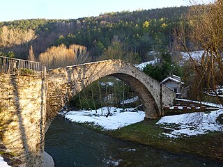
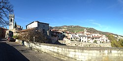
Civitella di Romagna | ||
|---|---|---|
| Comune di Civitella di Romagna | ||
 | ||
| ||
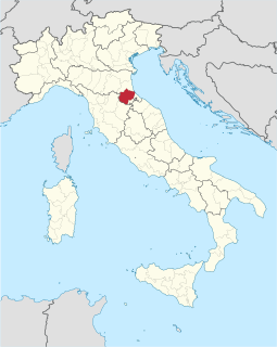
 Civitella di Romagna Location of Civitella di Romagna in Italy  Civitella di Romagna Civitella di Romagna (Emilia-Romagna) | ||
| Coordinates: 44°0′N11°56′E / 44.000°N 11.933°E Coordinates: 44°0′N11°56′E / 44.000°N 11.933°E | ||
| Country | Italy | |
| Region | Emilia-Romagna | |
| Province | forlì-Cesena (FC) | |
| Frazioni | Castagnolo, Cigno, Civorio, Collina, Cusercoli, Giaggiolo, Nespoli, Petrella, San Paolo, Seggio, Seguno, Voltre | |
| Government | ||
| • Mayor | Pierangelo Bergamaschi | |
| Area | ||
| • Total | 117.8 km2 (45.5 sq mi) | |
| Elevation | 219 m (719 ft) | |
| Population (31 May 2007 [1] ) | ||
| • Total | 3,790 | |
| • Density | 32/km2 (83/sq mi) | |
| Time zone | UTC+1 (CET) | |
| • Summer (DST) | UTC+2 (CEST) | |
| Postal code | 47012 | |
| Dialing code | 0543 | |
| Website | Official website | |
Civitella di Romagna (Romagnol : Zivitèla) is a comune (municipality) in the Province of Forlì-Cesena in the Italian region Emilia-Romagna, located about 70 kilometres (43 mi) southeast of Bologna and about 30 kilometres (19 mi) southwest of Forlì.

The comune is a basic administrative division in Italy, roughly equivalent to a township or municipality.
The province of Forlì-Cesena is a province in the Emilia–Romagna region of Italy. Its capital is the city of Forlì. The province has a population of 394,273 as of 2016 over an area of 2,378.4 square kilometres (918.3 sq mi). It contains 30 comuni and the provincial president is Davide Drei. Although located close to the independent Republic of San Marino, Forlì-Cesena does not share a land border with the sovereign state.

Italy, officially the Italian Republic, is a country in Southern and Western Europe. Located in the middle of the Mediterranean Sea, Italy shares open land borders with France, Switzerland, Austria, Slovenia and the enclaved microstates San Marino and Vatican City. Italy covers an area of 301,340 km2 (116,350 sq mi) and has a largely temperate seasonal and Mediterranean climate. With around 61 million inhabitants, it is the fourth-most populous EU member state and the most populous country in Southern Europe.
Civitella di Romagna borders the following municipalities: Cesena, Galeata, Meldola, Predappio, Santa Sofia, Sarsina.
Cesena (Italian pronunciation: [tʃeˈzɛːna]; Romagnol: Cisêna, is a city and comune in the Emilia-Romagna region, served by Autostrada A14, and located near the Apennine Mountains, about 15 kilometres from the Adriatic Sea. The total population is 97,137.

Galeata is a comune (municipality) in the Province of Forlì-Cesena in the Italian region Emilia-Romagna, located about 70 kilometres (43 mi) southeast of Bologna and about 30 kilometres (19 mi) southwest of Forlì.

Meldola is a town and comune near Forlì, in Emilia-Romagna, Italy.