Related Research Articles

Alleghany County is an American county located on the far western edge of Commonwealth of Virginia. It is bordered by the Allegheny Mountains, from which the county derives its name, and it is the northernmost part of the Roanoke Region. The county seat is Covington.

East Sahuarita was a census-designated place (CDP) in Pima County, Arizona, United States. The population was 1,419 at the 2000 census. It is the unincorporated neighborhoods east of incorporated Sahuarita, Arizona.
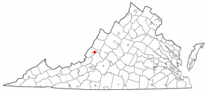
Low Moor is a census-designated place (CDP) in Alleghany County, Virginia. The population was 258 at the 2010 census.

Lake Monticello, a private gated community, is a census-designated place (CDP) in Fluvanna County, Virginia, United States. The population was 9,920 at the 2010 census, an increase of over 44% from 2000. The community is centered on a lake of the same name, which is formed by a dam on a short tributary of the nearby Rivanna River. Lake Monticello is part of the Charlottesville Metropolitan Statistical Area. Lake Monticello was developed in the 1960s as a summer vacation home community but quickly evolved into a bedroom community of Charlottesville, and to a smaller extent of Richmond. It also has a sizable retirement age population.

The Middle Peninsula is the second of three large peninsulas on the western shore of Chesapeake Bay in Virginia, in the United States. It lies between the Northern Neck and the Virginia Peninsula. This peninsula is bounded by the Rappahannock River on the north and the York River on the south, with the Chesapeake Bay to the east. It encompasses six Virginia counties: Essex, Gloucester, King and Queen, King William, Mathews, and Middlesex. Developed for tobacco plantations in the colonial era, in the 21st century the Middle Peninsula is known for its quiet rural life, vegetable truck-farming, and fishing industry.
Bigler's Mill was a small town in Virginia near Williamsburg in York County which is now extinct. It is considered one of the many lost towns of Virginia. The original community on this site was founded by James Bigler in the spring of 1852, who purchased 2400 acres of timberland, part of the tract known as Rippon Hall. He built a sawmill and gristmill with a long pier extending into the York River. A series of homes, a store and church were also constructed. During the Peninsula Campaign of the Civil War, the property was occupied by Confederate forces; in May 1862, Federal gunboats shelled the mill and set fire to the buildings and the pier, for which Bigler was later compensated.
There are several lakes named Mud Lake within the U.S. state of Nevada.
Hogans Hill is an unincorporated community in Westmoreland County, in the U. S. state of Virginia.
Crabbe Mill is an unincorporated community in Northumberland County, in the U.S. state of Virginia.
Lara is an unincorporated community in Northumberland and Richmond counties, in the U.S. state of Virginia.
Luttrellville is an unincorporated community in Northumberland and Richmond counties, in the U.S. state of Virginia.
Mila is an unincorporated community in Northumberland County, in the U.S. state of Virginia. Mila is located at 37°50′32″N76°19′39″W.
Miskimon is an unincorporated community in Northumberland County, in the U.S. state of Virginia.
Moon Corner is an unincorporated community in Northumberland and Richmond counties, in the U.S. state of Virginia.
Rainswood is an unincorporated community in Northumberland and Richmond counties, in the U.S. state of Virginia.
Williams is an unincorporated community in Mathews County, in the U. S. state of Virginia.
Mill Creek, Gloucester County is an unincorporated community in Gloucester County, in the U. S. state of Virginia.
Shades Death Creek is a stream in Fayette County, West Virginia, in the United States.
Bear Creek is a stream in northwestern St. Francois County in the U.S. state of Missouri. It is a tributary of the Big River.
Cowboy Rim is a cliff that runs along the Continental Divide in the Animas Mountains of Hidalgo County, New Mexico. It runs west from a point at 31°36′34″N108°41′37″W to its highpoint is at an elevation of 6,591 feet / 2,009 meters at 31°36′36″N108°39′31″W just east of Elephant Butte. Here Cowboy Rim overlooks the Gillespie Creek valley below it to the north, and the Continental Divide runs along this section of the rim, then turns of to the south-southwest from the highpoint, along a ridge west of Elephant Butte Canyon. Cowboy Rim continues eastward to Elephant Butte then turns south-southeastward to 31°32′52″N108°37′22″W. This section of the Rim overlooks the Playas Valley below it to the east.
References

Coordinates: 37°55′06″N76°39′31″W / 37.91833°N 76.65861°W
| | This Richmond County, Virginia state location article is a stub. You can help Wikipedia by expanding it. For articles relating to the City of Richmond, use Template:RichmondCityVA-geo-stub |