Moosburg an der Isar

Last updated
Moosburg an der Isar
Moosburg, Johannis- und Kastuluskirche 1.jpeg
Churches of Saint John and Saint Castulus
Wappen.Moosburg.svg
Location of Moosburg an der Isar within Freising district
Moosburg an der Isar in FS.svgEchingLangenbachWang
Germany adm location map.svg
Red pog.svg
Moosburg an der Isar
Bavaria location map.svg
Red pog.svg
Moosburg an der Isar
Coordinates: 48°28′N11°56′E / 48.467°N 11.933°E / 48.467; 11.933
Country Germany
State Bavaria
Admin. region Oberbayern
District Freising
Government
   Mayor (202026) Josef Dollinger [1]
Area
  Total43.86 km2 (16.93 sq mi)
Elevation
421 m (1,381 ft)
Population
 (2022-12-31) [2]
  Total19,832
  Density450/km2 (1,200/sq mi)
Time zone UTC+01:00 (CET)
  Summer (DST) UTC+02:00 (CEST)
Postal codes
85360–85368
Dialling codes 08761
Vehicle registration FS
Website www.moosburg.de

Moosburg an der Isar (Central Bavarian: Mooschbuag on da Isa) is a town in the Landkreis Freising of Bavaria, Germany.

Contents

The oldest town between Regensburg and Italy, it lies on the river Isar at an altitude of 421 m (1381 ft). It has 20,237 inhabitants (2022) and covers an area of 44 km2. It is easily reached by the A 92 autobahn and regional trains on the Munich–Regensburg line. Furthermore, it takes just 20 minutes to get to Munich Airport.

Moosburg is popular with commuters who travel to Munich, Freising, and Munich Airport. There is considerable industry in the town consisting of chemical, electro-technical, food processing, and machine-building plants.

History

There was a Benedictine abbey in Moosburg in the 8th century: a cluster of dwellings and artisans sprang up around it. Duke Heinrich der Löwe started the construction of the Kastulus Minster (cathedral) in 1171, dedicated to Saint Castulus – whose supposed relics were brought to the city. In the 12th century, a town was established and received its first charter in 1311. The walls and moat were completed in the 15th century. The town reached its peak during the early part of the 16th century. In 1599, the Benedictines moved to Landshut, reducing Moosburg's importance.

Sieges and plundering during the Thirty Year War started the decline of the town. In 1702, a fire reduced half the buildings to ashes. Moosburg suffered further depredation during the War of the Austrian Succession and the Napoleonic Wars. Another disastrous fire in 1865 resulted in the downtown area being redeveloped in the style of the late 19th century.

During the 1920s and 1930s, new industries revived the town. In September 1939, a prisoner of war camp Stalag VII-A was built to accommodate 10,000. By early 1945, the number of registered prisoners had grown to more than 70,000—including many in associated labor camps. It is likely that the presence of this camp close to the town center spared it from large-scale bombing.

After the liberation of the camp by the Americans at the end of April 1945, it was turned into Civilian Internment Camp #6 for 12,000 German men and women suspected of criminal activity for the Nazi regime. From 1948, the camp served to house German refugees exiled from Eastern Europe. It became a new part of the town, named Moosburg-Neustadt. [3]

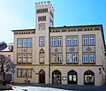
Main sights and culture

The main altar of the Kastulus Minster is the principal masterpiece of the wood sculptor Hans Leinberger of Landshut. Originally, the altar was a triptych in which the side panels could be swiveled inward to close the altar. Today, the side panels hang above the choir stalls.

The Romanesque-style west doorway of the Minster was actually built in the 19th century.

The Baroque facades that survived the 1865 fire can be seen at the east end of Herrnstrasse, for instance, the red front of the chemist's shop.

The memorial to inmates of Stalag VII-A is a fountain in the center of Neustadt. It consists of four bas-reliefs created out of local stone by the French sculptor Antoniucci Volti while he was a prisoner in the camp.

Partner cities

Books

Related Research Articles

<span class="mw-page-title-main">Abensberg</span> Town in Bavaria, Germany

Abensberg is a town in the Lower Bavarian district of Kelheim, in Bavaria, Germany, lying around 30 km (19 mi) southwest of Regensburg, 40 km (25 mi) east of Ingolstadt, 50 km (31 mi) northwest of Landshut and 100 km (62 mi) north of Munich. It is situated on the river Abens, a tributary of the Danube.

Erding is a Landkreis (district) in Bavaria, Germany. It is bounded by the districts of Landshut, Mühldorf, Ebersberg, Munich and Freising.

<span class="mw-page-title-main">Freising (district)</span> District in Bavaria, Germany

Freising is a Landkreis (district) in Bavaria, Germany. Following a recent ranking of the German magazine Focus-Money comparing all German districts it is number one concerning economic growth abilities. It is bounded by the districts of Kelheim, Landshut, Erding, Munich, Dachau and Pfaffenhofen. The district is located north of the Munich metropolitan area. The Isar and Amper rivers run in parallel from southwest to northeast. North of the rivers there is the Hallertau, a hilly region mainly used for hop growing.

<span class="mw-page-title-main">Landshut</span> Town in Bavaria, Germany

Landshut is a town in Bavaria in the south-east of Germany. Situated on the banks of the River Isar, Landshut is the capital of Lower Bavaria, one of the seven administrative regions of the Free State of Bavaria. It is also the seat of the surrounding district and has a population of more than 70,000. Landshut is the largest city in Lower Bavaria, followed by Passau and Straubing, and Eastern Bavaria's second biggest city after Regensburg.

Landshut is a Landkreis (district) in Bavaria, Germany. It is bounded by the districts of Kelheim, Straubing-Bogen, Dingolfing-Landau, Rottal-Inn, Mühldorf, Erding and Freising. The city of Landshut is enclosed by, but does not belong to the district. It is nonetheless its administrative seat.

<span class="mw-page-title-main">Freising</span> Town in Bavaria, Germany

Freising is a university town in Bavaria, Germany, and the capital of the Freising Landkreis (district), with a population of about 50,000.

<span class="mw-page-title-main">Ismaning</span> Municipality in Bavaria, Germany

Ismaning is a municipality in Bavaria, Germany, located near Munich.

<span class="mw-page-title-main">Ergoldsbach</span> Municipality in Bavaria, Germany

Ergoldsbach is a municipality in Bavaria, about 20 km north of Landshut and 80 km northeast of Munich in Germany.

<span class="mw-page-title-main">Landau an der Isar</span> Town in Bavaria, Germany

Landau an der Isar is the second-largest town in the Lower Bavarian district, or Landkreis, of Dingolfing-Landau, in the state of Bavaria, Germany. It lies on the river Isar, 120 km downstream from Munich. In 2020, its population was around 14,000.

<span class="mw-page-title-main">Neustadt an der Donau</span> Town in Bavaria, Germany

Neustadt an der Donau is a town in Lower Bavaria on the Danube in Bavaria, Germany. Lying on the western border of Landkreis Kelheim, Neustadt is primarily known for the thermal spa Bad Gögging. Neustadt had a population of 12,753 as of December 31, 2003.

<span class="mw-page-title-main">Dingolfing</span> Town in Bavaria, Germany

Dingolfing is a town in southern Bavaria, Germany. It is the seat of the Landkreis (district) Dingolfing-Landau. Dingolfing is home of a BMW assembly plant.

<span class="mw-page-title-main">Neufahrn bei Freising</span> Municipality in Bavaria, Germany

Neufahrn bei Freising is a municipality in the district of Freising, in Bavaria, Germany. It has about 20,000 inhabitants and is located near the river Isar, 12 km southwest of Freising and 20 km northeast of Munich.

<span class="mw-page-title-main">Stalag VII-A</span>

Stalag VII-A was the largest prisoner-of-war camp in Nazi Germany during World War II, located just north of the town of Moosburg in southern Bavaria. The camp covered an area of 35 hectares. It served also as a transit camp through which prisoners, including officers, were processed on their way to other camps. At some time during the war, prisoners from every nation fighting against Germany passed through it. At the time of its liberation on 29 April 1945, there were 76,248 prisoners in the main camp and 40,000 or more in Arbeitskommando working in factories, repairing railroads or on farms.

<span class="mw-page-title-main">Fahrenzhausen</span> Municipality in Bavaria, Germany

Fahrenzhausen is a municipality located on the river Amper in the district of Freising in Bavaria in Germany. The town is about 30 Kilometers north of Munich.

<span class="mw-page-title-main">Langenbach, Bavaria</span> Municipality in Bavaria, Germany

Langenbach is a municipality in the district of Freising in Bavaria in Germany.

<span class="mw-page-title-main">Mallersdorf-Pfaffenberg</span> Municipality in Bavaria, Germany

Mallersdorf-Pfaffenberg is a municipality in the district of Straubing-Bogen in Bavaria, Germany and has around 7000 inhabitants.

<span class="mw-page-title-main">Munich–Regensburg railway</span> Railway linking Munich and Regensburg

The Munich–Regensburg railway is a double track, electrified main line railway, linking Munich and Regensburg in the German state of Bavaria, with a total length of 138.1 km. It was opened in 1858 and 1859 and is one of the oldest railways in Germany.

<span class="mw-page-title-main">Hans Leinberger</span> German sculptor

Hans Leinberger, sometimes given as Lemberger was a Late Gothic sculptor from Altbayern, who worked in wood, metal and stone.

<span class="mw-page-title-main">Isarkreis</span> Former administrative district of the Kingdom of Bavaria

The Isarkreis was one of the 15 administrative districts of the Kingdom of Bavaria between 1806 and 1837. It is named after its main river, the Isar. It was the predecessor of the Regierungsbezirk Oberbayern.

Georg Maurus Gandershofer was a German librarian and historian.

References