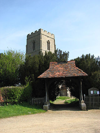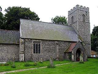
Stow Bedon is a village and former civil parish, now in the parish of Stow Bedon and Breckles, in the Breckland district of the English county of Norfolk. Stow Bedon adjoins the hamlet of Lower Stow Bedon, although the two are often considered to be one village. In the south of the parish is the village of Breckles. In 2011 the merged parish had a population of 290.

Ashwellthorpe and Fundenhall is a civil parish in the English county of Norfolk, situated some 6 km south-east of Wymondham and 20 km south-west of Norwich. The parish includes the villages of Ashwellthorpe and Fundenhall, which lie about 1 km apart, although rather farther by road.

West Newton is a village and former civil parish, now in the parish of Sandringham, in the King's Lynn and West Norfolk district, in the north of the county of Norfolk, England. The village is 1 kilometre (0.62 mi) south of Sandringham, 11 kilometres (7 mi) north of the town of King's Lynn and 60 kilometres (37 mi) north-west of the city of Norwich. In 1931 the parish had a population of 198.

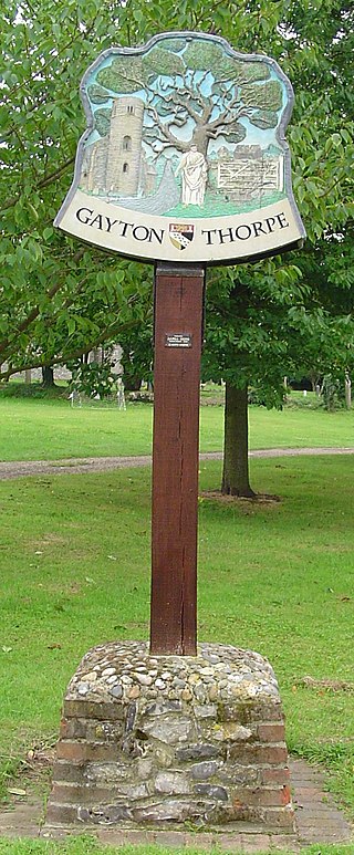
Gayton Thorpe is a village and former civil parish, now in the parish of Gayton, in the King's Lynn and West Norfolk district, in the county of Norfolk, England. The village is located 7.1 miles (11.4 km) south-east of King's Lynn and 31 miles (50 km) north-west of Norwich. In 1931 the parish had a population of 136.

East Lexham is a village and former civil parish, now in the parish of Lexham, in the Breckland district, in the English county of Norfolk. It is 7.7 miles (12.4 km) north of the town of Swaffham, 30.1 miles (48.4 km) west north west of Norwich and 106 miles (171 km) north east of London. In 1931 the parish had a population of 160.

West Lexham is a village and former civil parish, now in the parish of Lexham, in the Breckland district, in the county of Norfolk, England. It is 5.9 miles (9.5 km) north of the town of Swaffham, 30.6 miles (49.2 km) west north west of Norwich and 105 miles (169 km) north east of London. In 1931, the parish had a population of 101. On 1 April 1935 the parish was abolished to form Lexham.

Saxlingham is a village and former civil parish, now in the parish of Field Dalling, in the North Norfolk district, in the county of Norfolk, England. It lies 13 miles (21 km) west of Cromer, 26 miles (42 km) north-west of Norwich, 3.6 miles (5.8 km) west of the town of Holt and 126 miles (203 km) north-east of London. In 1931 the parish had a population of 122.

Tatterford is a village and former civil parish, now in the parish of Tattersett, in the North Norfolk district, in the county of Norfolk, England. The village is 4.8 miles south west of the town of Fakenham, 30.3 miles north west of Norwich and 112 miles north north east of London. The nearest railway station is at Sheringham for the Bittern Line which runs between Sheringham, Cromer and Norwich. The nearest airport is Norwich International Airport. In 1931 the parish had a population of 66.

Botolphs, is a village and former civil parish, located in the parish of Bramber, in the Horsham District of West Sussex, England. It is in the Adur Valley 1.5 miles (2.4 km) southeast of Steyning on the road between Steyning and Coombes. Botolphs lies on the South Downs Way long-distance footpath. In 1931 the parish had a population of 64. On 1 April 1933 the parish was abolished and merged with Bramber.

West Hythe is a hamlet and former civil parish, now in the parish of Hythe, in the Folkestone and Hythe district, in Kent, England, near Palmarsh and a few miles west of the cinque port town of Hythe. In 2020 it had an estimated population of 566.

Banningham is a village and former civil parish, now in the parish of Colby, in the North Norfolk district, in the English county of Norfolk. The village is 2.9 miles north east of Aylsham, 14.7 miles north of Norwich and 129 miles north east of London. The nearest railway station is at North Walsham Railway station where the Bittern Line from Cromer to Norwich can be accessed and the national rail network beyond. The nearest airport is Norwich International Airport. The village lies a small distance east from the A140 Cromer to Norwich road. In 1931 the parish had a population of 207.

Forncett St Mary is a village and former civil parish, now in the parish of Forncett, in the South Norfolk district, in the county of Norfolk, England. The village is located 7.4 miles (11.9 km) east of Attleborough and 10 miles (16 km) south-west of Norwich, close to the course of the River Tas. In 1931 the parish had a population of 153.

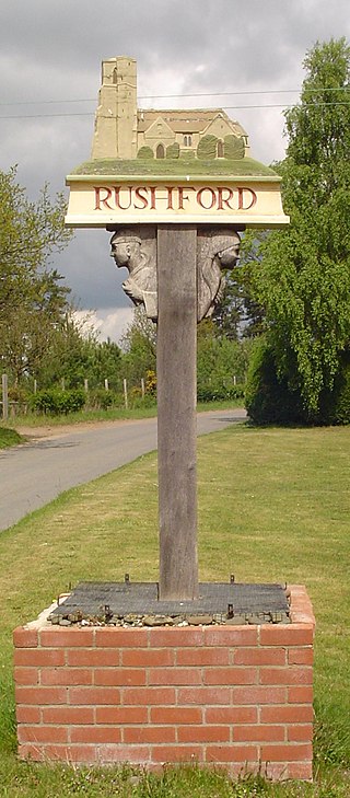
Rushford is a small village in the civil parish of Brettenham, in the Breckland district, in the county of Norfolk, England. It is situated on the north bank of the River Little Ouse, 3+1⁄2 miles (5.6 km) east of the town of Thetford and south of the main A1066 road. The river forms the boundary between Norfolk and Suffolk and, until 1894, Rushford was in both counties. Rushford Hall is south of the river and thus in Suffolk. In 1931 the parish had a population of 94. On 1 April 1935 the parish was abolished and merged with Brettenham.

Thuxton is a small village and former civil parish, now in the parish of Garvestone, Reymerston and Thuxton, in the Breckland district, in the county of Norfolk, England. It is 6 miles north west of Wymondham and 5 miles south east of Dereham. In 1931 the parish had a population of 83. The village retains a church, St Paul's, which has a monthly service and special events. On the 1st of April 1935 the parish was merged with Thuxton to form "Garveston", later the parish was renamed to "Garvestone, Reymerston and Thuxton".

Garvestone is a village and former civil parish, now in the parish of Garvestone, Reymerston and Thuxton, in the Breckland district, in the county of Norfolk, England. It is located 3.8 miles (6.1 km) south-east of Dereham and 7 miles (11 km) north-west of Wymondham, on the upper reaches of the River Yare.

Sharrington is a village and former civil parish, now in the parish of Brinton, in the North Norfolk district, in the county of Norfolk, England. The village is laid out on the southern edge of the A148, 3.5 miles west of Holt. The village is 10 miles east-northeast of the town of Fakenham, 13.4 miles west-southwest of Cromer and 124 miles north-northeast of London. The nearest railway station is at Sheringham for the Bittern Line which runs between Sheringham, Cromer and Norwich. The nearest airport is at Norwich. In 1931 the parish had a population of 195. On 1 April 1935 the parish was abolished and merged with Brinton.

Kimberley is a village in the civil parish of Kimberley and Carleton Forehoe, in the South Norfolk district, in the county of Norfolk, England, situated about 3 miles (4.8 km) north-west of Wymondham, around the crossroads of the B1108 and B1135. The parish absorbed the parish of Carleton Forehoe on the 1 April 1935. In 1931 the parish of Kimberley had a population of 163.

Morley is a civil parish in the South Norfolk district, in the county of Norfolk, England. It includes the villages of Morley St Botolph and Morley St Peter. It covers an area of 8.21 km2 (3.17 sq mi) and had a population of 973 in 182 households at the 2001 census, increasing to a population of 1.241 in 191 households at the 2011 census.

Reymerston is a village and former civil parish, now in the parish of Garvestone, Reymerston and Thuxton, in the Breckland district, in the county of Norfolk, England, six miles north west of Wymondham, six miles south east of Dereham, and a half mile south west of Thuxton. In 1931 the parish had a population of 220. The village retains a church, St. Peter, which has a weekly service and special events. One of the village's residents was Wing Commander Ken Wallis, who lived at Reymerston Hall. He built autogyros and constructed "Little Nellie" for the James Bond film You Only Live Twice. On the 1st of April 1935 the parish was merged with Thuxton to form "Garveston"; later the parish was renamed to "Garvestone, Reymerston and Thuxton".

Metton is a small village and former civil parish, now in the parish of Sustead, in the North Norfolk district, in the county of Norfolk, England. The village is 2.1 km west of Roughton, 5.2 km south of Cromer, 29.3 km north of Norwich and 11.2 km northwest of North Walsham. In 1931 the parish had a population of 86. On 1 April 1935 the parish was abolished and merged with Sustead.


