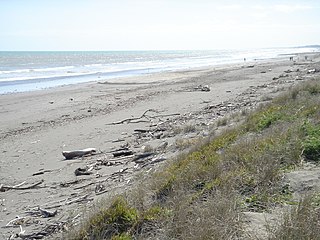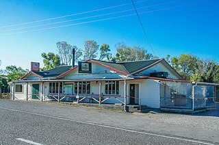
Carterton is a small town in the Wellington Region of New Zealand and the seat of the Carterton District. It lies in a farming area of the Wairarapa in New Zealand's North Island. It is located 14 kilometres (8.7 mi) southwest of Masterton and 80 kilometres (50 mi) northeast of Wellington. The town has a population of 5,800, out of a total district population of 9,960.
Te Mārua is the easternmost urban suburb of Upper Hutt. For reasons of location and distance from the city, the area is often classified as rural. Te Mārua is well known for its Plateau Reserve where remnants of the old Rimutaka Railway path can be found, which now form part of a historic walk. Mt Climie, the highest peak of the Remutaka Range, can also be reached from the reserve. The suburb is also the location of the Wellington Speedway, a nationally important venue for stock car racing, and of the Wellington Naturist Club's club grounds, venue of the historic 2016 World Congress of the International Naturist Federation.

Houghton Bay and Valley is one of the southern suburbs of Wellington, New Zealand. It is located between Island Bay and Lyall Bay, on the rocky shores of the Cook Strait. It has two beaches, Houghton Bay and Princess Bay, used by surfers, swimmers and divers.

Peka Peka, sometimes spelled Pekapeka, is a seaside locality on the Kapiti Coast of New Zealand's North Island. It is located just off State Highway 1 and the North Island Main Trunk railway between Waikanae and Te Horo.

The Akatarawa Valley is a valley in the Tararua Range of New Zealand's North Island. It provides a link from the upper reaches of the Hutt Valley to Waikanae on the Kapiti Coast through rugged hill country. The valley is lowly populated and contains the localities of Reikorangi and Cloustonville. At the Hutt Valley end, the Akatarawa Valley is rugged and the Akatarawa River flows through it. The terrain is less difficult at the Kapiti end, where the Waikanae River flows through part of the valley on its route from its headwaters in the Tararuas to the Tasman Sea, and is met in the valley by tributaries such as the Ngatiawa River and the Reikorangi Stream.

Gladstone is a lightly populated locality in the Carterton District of New Zealand's North Island, located on the Mangahuia Stream near where the Tauweru River joins the Ruamahanga River. The nearest town is Carterton 15 kilometres to the northwest, and nearby settlements include Ponatahi to the west and Longbush to the south. It was named after British prime minister William Ewart Gladstone.

Belmont Regional Park is a Wellington Regional park located between Lower Hutt and Porirua, New Zealand. It is the largest of the Wellington Regional parks, stretching close to 15 kilometres (9 mi) from Wellington Harbour to Haywards and 10 kilometres (6 mi) to Porirua, containing farm land, native bush, and peaks up to 456 metres (1,496 ft).

Wellington Central is an inner-city suburb of New Zealand's capital, Wellington. It comprises the northern part of the central business district, with the majority of Wellington's high-rise buildings.

Pencarrow Head, also known as Pencarrow, is a headland in the Wellington Region of New Zealand and the name of the surrounding area.

Ohariu is a suburb of Wellington, New Zealand. It is a rural area, located 5 kilometres (3.1 mi) from Khandallah.

Karaka Bays is a suburb of Wellington, New Zealand. It lies on the northeast coast of the Miramar Peninsula, 6 km east-south-east of the city centre, and has an expansive view of Wellington Harbour. It takes its name from a New Zealand native tree, the karaka or New Zealand laurel.

Takapu Valley, one of the northern suburbs of Wellington, New Zealand, is a rural area. The only road, Takapu Road, which runs by the Takapu Stream, goes down past Grenada North to the intersection with the Johnsonville-Porirua Motorway, and to Tawa where most facilities are. There is a supermarket and the Takapu Road Railway Station near the motorway intersection, but neither are in the valley itself.

Maupuia on the Miramar Peninsula is an eastern suburb of Wellington to the north-west of Miramar. Developed in the 1970s, it is in the Eastern Ward.
Broadmeadows is a minor western suburb of Wellington, New Zealand. It is located to the north of Khandallah and south of Johnsonville. It is located 7 kilometres (4.3 mi) from the Wellington central business district. Despite its name suggesting that the area was once flat open fields, the suburb was created on steeply sloping hills and features the highest streets within Wellington City with a number of houses located more than 300m above sea level. Broadmeadows has a population of 1,635.
Pipitea is a central suburb of Wellington, in the Wellington region of New Zealand's North Island.
Forest Lakes is a rural locality in the Kapiti Coast District of the Wellington Region of New Zealand's North Island. It is located between Ōtaki and the northern boundary of Kapiti Coast. Forest Lakes Road runs west from State Highway 1. The area contains Lake Waitawa, Ngatotara Lagoon, and several smaller lakes. Lake Kopureherehere is just north of the district border.

Ōtaki Forks is a rural locality in the Kapiti Coast District of the Wellington Region of New Zealand's North Island. It is located at the confluence of the Ōtaki River with its tributaries Waiotauru River and Waitatapia River. It is 18 km southeast of Ōtaki by road. It is the major entrance to the Tararua Forest Park from the west.

Paekākāriki Hill is a rural locality in Porirua in New Zealand's North Island. It is located inland, behind Paraparaumu and Raumati. Paekākāriki Hill Road runs approximately north to south from Paekākāriki to Pāuatahanui. Grays Road runs along the northern coast of Te Awarua-o-Porirua Harbour's Pauatahunui Arm, which forms the locality's southern boundary.

Southgate is a suburb of Wellington, New Zealand, in the Paekawakawa/Southern Ward. The main road is Buckley Road, which runs south from the point at which Mount Albert Road changes name to Houghton Bay Road.
Kokotau is a rural locality and a statistical area in the Carterton District and Wellington Region of New Zealand's North Island. The locality is about 8 km southeast of Carterton by road, and the statistical area covers the district east of Carterton to the Ruamahanga and Waingawa rivers.


