
Marathon County is a county located in the U.S. state of Wisconsin. As of the 2010 census, the population was 134,063. Its county seat is Wausau. It was founded in 1850, created from a portion of Portage County. At that time the county stretched to the northern border with the upper Michigan peninsula. It is named after the battlefield at Marathon, Greece.

Chippewa County is a county located in the U.S. state of Wisconsin. As of the 2010 census, the population was 62,415. Its county seat is Chippewa Falls. The county was founded in 1845 from Crawford County, then in the Wisconsin Territory, and organized in 1853.

Altoona is a city in Eau Claire County, Wisconsin, United States. The population was 6,706 at the 2010 census, with an estimated population in 2014 of 7,155. The city is a railroad terminal on the Union Pacific Railroad.

Eau Claire is a city in Chippewa and Eau Claire counties in the west-central part of the U.S. state of Wisconsin. Located almost entirely in Eau Claire County, for which it is the county seat, the city had a population of 65,883 at the 2010 census, making it the state's ninth-largest city. Eau Claire is the principal city of the Eau Claire, Wisconsin Metropolitan Statistical Area, which is a part of the Eau Claire-Menomonie Combined Statistical Area.
U.S. Route 53, or U.S. Highway 53 (U.S. 53), is a north–south U.S. highway that runs for 403 miles (649 km) from La Crosse, Wisconsin to International Falls, Minnesota. It is the primary north–south route in northwestern Wisconsin, serving as a vital link between I-94 at Eau Claire, Wisconsin and the city of Duluth, Minnesota. The entire route from Eau Claire to the city limits of Superior, Wisconsin is a four lane divided highway. The highway's northern terminus is at the Fort Frances-International Falls Bridge in International Falls, Minnesota, at the Canada–US border. Its southern terminus is in La Crosse, Wisconsin, at U.S. Highway 14.
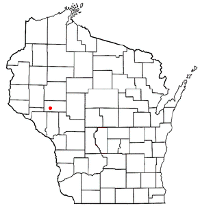
Cleghorn is an unincorporated community in the east central part of the town of Pleasant Valley in Eau Claire County, Wisconsin, United States, about six miles south of Eau Claire. Cleghorn is located one mile east of Wis. 93 along Eau Claire County Highway "HH", at the junction of "HH", "I", and "V". The now-extinct community of Hadleyville lies approximately three miles to the west, along Eau Claire County Highway "HH". Clegorn was once the home of Cleghorn Elementary School. Cleghorn school was a small school located in the center of town. Cleghorn school was shut down in 2003. After the school was torn down, a park pavilion was built, and Cleghorn community park established in 2006. Every year, community members hold a Cleghorn Harvest Festival. This festival has a softball tournament, parade, old fashion car show, craft show, and bike race.

Hadleyville was an unincorporated community in Eau Claire County, Wisconsin, United States, located in the Town of Pleasant Valley just west of the modern junction of S. Lowes Creek Road and County Trunk Highway HH, two miles west of Wis. 93. Although older by several decades than nearby Cleghorn, three miles to the east, the community has long since ceased to exist.

Foster is an unincorporated community in the town of Clear Creek in Eau Claire County, Wisconsin, United States. It lies approximately 9 miles south-southwest of Fall Creek, 7 miles southeast of Cleghorn, and 6 miles northwest of Osseo. Located primarily along Eau Claire County Highway "HH", it is flanked on the west by U.S. Highway 53 and on the east by Interstate 94, being the site of I-94's exit #81 in Wisconsin, placing it 11 miles southeast along the freeway from southeastern Eau Claire and 7 miles northwest of Osseo.
Allen is an unincorporated community in the town of Clear Creek in Eau Claire County, Wisconsin, United States. It lies almost exactly midway between Cleghorn and Foster, at the southern junction of Eau Claire County Highways "D" and "V".
Hale Corner is an unincorporated community located in the town of Otter Creek, Eau Claire County, Wisconsin, United States. The community was named for its first known settler, Charles H. Hale, who came from Maine in 1856.
Hogarty is an unincorporated community located in the towns of Harrison and Plover, Marathon County, Wisconsin, United States. Hogarty is located on the Eau Claire River at the junction of Wisconsin Highway 52 and County Highway Y, 16.5 miles (26.6 km) east-northeast of Wausau. The community was named for John C. Hogarty, who opened a trading post in the area in 1850 and became the first postmaster when the post office opened in 1881.
Union is an unincorporated community located in the town of Union, Eau Claire County, Wisconsin, United States. Union is located along the northwest border of Eau Claire; County Highway T runs through the community.
Little Eau Claire is an unincorporated community located in the town of Reid, Marathon County, Wisconsin, United States.
Nelsonville is a ghost town in Eau Claire County, Wisconsin, United States. Nelsonville was located in the town of Drammen at what is currently the junction of County Highways B and ZZ, 7.8 miles (12.6 km) northeast of Mondovi. The town was marked on USGS maps as late as 1932.
Oak Grove is a ghost town in Eau Claire County, Wisconsin, United States. Oak Grove was located in the town of Drammen along what is now Wisconsin Highway 37, 7.9 miles (12.7 km) east-northeast of Mondovi. The town was marked on USGS maps as late as 1932.
Nix Corner is an unincorporated community in the town of Clear Creek, Eau Claire County, Wisconsin, United States.
Candy Corners is an unincorporated community in Eau Claire County, Wisconsin, United States. Its name is taken from the Candy Corners store, which was established by Jothan Garnett around 1888.


