
Mount Everest is Earth's highest mountain above sea level, located in the Mahalangur Himal sub-range of the Himalayas. The China–Nepal border runs across its summit point. Its elevation of 8,848.86 m was most recently established in 2020 by the Chinese and Nepali authorities.
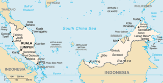
The geography of Malaysia includes both the physical and the human geography of Malaysia, a Southeast Asian country made up of two major landmasses separated by water—Peninsular Malaysia to the west and East Malaysia to the east—and numerous smaller islands that surround those landmasses. Peninsular Malaysia is on the southernmost part of the Malay Peninsula, south of Thailand, north of Singapore and east of the Indonesian island of Sumatra; East Malaysia comprises most of the northern part of Borneo island, and shares land borders with Brunei to the north and Indonesian Borneo to the south.

Mount Tahan, is the highest point in Peninsular Malaysia with an elevation of 7,175 ft (2,187 m) above sea level, on the border between the states of Pahang and Kelantan, with the peak lies on the Pahangese side. It is part of the Taman Negara that straddles Jerantut District in Pahang, Gua Musang District in Kelantan and Hulu Terengganu District in Terengganu. The mountain is part of the Tahan Range in the Tenasserim Hills and is popular with local climbers.

Korab is the highest peak of the eponymous mountain range and the fourth-highest mountain located entirely in the Balkan Peninsula, standing at 2,764 metres.

Dhaulagiri is the seventh highest mountain in the world at 8,167 metres (26,795 ft) above sea level, and the highest mountain within the borders of a single country (Nepal). It was first climbed on 13 May 1960 by a Swiss-Austrian-Nepali expedition. Annapurna I is 34 km (21 mi) east of Dhaulagiri. The Kali Gandaki River flows between the two in the Kaligandaki Gorge, said to be the world's deepest. The town of Pokhara is south of the Annapurnas, an important regional center and the gateway for climbers and trekkers visiting both ranges as well as a tourist destination in its own right.

Manaslu is the eighth-highest mountain in the world at 8,163 metres (26,781 ft) above sea level. It is in the Mansiri Himal, part of the Nepalese Himalayas, in the west-central part of Nepal. The name Manaslu means "mountain of the spirit" and is derived from the Sanskrit word manasa, meaning "intellect" or "soul". Manaslu was first climbed on May 9, 1956, by Toshio Imanishi and Gyalzen Norbu, members of a Japanese expedition. It is said that, given the many unsuccessful attempts by the British to climb Everest before Nepali Tenzing Norgay and New Zealander Edmund Hillary, "just as the British consider Everest their mountain, Manaslu has always been a Japanese mountain".

Grays Peak is the tenth-highest summit of the Rocky Mountains of North America and the U.S. state of Colorado. The prominent 14,278-foot (4352 m) fourteener is the highest summit of the Front Range and the highest point on the Continental Divide and the Continental Divide Trail in North America. Grays Peak is located in Arapahoe National Forest, 3.9 miles (6.2 km) southeast by east of Loveland Pass on the Continental Divide between Clear Creek and Summit counties. The peak is the highest point in both counties.

The Cameron Highlands is a district in Pahang, Malaysia, occupying an area of 712.18 square kilometres (274.97 sq mi). To the north, its boundary touches that of Kelantan; to the west, it shares part of its border with Perak. Situated at the northwestern tip of Pahang, Cameron Highlands is approximately 90 kilometres (56 mi) east from Ipoh, roughly 200 kilometres (120 mi) north from Kuala Lumpur or about 355 kilometres (221 mi) from Kuantan, the capital of Pahang. It is the smallest municipality in the state.
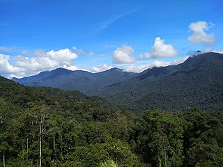
The Titiwangsa Mountains, also known as Banjaran Besar by locals, is the chain of mountains that forms the backbone of the Malay Peninsula. The northern section of the range is in southern Thailand, where it is known as Sankalakhiri Range.

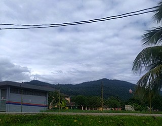
Bukit Larut is a hill resort in Malaysia located in the state of Perak, Malaysia, 10 kilometres southwest from Taiping. It was established under the direction of British colonists in 1884 as a place of observation for tin mining activity and as a retreat for the English people who were based in nearby Larut and Taiping. The area was initially named Maxwell Hill after the British Malaya administrator George Maxwell, and was renamed as Bukit Larut in 1979.
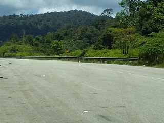
Second East–West Highway, also known as Simpang Pulai–Kuala Berang Highway, Federal Route 185 and Federal Route 36, is a highway in Peninsular Malaysia which connects Simpang Pulai in Perak to Kuala Jeneris in Terengganu. It overlaps with Federal Route 8 Federal Route 8 between Gua Musang and Sungai Relau. It is notorious for its many sharp corners which increase the risk of road accidents.

The Tangkak District is a district in western Johor, Malaysia, bordering Muar District to the south, Segamat District to the northeast, and Jasin District, Malacca to the west. The district also shares a 2 kilometre border with Tampin District, Negeri Sembilan to the northwest. The district capital and largest settlement is the town of Tangkak.

There are two base camps on Mount Everest, on opposite sides of the mountains: South Base Camp is in Nepal at an altitude of 5,364 metres (17,598 ft), while North Base Camp is in China at 5,150 metres (16,900 ft).
Mount Gayong is a mountain in Peninsular Malaysia, situated within the Titiwangsa Range along the border between the states of Perak and Kelantan. It is fourth highest mountain in the Malay Peninsula, at 2,173 metres. It can be reached in about an hour's trek from the peak of Mount Korbu, the highest mountain of the range and the second highest mountain in Peninsular Malaysia. Due to the close proximity between the two mountains, they are collectively known as Korga among the hiking and mountaineering community.

Mount Belumut, or known locally as Gunung Lumut, standing at 1,010 metres (3,314 ft), is a mountain located in Mount Belumut Recreational Forest in Kluang District, Johor, Malaysia, located within a massif north of Linggiu Reservoir. It is the third tallest peak in Johor.

Mount Yong Yap is a mountain located along the Perak and Kelantan state border in Peninsular Malaysia. At 2,168 m (7,113 ft), it is the third highest mountain in Kelantan and the sixth highest in Peninsular Malaysia. This mountain is part of the Titiwangsa Range which is an extension of the Tenasserim Range from Myanmar and Thailand.

Pikes Peak is the highest summit of the southern Front Range of the Rocky Mountains in North America. The ultra-prominent 14,115-foot (4,302.31 m) fourteener is located in Pike National Forest, 12 miles (19 km) west of downtown Colorado Springs, Colorado. The town of Manitou Springs lies at its base.

Mount Yong Belar is a mountain on the border of the states Kelantan and Perak in the Titiwangsa Mountains of Malaysia. Its summit is 2,181 m (7,156 ft) above sea level, making it the highest mountain in the state of Kelantan, and the third highest in Peninsular Malaysia, behind Mounts Tahan and Korbu, the latter being located 8 km north.

The Peninsular Malaysian montane rain forests is an ecoregion on Malay Peninsula. It occupies the mountainous spine of the peninsula in Malaysia and southernmost Thailand. It is in the tropical and subtropical moist broadleaf forests biome.
Mount Tampin is a mountain in Tampin District, Negeri Sembilan, Malaysia, close to the border with Malacca.


