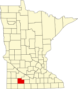
Mountain Lake Township, Cottonwood County, Minnesota

Last updated

Mountain Lake Township
Mountain Lake Township.JPG
A farm in Mountain Lake Township
USA Minnesota location map.svg
Red pog.svg
Mountain Lake Township
Location within the state of Minnesota
Usa edcp location map.svg
Red pog.svg
Mountain Lake Township
Mountain Lake Township (the United States)
Coordinates: 43°53′53″N94°55′47″W / 43.89806°N 94.92972°W / 43.89806; -94.92972
Country United States
State Minnesota
County Cottonwood
Area
  Total35.8 sq mi (92.6 km2)
  Land35.7 sq mi (92.5 km2)
  Water0.1 sq mi (0.2 km2)
Elevation
1,316 [1]  ft (401 m)
Population
 (2010)
  Total384 [2]
  Density10.73/sq mi (4.14/km2)
Time zone UTC-6 (Central (CST))
  Summer (DST) UTC-5 (CDT)
ZIP code
56159
Area code 507
FIPS code 27-44584 [3]
GNIS feature ID0665055 [4]

Mountain Lake Township is a township located in Cottonwood County, Minnesota, United States. According to the 2010 census, the population was 384. [2] The township was organized in 1871. [5]

Contents

Geography

Mountain Lake Township has a total area of 35.8 square miles (93 km2), of which 35.7 square miles (92 km2) is land and 0.1 square miles (0.26 km2), or 0.17%, is water. [6]

It derives its name from the (now drained) lake of the same name which existed within its borders. Otherwise, there are several small creeks flowing in the township. Except for the extreme southern portion of the town of Mountain Lake, which is primarily located in Midway township, there are no incorporated towns within the township. [7] An early historical source describes the land within its borders thus, "It is excellent land and produces immense crops of all grains and grasses common to this latitude." [7]

History

Mountain Lake Township was formally organized on May 6, 1871, at a meeting in the home of A. A. Soule. (The village of the same name, which encompasses a small part of its northern boundary, was platted on May 25, 1872.) [5] [7] It is a full thirty-six section township, located directly south of Midway township, west of the Watonwan county line, north of Jackson county, and directly east of Lakeview township. [7] [8]

Early history

The name "Mountain Lake" itself is attributed to the township's earliest non-native inhabitant, William Mason. As told on the city's (of the same name) website, “the first white settler to the area, William Mason, found a shallow 900-acre lake with three islands. The two smaller islands just broke the water's surface. The third much larger, higher island looked to Mason like a mountain rising from the lake. He named the lake Mountain Lake and the island Mountain Island.” [9] The almost circular island, located in the center of the lake, was flat on top and rose about forty feet out of the water. The top of the island was covered with trees which could be seen for many miles, thus serving as a land-mark and a guide for early settlers. [7] The township was named from the lake which contained the prominent island. [5]

Demand for tillable farmland and construction advances led to the lake's draining in the 1905–06 timeframe. [9] The original lake's largest island – now a tree-covered hill amidst the surrounding farmland – has become a county park, which since 1973 been listed on the National Register of Historic Places. [10] Archeological evidence unearthed in a 1976 dig revealed remnants of a Meskwaki inhabitation from what could be as early as 500 B.C., making the former island's location within the township the oldest human habitation yet to be discovered in the state of Minnesota. [11] [12]

Formation

On May 6, 1871, Daniel D. Bates and others presented a petition at the organizational board meeting held in the home of A. A. Soule, requesting that "township 105, range 34 be set off and called Mountain Lake township." At the organizational meeting, the aforementioned Daniel D. Bates and A. A. Soule, plus M. Jacobson were appointed election judges and S. H. Soule was appointed clerk. The legal description of the newly formed townships was: "Commencing at the northeast corner of township 105, range 34, thence south to the southeast corner of said township and range; thence west to the southwest corner of said township, thence east to the northeast corner of said township and to the northeast corner of said township, thence to the place of beginning." [7]

Mennonite settlement

Mennonite immigrants from Ukraine (at the time, Ukraine was part of Russia) began to arrive in the Mountain Lake area in 1873, having been recruited by William Seeger, a member of the Minnesota State Board of Immigration. Seeger had intentionally targeted these Mennonite farmers, “because they were believed to be hard workers of good character.” [13]

Because the township's farmland was already surveyed, the Mennonites could not arrange themselves in the traditional communal villages they had been accustomed to in their Ukrainian colonies. This forced them to adapt to American-style, single family farms and to live amongst their non-Mennonite neighbors. As settlement continued, however, they soon established a successful and cohesive farming community, “based primarily on agriculture and local commerce.” Many of the township's current residents are descendants of these immigrants. [13]

The township contains a historic cemetery dating to circa 1880, located in section 22 of the township, where some of the pioneer Mennonite residents are buried. The population of the township in 1895 was 612 and the 1900 census counted 512 inhabitants. [7]

Hutterite settlement

In 1994, the Neuhof Hutterite Colony in Mountain Lake township was founded as a division of the Spring Lake Hutterite Colony of Oldham, South Dakota. [14] The Neuhof Colony reports 64 residents. [15] Neuhof is associated with the Hutterite branch known as Schmiedeleut. [16]

In 2005, a second Hutterite colony was formed as a branch of the Upland Hutterite Colony of Letcher, South Dakota, called Elmendorf Christian Community. This community is an independent colony, with a Hutterite tradition. [17] Elmendorf reports 135 residents. [18] Elmendorf is affiliated with a group of independent Hutterites known as the Hutterite Christian Communities.

Demographics

According to the U.S. Census, as of 2010 the township's population was 384, [2] down from 442 in the 2000 census, [19] making the population density 10.73 persons per square mile (4.8/km2). [20]

The 2010 population included 100 households and 81 families residing in the township. There were 100 occupied housing units, with an average household size of 3.84. The racial makeup of the township was 95.8% White, 0.3% African American, 0.8% Asian, 0.5% from two or more races, and 2.6% reporting "some other race". Hispanic or Latino of any race were reported as 5.5% of the population. [2]

Of the 100 households in the township, 19% were non-family households and 81% were families. There were 40 households which had children under the age of 18. 77% of the family households were husband-wife/married families, 2% were male householders with no wife present, and 2% were female householders with no husband present. Of the non-family households, 17 were householders living alone. The average household size was 3.84 and the average family size was 4.21. [2]

In the township, 27.9% the population was under the age of 18 and 72.1% was 18 and over. 10.2% of the population was 65 years of age or older. The median age was 26.7 years. There were 92 females and 92 males. [2]

Government

Mountain Lake Township is governed by an elected township board. [21]

It is located within Minnesota's 1st congressional district, represented by Jim Hagedorn, a Republican. At the state level, the township is located in Senate District 22, represented by Republican Bill Weber, and in House District 22B, represented by Republican Rod Hamilton. [22]

Further reading

Related Research Articles

<span class="mw-page-title-main">Spink County, South Dakota</span> County in South Dakota, United States

Spink County is a county in the U.S. state of South Dakota. As of the 2020 census, the population was 6,361. Its county seat is Redfield. The county was created in 1873, and was organized in 1879 within Dakota Territory.

<span class="mw-page-title-main">Hutchinson County, South Dakota</span> County in South Dakota, United States

Hutchinson County is a county in the U.S. state of South Dakota. As of the 2020 census, the population was 7,427. Its county seat is Olivet. The county was created in 1862 and organized in 1871; it was named for John Hutchinson, first territorial secretary.

<span class="mw-page-title-main">Watonwan County, Minnesota</span> County in Minnesota, United States

Watonwan County is a county in the U.S. state of Minnesota. As of the 2020 census, the population was 11,253. Its county seat is St. James.

<span class="mw-page-title-main">Redwood County, Minnesota</span> County in Minnesota, United States

Redwood County is a county in the U.S. state of Minnesota. As of the 2020 census the population was 15,425. Its county seat is Redwood Falls, along the Redwood River near its confluence with the Minnesota River.

<span class="mw-page-title-main">Lyon County, Minnesota</span> County in Minnesota, United States

Lyon County is a county in the U.S. state of Minnesota. As of the 2020 census, the population was 25,269. Its county seat is Marshall.

<span class="mw-page-title-main">Cottonwood County, Minnesota</span> County in Minnesota, United States

Cottonwood County is a county in the U.S. state of Minnesota. As of the 2020 census, the population was 11,517. Its county seat is Windom.

<span class="mw-page-title-main">Brown County, Minnesota</span> County in Minnesota, United States

Brown County is a county in the U.S. state of Minnesota. As of the 2020 census, the population was 25,912. Its county seat is New Ulm. The county was formed in 1855 and organized in 1856.

<span class="mw-page-title-main">Blue Earth County, Minnesota</span> County in Minnesota, United States

Blue Earth County is a county in the State of Minnesota. As of the 2020 census, the population was 69,112. Its county seat is Mankato. The county is named for the Blue Earth River and for the deposits of blue-green clay once evident along the banks of the Blue Earth River. Blue Earth County is part of the Mankato-North Mankato metropolitan area.

Albin Township is a township in Brown County, Minnesota, United States. The population was 329 at the 2000 census. Albin Township was organized in 1870.

Bashaw Township is a township in Brown County, Minnesota, United States. The population was 243 as of the 2010 census.

Linden Township is a township in Brown County, Minnesota, United States. The population was 343 as of the 2000 census.

Mulligan Township is a township in Brown County, Minnesota, United States. The population was 245 as of the 2000 census. Mulligan Township was organized in 1871.

Spring Prairie Township is a township in Clay County, Minnesota, United States. As of the 2020 census, the population was 506, up from 368 at the previous census.

<span class="mw-page-title-main">Mountain Lake, Minnesota</span> City in Minnesota, United States

Mountain Lake is a city in Cottonwood County, Minnesota, United States. The population was 2,104 at the 2010 census.

<span class="mw-page-title-main">Corn, Oklahoma</span> Town in Oklahoma, United States

Corn is a town in Washita County, Oklahoma, United States. The population was 503 at the 2010 census.

Neuhof may refer to:

The Elmendorf Christian Community is an independent Anabaptist community of Hutterite tradition. Even though the majority of the members are ethnic Hutterites, there are also members from different other backgrounds in the community. They are located in rural Mountain Lake, Minnesota. As of 2024 the ministers are Gary Wurtz and Dwayne Wipf and the manager is William Wurtz.

Altona Christian Community, called Altona Hutterite Colony by GAMEO, is an independent Anabaptist community of Hutterite tradition. Even though the majority of the members are ethnic Hutterites, there are also members from different other backgrounds in the community. They are located in rural Henderson, Minnesota. As of 2017 the minister is Richard Stahl and the secretary was Mark Wollman

The Hutterite Christian Communities are an affiliation of independent Hutterite colonies that work closely together and also have their preachers delivering sermons in the other colonies of this affiliation.

Newdale Colony is a Hutterite colony and census-designated place (CDP) in Brookings County, South Dakota, United States. It was first listed as a CDP prior to the 2020 census. The population of the CDP was 6 at the 2020 census.

References

  1. "Feature Detail Report for: Township of Mountain Lake". Geographic Names Information System(GNIS). United States Geological Survey. September 1, 1995. Retrieved May 4, 2016.
  2. 1 2 3 4 5 6 "Profile of General Population and Housing Characteristics: 2010 Demographic Profile Data (DP-1): Mountain Lake township, Cottonwood County, Minnesota". U.S. Census Bureau, American Factfinder. Archived from the original on February 13, 2020. Retrieved February 2, 2016.
  3. "U.S. Census website". United States Census Bureau . Retrieved January 31, 2008.
  4. "US Board on Geographic Names". United States Geological Survey. October 10, 2007. Retrieved January 31, 2008.
  5. 1 2 3 Upham, Warren (1920). Minnesota Geographic Names: Their Origin and Historic Significance. Minnesota Historical Society. p. 151.
  6. "Mountain Lake township, Cottonwood County, Minnesota (MN)". city-data.com. city-data.com. Retrieved February 1, 2016.
  7. 1 2 3 4 5 6 7 Brown, John A. "Townships of Cottonwood County Minnesota 1916". History Of Cottonwood And Watonwan Counties Minnesota Their People, Industries And Institutions. Vol. 1 (1916 ed.). B.F.Bowen and Company. Retrieved April 2, 2019.
  8. The author or transcriptionist incorrectly says "Lakewood" instead of "Lakeview" township. Lakewood township does not exist.
  9. 1 2 "mountainlakemn.com" . Retrieved October 15, 2015.
  10. "National Register of Historic Places". NRHP. Retrieved October 15, 2015.
  11. "Cottonwood County Parks". Cottonwood County, Minnesota. Retrieved October 15, 2015.
  12. "Archeology Site at Mountain Park". Mountain Lake, Minnesota. Retrieved October 15, 2015.
  13. 1 2 "MNopedia "Mennonites of Mountain Lake"". Minnesota Historical Society. Retrieved October 6, 2015.
  14. Friesen, Bert. "Neuhof Hutterite Colony". Global Anabaptist Mennonite Encyclopedia Online. GAMEO. Retrieved December 1, 2015.
  15. "Hutterite contact directory - Minnesota". Cedrontech. Newdale HB, Inc. Retrieved April 7, 2019.
  16. "Geographic Distribution of the Hutterites". hutterites.org. Waldner and Waldner. Retrieved December 1, 2015.
  17. Friesen, Bert. "Elmendorf Hutterite Colony". Global Anabaptist Mennonite Encyclopedia Online. GAMEO. Retrieved December 1, 2015.
  18. "Hutterite contact directory - Minnesota". Cedrontech. Newdale HB, Inc. Retrieved April 7, 2019.
  19. "Profile of General Demographic Characteristics: 2000 Census 2000 Summary File 1 (SF 1) 100-Percent Data: Mountain Lake township, Cottonwood County, Minnesota". American Factfinder. U.S. Census Bureau, American Factfinder. Archived from the original on February 13, 2020. Retrieved February 1, 2016.
  20. Population density calculated as follows: 2010 population / area in sq. miles e.g. 384/35.8 = 10.73
  21. "Township officials - Mountain Lake". Cottonwood County, Minnesota. Cottonwood County. Retrieved February 2, 2016.
  22. "Who Represents Me?". Legislative Coordinating Commission - Geospatial Information. LCC-GIS Office. Retrieved January 6, 2019.