
The Murray River is a river in Southeastern Australia. It is Australia's longest river at 2,508 km (1,558 mi) extent. Its tributaries include five of the next six longest rivers of Australia. Together with that of the Murray, the catchments of these rivers form the Murray–Darling basin, which covers about one-seventh the area of Australia. It is widely considered Australia's most important irrigated region.

The population of Australia is estimated to be 27,651,800 as of 4 February 2025. It is the 54th most populous country in the world and the most populous Oceanian country. Its population is concentrated mainly in urban areas, particularly on the Eastern, South Eastern and Southern seaboards, and is expected to exceed 30 million by 2029.

The City of Cockburn is a local government area in the southern suburbs of the Western Australian capital city of Perth about 8 kilometres (5 mi) south of Fremantle and about 24 kilometres (15 mi) south of Perth's central business district. The City covers an area of 167.5 square kilometres (64.7 sq mi) and had a population of over 104,000 as at the 2016 Census.

Bradford Peverell is a village and civil parish in the English county of Dorset, 2 miles (3.2 km) north-west of the county town Dorchester. It is sited by the south bank of the River Frome, among low chalk hills on the dip slope of the Dorset Downs. The A37 road between Dorchester and Yeovil passes to the north of the village on the other side of the river's water meadows. In the 2011 census the population of the parish was 357.

Stratton is a village and civil parish in Dorset, England, situated in the Frome valley about 3 miles (4.8 km) north-west of Dorchester. The parish includes the hamlets of Grimstone, Ash Hill and Wrackleford which, like the village, lie on or near the A37 trunk road. Ash Hill is a small estate east of the village near the railway. Wrackleford is a group of houses further east and centred about Wrackleford House and including Higher Wrackleford and Lower Wrackleford. In addition there are a number of isolated farms and houses including a few in an area called Langford near the Sydling Water in the north-west part of the parish.

The Victorian Goldfields Railway is a 1,600 mm broad gauge tourist railway in Victoria, Australia. It operates along a formerly disused branch line between the towns of Maldon and Castlemaine.

Maldon is a town in Victoria, Australia, in the Shire of Mount Alexander local government area. It has been designated "Australia's first notable town" and is notable for its 19th-century appearance, maintained since gold-rush days. At the 2016 census, Maldon had a population of 1,513.

The states and territories are the second level of government of Australia. The states are partially sovereign, administrative divisions that are self-governing polities, having ceded some sovereign rights to the federal government. They have their own constitutions, legislatures, executive governments, judiciaries and law enforcement agencies that administer and deliver public policies and programs. Territories can be autonomous and administer local policies and programs much like the states in practice, but are still legally subordinate to the federal government.

Muckleford is a railway station on the Maldon branch line off the main Echuca, Swan Hill lines in Victoria, Australia. The station was originally opened on 16 June 1884 and was closed to passenger services on 6 January 1941. After this date, the line was used only for goods traffic until closure on 3 December 1976.
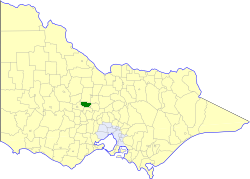
The Shire of Maldon was a local government area about 140 kilometres (87 mi) northwest of Melbourne, the state capital of Victoria, Australia, and 35 kilometres (22 mi) southwest of the regional city of Bendigo. The shire covered an area of 549 square kilometres (212.0 sq mi), and existed from 1858 until 1995.

The Shire of Newstead was a local government area about 120 kilometres (75 mi) northwest of Melbourne, the state capital of Victoria, Australia. The shire covered an area of 409.22 square kilometres (158.0 sq mi), and existed from 1860 until 1995.
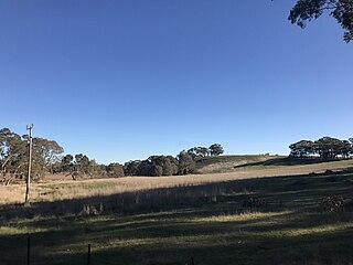
Muckleford is a locality in central Victoria, Australia. The area, also known as Wattle Flat, lies along the Muckleford Creek, a minor tributary of the Loddon River, approximately 127 kilometres north-west of the Melbourne city centre, and within the jurisdiction of the Mount Alexander Shire council. The nearest sizeable town is Castlemaine, approximately 7 km to the east. The original township is named after the English hamlet of the same name in Dorset, UK.

Castlemaine Boroughs was an electoral district of the Legislative Assembly in the Australian state of Victoria from 1856 to 1859. It included the towns Castlemaine, Muckleford, Harcourt and Elphinstone, all roughly 110 to 130 km north-west of Melbourne. The boundaries included non-continuous urban areas.

Castlemaine was an electoral district of the Legislative Assembly in the Australian state of Victoria from 1859 to 1904. It included the towns of Castlemaine, Muckleford and Harcourt.
for the lower house seats in the Victorian Legislative Assembly, see Electoral district of Castlemaine Boroughs (1856–1859) and Electoral district of Castlemaine (1859–1904)
Andrew Butcher is an Australian businessman, former spokesperson for Rupert Murdoch, accomplished race car driver, and partner in corporate advisory firm and political lobbyist, Bespoke Approach.
The 2021 Australian census, simply called the 2021 Census, was the eighteenth national Census of Population and Housing in Australia. The 2021 Census took place on 10 August 2021, and was conducted by the Australian Bureau of Statistics (ABS). It had a response rate of 96.1%, up from the 95.1% at the 2016 census. The total population of the Commonwealth of Australia was counted as 25,422,788, an increase of 8.6 per cent or 2,020,896 people over the previous 2016 census.
Strangways is a locality split between the local government areas of Hepburn Shire and Mount Alexander Shire, in Central Victoria, Australia. It covers an area of 20.105 square kilometres between the townships of Guidford to the east, Newstead to the north-west and Clydesdale to the south.
