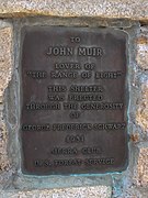
The John Muir Trail (JMT) is a long-distance trail in the Sierra Nevada mountain range of California, passing through Yosemite, Kings Canyon and Sequoia National Parks. It is named after John Muir, a naturalist.

Mount Whitney is the highest mountain in the contiguous United States, with an elevation of 14,505 feet (4,421 m). It is in East–Central California, in the Sierra Nevada, on the boundary between California's Inyo and Tulare counties, and 84.6 miles (136.2 km) west-northwest of North America's lowest topographic point, Badwater Basin in Death Valley National Park, at 282 ft (86 m) below sea level. The mountain's west slope is in Sequoia National Park and the summit is the southern terminus of the John Muir Trail, which runs 211.9 mi (341.0 km) from Happy Isles in Yosemite Valley. The eastern slopes are in Inyo National Forest in Inyo County. Mount Whitney is ranked 18th by topographic isolation.

The John Muir Wilderness is a wilderness area that extends along the crest of the Sierra Nevada of California for 90 miles (140 km), in the Inyo and Sierra National Forests. Established in 1964 by the Wilderness Act and named for naturalist John Muir, it encompasses 652,793 acres (2,641.76 km2). The wilderness lies along the eastern escarpment of the Sierra from near Mammoth Lakes and Devils Postpile National Monument in the north, to Cottonwood Pass near Mount Whitney in the south. The wilderness area also spans the Sierra crest north of Kings Canyon National Park, and extends on the west side of the park down to the Monarch Wilderness.

Mount Muir is a peak in the Sierra Nevada of California, 0.95 miles (1.5 km) south of Mount Whitney. This 14,018-foot (4,273 m) peak is named in honor of John Muir, a geologist, conservationist and founder of the Sierra Club. The southernmost section of the John Muir Trail contours along the west side of Mount Muir near its summit and ends on the summit of Mount Whitney.

Mount Morgan is a mountain located in northwestern Inyo County, California, in the John Muir Wilderness of the Inyo National Forest.

Donohue Pass is a high mountain pass on the boundary between Yosemite National Park and the Ansel Adams Wilderness. Its elevation is 11,066 feet (3,373 m). It is situated between Mount Lyell and Donohue Peak. The John Muir Trail and the Pacific Crest Trail both transverse the pass. Following the John Muir Trail, the pass is 6.3 miles (10.1 km) from Thousand Island Lake, and 12.8 miles (20.6 km) from Tuolumne Meadows. Donohue Pass is the sixth highest pass of the ten named passes on the John Muir Trail.

Mount Goode is a 13,085-foot-elevation mountain summit located on the crest of the Sierra Nevada mountain range in California, United States. It is situated on the shared boundary of Kings Canyon National Park with John Muir Wilderness, and along the common border of Fresno County with Inyo County. It is also approximately one mile west-northwest of Bishop Pass, one mile east-southeast of Mount Johnson, 1.23 miles (1.98 km) south of Hurd Peak, and 16 miles (26 km) west of the community of Big Pine.

Mount Dade is a 13,606 feet (4,147 m) mountain located on the crest of the Sierra Nevada mountain range in northern California, United States. It is situated in the John Muir Wilderness on the boundary between Sierra National Forest and Inyo National Forest, and along the common border of Fresno County with Inyo County. It is one mile west of Dade Lake, and approximately 22 miles (35 km) west of the community of Bishop. Nearby neighbors include Mount Abbot, 0.4 mile to the northwest, and Bear Creek Spire 1.2 mile to the southeast. The USGS probably named this peak during a 1907–09 survey, and the first ascent was made August 19, 1911, by Liston and McKeen, of Fresno.

Black Giant is a 13,330-foot-elevation (4,060-meter) mountain summit located west of the crest of the Sierra Nevada mountain range, in Fresno County of central California, United States. Black Giant ranks as the 86th highest summit in California. It is the northernmost and highest summit on its namesake ridge, the Black Divide in northern Kings Canyon National Park. The peak is situated 3.9 miles (6.3 km) east of Mount Goddard, and 2.6 miles (4.2 km) south-southeast of Mount Fiske, which is the nearest higher neighbor. Topographic relief is significant as it rises 4,000 feet above Le Conte Canyon in approximately two miles. Muir Pass is 1.4 miles (2.3 km) to the northwest, and the approach to this remote peak is made via the John Muir Trail.

Mount Warlow is a 13,206-foot-elevation mountain summit located 1.5 miles (2.4 km) west of the crest of the Sierra Nevada mountain range, in Fresno County of northern California, United States. It is situated on the Goddard Divide in northern Kings Canyon National Park, 1.2 miles (1.9 km) north of Muir Pass, 0.69 miles (1.11 km) southeast of Mount Huxley, and 0.68 miles (1.09 km) southwest of Mount Fiske, which is the nearest higher neighbor. Mount Warlow ranks as the 108th highest summit in California. The approach to this remote peak is made via the John Muir Trail.

Red and White Mountain is a remote 12,816-foot-elevation mountain summit located on the crest of the Sierra Nevada mountain range in northern California, United States. It is situated in the John Muir Wilderness on the shared boundary of Sierra National Forest with Inyo National Forest, and along the common border of Fresno County with Mono County. It is eight miles northeast of Lake Thomas A Edison, and approximately 13 miles (21 km) southeast of the community of Mammoth Lakes. The nearest higher neighbor is Red Slate Mountain, 2 miles (3.2 km) to the north-northwest.

Mount Rixford is a 12,887-foot-elevation (3,928-meter) mountain summit located one mile west of the crest of the Sierra Nevada mountain range, in the southeast corner of Fresno County, in northern California. It is situated in Kings Canyon National Park, 11.5 miles (18.5 km) west of the community of Independence, and one mile north of the Kearsarge Pinnacles and Kearsarge Lakes. Topographic relief is significant as the north aspect rises 2,346 feet above Rae Lakes in one mile. The John Muir Trail crosses Glen Pass one mile to the west of this mountain. Mt. Rixford ranks as the 183rd highest summit in California. Painted Lady is a subsidiary summit at the end of Rixford's north ridge.

Mount Hilgard is a 13,361-foot-elevation (4,072 meter) mountain summit located west of the crest of the Sierra Nevada mountain range in Fresno County of northern California, United States. It is situated in the John Muir Wilderness on land managed by Sierra National Forest, approximately eight miles east-southeast of Lake Thomas A Edison, and immediately above the west end of Lake Italy. The nearest higher neighbor is Mount Gabb, 1.75 miles (2.82 km) to the northeast, and Recess Peak is 2.2 miles (3.5 km) to the northwest. The John Muir Trail follows Bear Creek to the west of this remote peak, providing an approach. Mt. Hilgard ranks as the 82nd highest summit in California.

Mount McDuffie is a 13,291-foot-elevation (4,051-meter) mountain summit located west of the crest of the Sierra Nevada mountain range, in Fresno County of central California, United States. This peak is situated in northern Kings Canyon National Park, 1.9 miles (3.1 km) northwest of The Citadel, and two miles south of Black Giant, which is the nearest higher neighbor. McDuffie ranks as the 93rd highest summit in California, and the second-highest point on Black Divide. Topographic relief is significant as it rises nearly 4,900 feet above Le Conte Canyon in approximately 2.5 miles. An approach to this remote peak is made possible via the John Muir Trail.

Mount Baldwin is a 12,614-foot-elevation (3,845-meter) mountain summit located in the Sierra Nevada mountain range in Mono County of northern California, United States. It is situated in the John Muir Wilderness on land managed by Inyo National Forest. It is four miles north of Red and White Mountain, and approximately 10.5 miles (16.9 km) southeast of the community of Mammoth Lakes. The nearest higher neighbor is Red Slate Mountain, 2 miles (3.2 km) to the south-southwest. Baldwin ranks as the 257th highest summit in California. Topographic relief is significant as the east aspect rises 3,775 feet above McGee Canyon in 1.5 mile. The first ascent of the summit was made July 2, 1928, by Norman Clyde, who is credited with 130 first ascents, most of which were in the Sierra Nevada.

Mount Starr, elevation 12,835 feet (3,912 m), is a mountain summit located on the crest of the Sierra Nevada mountain range in northern California, United States. It is situated in the John Muir Wilderness on the common boundary shared by Sierra National Forest with Inyo National Forest, and along the common border of Fresno County with Inyo County. It is bound on the east by Little Lakes Valley, and is 0.8 mile northeast of Mono Pass. Topographic relief is significant as the summit rises 2,300 feet above Little Lakes Valley in approximately one-half mile (0.80 km). Neighbors include Mount Abbot, three miles to the south-southwest, Mount Morgan, 2.5 miles to the southeast, and Pointless Peak is 2.5 miles to the north.

Mount Senger is a 12,286-foot-elevation (3,745 meter) mountain summit located west of the crest of the Sierra Nevada mountain range in Fresno County of northern California, United States. It is set within the John Muir Wilderness, on land managed by Sierra National Forest. It is situated 2.2 miles (3.5 km) southeast of Mount Hooper, 2.6 miles (4.2 km) southwest of Gemini, and 2.7 miles (4.3 km) south-southwest of Seven Gables. Senger ranks as the 348th-highest summit in California. Topographic relief is significant as the summit rises over 4,600 feet above the South Fork San Joaquin River in approximately three miles. The John Muir Trail traverses the south and west slopes of the mountain, providing an approach option.

Mount Stanford is a 12,838-foot-elevation (3,913 meter) mountain summit located on the crest of the Sierra Nevada mountain range in northern California, United States. It is situated in the John Muir Wilderness, on the boundary shared by Sierra National Forest with Inyo National Forest, and along the common border of Fresno County with Mono County. It is 10 miles northeast of Lake Thomas A Edison, and approximately 15 miles (24 km) southeast of the community of Mammoth Lakes. Topographic relief is significant as the north aspect rises 3,200 feet above McGee Creek in approximately 1.75 mile. There is another Mount Stanford in the Sierra Nevada which is named for Stanford University.

Mount Hooper is a 12,349-foot (3,764 meter) high mountain summit located west of the crest of the Sierra Nevada mountain range in Fresno County of northern California, United States. It is set within the John Muir Wilderness, on land managed by Sierra National Forest. It is situated 4.26 miles (6.86 km) west of Gemini, 3.6 miles (5.8 km) southwest of Seven Gables, and 2.25 miles (3.62 km) west-northwest of Mount Senger. Hooper ranks as the 326th-highest summit in California, and topographic relief is significant as the summit rises over 5,000 feet above Florence Lake in approximately four miles. The John Muir Trail traverses the east slope of the mountain, providing an approach option.

Pinchot Pass is a high mountain pass in the Sierra Nevada mountain range of California, in the United States. It lies within far eastern Fresno County, inside Kings Canyon National Park and the Sequoia-Kings Canyon Wilderness.


