Mulgrave-et-Derry, Quebec

Last updated

Mulgrave-et-Derry
Mulgrave-et-Derry QC.JPG
Quebec Route 315 through Blanche, Mulgrave-et-Derry
Mulgrave-et-Derry Quebec location diagram.png
Location within Papineau RCM
Canada Western Quebec location map.png
Red pog.svg
Mulgrave-et-Derry
Location in western Quebec
Coordinates: 45°47′N75°22′W / 45.783°N 75.367°W / 45.783; -75.367 [1]
CountryFlag of Canada (Pantone).svg  Canada
Province Flag of Quebec.svg  Quebec
Region Outaouais
RCM Papineau
ConstitutedJanuary 1, 1870
Government
[2]
  MayorMichael Kane
   Federal riding Argenteuil—Papineau—Mirabel
   Prov. riding Papineau
Area
  Total319.00 km2 (123.17 sq mi)
  Land289.52 km2 (111.78 sq mi)
Population
 (2021) [3]
  Total461
  Density1.6/km2 (4/sq mi)
  Pop 2016-2021
Increase2.svg 24.9%
  Dwellings
476
Time zone UTC−5 (EST)
  Summer (DST) UTC−4 (EDT)
Postal code(s)
Area code 819
HighwaysQc315.svg R-315
Website www.mulgrave-derry.ca OOjs UI icon edit-ltr-progressive.svg

Mulgrave-et-Derry, is a village north of Mayo, in the Papineau Regional County Municipality, Quebec, Canada. The region includes a number of notable lakes, including Gull Lake, Hawk Lake, Lady Lake, Smallian Lake, Lac St. Sixte, Lac La Blanche and Little Lake. Community buildings include the Hill and Gully Riders Snowmobile Club, St. Matthew's Evangelical Lutheran Church, and Our Lady of Light Roman Catholic Church (now Our Lady of Light Cultural Centre).

Contents

The Wallingford-Back mine, once one of Canada's largest sources of quartz, is located in Mulgrave-et-Derry. It became a tourist destination after ceasing operations in the 1970s, but also became unsafe; in 2017, it was barricaded. [4]

Demographics

Canada census – Mulgrave-et-Derry community profile
2021 2016 2011
Population461 (+24.9% from 2016)369 (0.8% from 2011)366 (% from 2006)
Land area289.52 km2 (111.78 sq mi)293.75 km2 (113.42 sq mi)295.99 km2 (114.28 sq mi)
Population density1.6/km2 (4.1/sq mi)1.3/km2 (3.4/sq mi)1.2/km2 (3.1/sq mi)
Median age55.6 (M: 56.8, F: 53.6)55.8 (M: 55.8, F: 55.6)52.3 (M: 52.8, F: 51.8)
Private dwellings230 (total) 396 (total) 428 (total) 
Median household income$70,000$57,728
References: 2021 [5] 2016 [6] 2011 [7] earlier [8] [9]
Historical census populations – Mulgrave-et-Derry, Quebec
YearPop.±%
1986 225    
1991 233+3.6%
1996 250+7.3%
2001 235−6.0%
2006 389+65.5%
2011 366−5.9%
2016 369+0.8%
2021 461+24.9%
The 2011 population is based on the revised count.
Source: Statistics Canada

Arms

Coat of arms of Mulgrave-et-Derry, Quebec
Notes
Granted 15 September 2022 [10]
Crest
A cerulean warbler singing proper perched on an oak branch fructed Or leaved Vert.
Escutcheon
Per pale Vert and Or on a pile reversed throughout per pale Argent and Azure a log cabin above a bar gemel wavy counterchanged.
Supporters
Two black bears proper, that to the dexter supporting on its shoulder a pickaxe Or its blade Argent, that to the sinister supporting on its shoulder an axe Or its blade Argent, both standing on a grassy mount set with bloodroot wildflowers proper and a split-rail fence Or.
Motto
Ad Harmoniam Cum Natura (Towards Harmony With Nature)
Badge
A lozenge per pale Argent and Azure charged with a snowmobile above a bar gemel wavy counterchanged and surmounting an annulus per pale Azure and Argent edged and inscribed with the Motto counterchanged.

See also

Related Research Articles

<span class="mw-page-title-main">Le Domaine-du-Roy Regional County Municipality</span> Regional county municipality in Quebec, Canada

Le Domaine-du-Roy(The King's Domain) is a regional county municipality in the Saguenay-Lac-Saint-Jean region of Quebec, Canada. Its seat is in Roberval, and it is named for the King of France, who owned the land at the time of the colonization of Quebec.

<span class="mw-page-title-main">Témiscouata Regional County Municipality</span> Regional county municipality in Quebec, Canada

Témiscouata is a regional county municipality in the Bas-Saint-Laurent region of Quebec, Canada. It is located southeast of Rivière-du-Loup, bordering New Brunswick, and is centred on Lake Témiscouata. Its seat is Témiscouata-sur-le-Lac.

<span class="mw-page-title-main">Mayo, Quebec</span> Municipality in Quebec, Canada

Mayo is a municipality in the Papineau Regional County Municipality of western Quebec, located northeast of the city of Gatineau. Mayo is south of the hamlet of Mulgrave-et-Derry.

<span class="mw-page-title-main">Lac-Etchemin, Quebec</span> Municipality in Quebec, Canada

Lac-Etchemin is a municipality in and the seat of the Municipalité régionale de comté des Etchemins in Quebec, Canada. It is part of the Chaudière-Appalaches region and the population is 4,028 as of 2021. It takes its name from Etchemin Lake, at the centre of the municipality. "Etchemin" means "men, human beings" in Abenaki language.

<span class="mw-page-title-main">Nominingue</span> Municipality in Quebec, Canada

Nominingue is a small village and municipality located 200 kilometres (120 mi) north of Montreal, Quebec, Canada, in the Laurentian Mountains. It was formerly called Lac-Nominingue, but changed name on September 16, 2000.

<span class="mw-page-title-main">Les Lacs-du-Témiscamingue</span> Unorganized territory in Quebec, Canada

Les Lacs-du-Témiscamingue is a large unorganized territory in the Abitibi-Témiscamingue region of Quebec, Canada. With a total area of 12,224.27 square kilometres (4,719.82 sq mi), it takes up over 60% of the eastern portion of the Témiscamingue Regional County Municipality.

<span class="mw-page-title-main">Laniel, Quebec</span> Unorganized territory in Quebec, Canada

Laniel is an unorganized territory in the Témiscamingue Regional County Municipality, Abitibi-Témiscamingue region, Quebec, Canada. It surrounds the northern portion of Lake Kipawa.

<span class="mw-page-title-main">Montpellier, Quebec</span> Municipality in Quebec, Canada

Montpellier is a town and municipality in the Papineau Regional County Municipality in the Outaouais region of Quebec, Canada. The town is located 30 kilometres (19 mi) northwest of Papineauville.

<span class="mw-page-title-main">Duhamel, Quebec</span> Municipality in Quebec, Canada

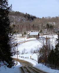
Duhamel is a town and municipality in the Outaouais region of Quebec, Canada. It is the largest municipality in surface area in the Papineau Regional County Municipality.

<span class="mw-page-title-main">Lac-Simon, Outaouais</span> Municipality in Quebec, Canada

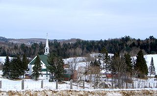
Lac-Simon is a town and municipality in the Outaouais region of Quebec, Canada, part of the Papineau Regional County Municipality.

<span class="mw-page-title-main">Lac-Granet</span> Unorganized territory in Quebec, Canada

Lac-Granet is an unorganized territory in the Abitibi-Témiscamingue region of Quebec, Canada. It is one of five unorganized territories in the La Vallée-de-l'Or Regional County Municipality.

<span class="mw-page-title-main">Namur, Quebec</span> Municipality in Quebec, Canada

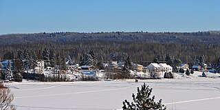
Namur is a town and municipality in the Outaouais region of Quebec, Canada, part of the Papineau Regional County Municipality. It is nicknamed "la Nouvelle Belgique".

<span class="mw-page-title-main">Lac-des-Plages, Quebec</span> Municipality in Quebec, Canada

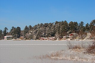
Lac-des-Plages is a town and municipality in the Outaouais region of Quebec, Canada, part of the Papineau Regional County Municipality. It is named after Lac des Plages which attracts many vacationers with the beauty of its beaches.

<span class="mw-page-title-main">Sainte-Anne-du-Lac</span> Municipality in Quebec, Canada

Sainte-Anne-du-Lac is a municipality and village in the Laurentides region of Quebec, Canada, part of the Antoine-Labelle Regional County Municipality.

<span class="mw-page-title-main">Mont-Blanc, Quebec</span> Municipality in Quebec, Canada

Mont-Blanc, is a municipality in the Laurentides region of Quebec, Canada, part of the Les Laurentides Regional County Municipality.

<span class="mw-page-title-main">Notre-Dame-du-Laus</span> Municipality in Quebec, Canada

Notre-Dame-du-Laus is a municipality in the Laurentides region of Quebec, Canada, part of the Antoine-Labelle Regional County Municipality.

<span class="mw-page-title-main">Lac-du-Cerf</span> Municipality in Quebec, Canada

Lac-du-Cerf is a municipality in the Laurentides region of Quebec, Canada, part of the Antoine-Labelle Regional County Municipality. It is located on and named after Lac du Cerf.

<span class="mw-page-title-main">Saint-Aimé-du-Lac-des-Îles</span> Municipality in Quebec, Canada

Saint-Aimé-du-Lac-des-Îles is a municipality in the Laurentides region of Quebec, Canada, part of the Antoine-Labelle Regional County Municipality.

<span class="mw-page-title-main">Lac-des-Écorces, Quebec</span> Municipality in Quebec, Canada

Lac-des-Écorces is a municipality and village in the Laurentides region of Quebec, Canada, part of the Antoine-Labelle Regional County Municipality.

<span class="mw-page-title-main">Lac-Saint-Paul, Quebec</span> Municipality in Quebec, Canada

Lac-Saint-Paul is a municipality in the Laurentides region of Quebec, Canada, part of the Antoine-Labelle Regional County Municipality.

References

  1. "Banque de noms de lieux du Québec: Reference number 379132". toponymie.gouv.qc.ca (in French). Commission de toponymie du Québec.
  2. 1 2 "Répertoire des municipalités: Geographic code 80085". www.mamh.gouv.qc.ca (in French). Ministère des Affaires municipales et de l'Habitation.
  3. 1 2 "Profile table, Census Profile, 2021 Census of Population - Mulgrave-et-Derry, Municipalité (MÉ) [Census subdivision], Quebec". 9 February 2022.
  4. "Barricades installed to keep tourists away from scenic Outaouais mine". CBC News. 30 July 2017. Retrieved 30 July 2017.
  5. "2021 Community Profiles". 2021 Canadian Census . Statistics Canada. February 4, 2022. Retrieved 2022-08-23.
  6. "2016 Community Profiles". 2016 Canadian Census . Statistics Canada. August 12, 2021. Retrieved 2020-01-30.
  7. "2011 Community Profiles". 2011 Canadian Census . Statistics Canada. March 21, 2019. Retrieved 2020-01-30.
  8. "2006 Community Profiles". 2006 Canadian Census . Statistics Canada. August 20, 2019.
  9. "2001 Community Profiles". 2001 Canadian Census . Statistics Canada. July 18, 2021.
  10. "Municipalité de Mulgrave-et-Derry". Canadian Heraldic Authority. Retrieved 30 July 2023.