
The city of Rome, Italy is divided into first-level administrative subdivisions.
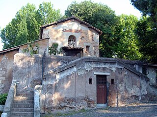
The Via Laurentina is the name born by an ancient and a modern road of Italy, both leading southwards from Rome.

Torrenova is the 16th zona of Rome, identified by the initials Z. XVI. It belongs partly to the Municipio VI and partly to the Municipio VII.

Ponte Galeria is the 41st zona of Rome, Italy, identified by the initials Z. XLI. Geographically it was part of Agro Romano. The zone belongs to the Municipio XI.

Via Cristoforo Colombo is a street in Rome (Italy) that links the historic centre to Ostia. Along most of its route, the street has three lanes for each direction of movement. With its 27 kilometres (17 mi) length it is the longest Italian road among those included within the borders of a single municipality and, in several stretches, the largest in Italy.

Ostiense is the 10th quartiere of Rome, identified by the initials Q. X.
Colle Salario is a frazione of the Municipality of Rome (Italy), located in the zone Z. II Castel Giubileo, within the territory of the urban zone 4E Serpentara of the Municipio Roma III.
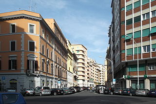
Portuense is the 11th quartiere of Rome (Italy), identified by the initials Q.XI.

Giuliano-Dalmata is the 31st quartiere of Rome, identified by the initials Q. XXXI. Its name refers to the Julian, Istrian and Dalmatian refugees that settled there in the postwar period.

Pietralata is the 21st quartiere of Rome, identified by the initials Q. XXI, and belongs to the Municipio IV. Its name comes from the Latin Prata Lata meaning large fields, which is possibly a reference to the large amount of nature and vegetation present.

Municipio Roma III is the third administrative subdivision of Rome (Italy).

The following outline is provided as an overview of and topical guide to Rome:
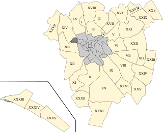
The Quarters of Rome are the areas in and around the Italian city of Rome which became urbanised after the foundation of the last city-centre rione, Prati.

Municipio Roma VII is the seventh administrative subdivision of the Municipality of Rome (Italy).

Salario is the 4th quarter of Rome (Italy), identified with the initials Q. IV.
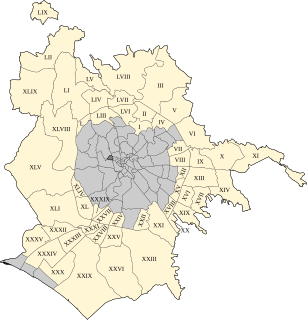
The zones of Rome are toponymic subdivisions within the area of the Ager Romanus, belonging to the Municipalities of Rome and Fiumicino, Italy.

The Suburbi di Roma are the third level of toponomastic subdivision of the Municipality of Rome (Italy).
Prenestino-Labicano is the 7th quartiere of Rome (Italy), identified by the initials Q. VII. The name derives from the ancient roads Via Prenestina and Via Labicana, today the initial stretch of Via Casilina. It belongs to the Municipio V and Municipio VII.
Tuscolano is the 8th quartiere of Rome (Italy), identified by the initials Q. VIII. The name derives from the ancient road Via Tuscolana. It belongs to the Municipio V and Municipio VII.

Ardeatino is the 20th quartiere of Rome (Italy), identified by the initials Q. XX. It belongs to the Municipio I and VIII.
This page is based on this
Wikipedia article Text is available under the
CC BY-SA 4.0 license; additional terms may apply.
Images, videos and audio are available under their respective licenses.


