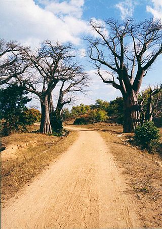
Transportation in Malawi is poorly developed. The country of almost 14 million has 39 airports, 6 with paved runways and 33 with unpaved runways. It has 797 kilometres of railways, all narrow-gauge and about 45 percent of its roads are paved. Though it is landlocked, Malawi also has 700 km (435 mi) of waterways on Lake Malawi and along the Shire River.
This article is about the Transport in Zambia.

Lilongwe is the capital and largest city of Malawi. It has a population of 989,318 as of the 2018 Census, up from a population of 674,448 in 2008. In 2020 that figure was 1,122,000. The city is located in the central region of Malawi, in the district of the same name, near the borders with Mozambique and Zambia, and it is an important economic and transportation hub for central Malawi. It is named after the Lilongwe River.
Mchinji is a town and the capital of the Mchinji District in the Central Region of Malawi. Mchinji Boma, located 12 kilometres from the Zambian border and 109 km (68 mi) from the national capital, Lilongwe, is the major hub of government and general business. It has a major railroad junction, being the railhead nearest to Zambia. The area's economy is sustained by rain-fed agriculture.

Mulanje, formerly called Mlanje, is a town in the Southern Region of Malawi, close to the border with Mozambique, to the east. It is near the Mulanje Massif.

Chipata is a city and administrative centre of the Eastern Province of Zambia and Chipata District. It was declared the 5th city of the country, after Lusaka, Ndola, Kitwe and Livingstone, by President Edgar Lungu on 24 February 2017. The city has undergone rapid economic and infrastructure growth in the years, leading up to city status.

Mpika is a town in the Muchinga Province of Zambia, lying at the junction of the M1 Road to Kasama and Mbala and the Tanzam Highway to Dar es Salaam, Tanzania in the north-east and Lusaka in the south-west. It also has a railway station on the TAZARA Railway about 5 kilometres (3 mi) away. Mpika is situated between the Muchinga Escarpment to the east and vast miombo plains to the west. The town has an estimated population of 40,000 inhabitants (2008), while the district population is estimated at 150,000 inhabitants. Since Mpika District was the biggest district in Zambia before its division in 2017, the population density was less than 4 people per square kilometre.

The Great East Road is a major road in Zambia and the main route linking its Eastern Province with the rest of the country. It is also the major link between Zambia and Malawi and between Zambia and northern Mozambique. However, the route does not carry as much traffic as many of the other regional arterial roads and between the main cities it serves, Lusaka and Chipata, it passes through rural and wilderness areas. In Lusaka the road forms the main arterial road for the eastern suburbs. The entire route from Lusaka to Chipata and the border with Malawi is designated the T4 road on Zambia's road network.
Malawi Railways was a government corporation that ran the national rail network of Malawi, Africa, until privatisation in 1999. With effect from 1 December 1999, the Central East African Railways consortium led by Railroad Development Corporation won the right to operate the network. This was the first rail privatisation in Africa which did not involve a parastatal operator.
Chipata Airport is an airport serving Chipata, a city in the Eastern Province of Zambia.

The T1 or Lusaka–Livingstone Road is the main highway of the Southern Province of Zambia. It begins 55 kilometres south of the city of Lusaka and heads south-west to the principal tourist destination, Victoria Falls in Livingstone, via Mazabuka, Monze, Choma and Kalomo, measuring approximately 430 kilometres (267 mi). The entire route is part of Trans-African Highway network number 4 or Cairo-Cape Town Highway between Cairo and Cape Town.

Railway stations in Zambia include:
Malawi Railways is the national rail network in Malawi, run by a government corporation until privatisation in 1999. As of 1 December 1999 the Central East African Railways, a consortium led by Railroad Development Corporation, won the right to operate the network.

Chipata District is a district of Zambia, located in Eastern Province. The capital lies at Chipata. As of the 2010 Zambian Census, the district had a population of 455,783 people.
Investrust Bank Plc., commonly known as Investrust Bank, is a commercial bank in Zambia. It is licensed by the Bank of Zambia, the central bank and national banking regulator.
DMI–St. Eugene university is a multi-campus private university in Zambia, that is affiliated with the Roman Catholic Archdiocese of Lusaka. The university is administered by the Daughters of Mary Immaculate.
Chelston, also Chelstone or Chakunkula, is a neighborhood in Zambia's capital city, Lusaka. Before the 1960s Chelstone was an separate town until it was annexed into the greater city of Lusaka.
Nakonde is a town in the Muchinga Province of Zambia, on the border with Tanzania. It is at the northern end of Zambia's Great North Road. It is the principal commercial and political headquarters of Nakonde District and the district headquarters are located here.
The Muloza–Chiringa Road is a road in the Southern Region of Malawi, connecting the towns of Muloza in Mulanje District, and Chiringa, in Phalombe District.

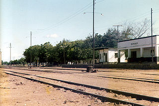
Sena railway, also called Shire Highlands railway, Dondo-Malawi railway and North-South Malawi railway, is a railway that connects Dondo, Mozambique, to Chipata, in Zambia. It is c. 1000 km long, in a 1067 mm gauge.
