Lake Mweru is a freshwater lake on the longest arm of Africa's second-longest river, the Congo. Located on the border between Zambia and Democratic Republic of the Congo, it makes up 110 kilometres (68 mi) of the total length of the Congo, lying between its Luapula River (upstream) and Luvua River (downstream) segments.

The Etosha Pan is a large endorheic salt pan, forming part of the Cuvelai-Etosha Basin in the north of Namibia. It is a vast hollow in the ground in which water may collect or in which a deposit of salt remains after water has evaporated. The 120-kilometre-long (75-mile-long) dry lakebed and its surroundings are protected as Etosha National Park, Namibia's second-largest wildlife park, covering 22,270 square kilometres (8,600 sq mi). The pan is mostly dry but after heavy rains it is flooded with a thin layer of water, which is heavily salted by the mineral deposits on the surface.

The East Sudanian savanna is a hot, dry, tropical savanna ecoregion of Central and East Africa.

Nsumbu National Park lies on the western shore of Lake Tanganyika near its southern extremity, in Zambia's Northern Province. It covers about 2000 km² and has some 80 km of lake shore including four bays, and Nundo Head Peninsula.

Chiengi or is a historic colonial boma of the British Empire in central Africa and today is a settlement in the Luapula Province of Zambia, and headquarters of Chiengi District. Chiengi is in the north-east corner of Lake Mweru, and at the foot of wooded hills dividing that lake from Lake Mweru Wantipa, and overlooking a dambo stretching northwards from the lake, where the Chiengi rivulet flows down from the hills.

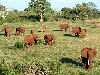
The wildlife of Zambia refers to the natural flora and fauna of Zambia. This article provides an overview, and outline of the main wildlife areas or regions, and compact lists of animals focusing on prevalence and distribution in the country rather than on taxonomy. More specialized articles on particular groups are linked from here.

The Zambezian flooded grasslands is an ecoregion of southern and eastern Africa that is rich in wildlife.
The biomes and ecoregions in the ecology of Zambia are described, listed and mapped here, following the World Wildlife Fund's classification scheme for terrestrial ecoregions, and the WWF freshwater ecoregion classification for rivers, lakes and wetlands. Zambia is in the Zambezian region of the Afrotropical biogeographic realm. Three terrestrial biomes are well represented in the country . The distribution of the biomes and ecoregions is governed mainly by the physical environment, especially climate.

The following outline is provided as an overview of and topical guide to Zambia:

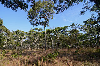
The Central Zambezian miombo woodlands ecoregion spans southern central Africa. Miombo woodland is the predominant plant community. It is one of the largest ecoregions on the continent, and home to a great variety of wildlife, including many large mammals.

Chiengi District with headquarters at Chiengi is the smallest and most northerly district in the Luapula Province of Zambia and was carved out of Nchelenge District after Zambia's independence. As of the 2010 Zambian Census, the district had a population of 109,147 people. Most of its population live in fishing villages along the 70 km (approx.) of the north-east shore of Lake Mweru which lies within the district. The largest settlement is Puta, 5 km south of Chiengi town, named after Chief Puta. The district is bounded by the DR Congo border in the north, Kaputa District in the east and the Kalungwishi River in the south.

The Albany thickets is an ecoregion of dense woodland in southern South Africa, which is concentrated around the Albany region of the Eastern Cape.

The Itigi-Sumbu thicket is an ecoregion consisting of two small areas of thick shrubland in Tanzania, Zambia and the adjacent Democratic Republic of the Congo, in East Africa. The floral community of dense deciduous brush is unique, with many endemic species, and almost no transition zone between it and the surrounding dry miombo woodlands. The distinctive nature of this small region is partly due to its setting on dry alluvial soil over a hard duricrust, while the surrounding areas are rocky hills and plateaus.

The Northern Acacia–Commiphora bushlands and thickets are a tropical grasslands, savannas and shrublands ecoregion in eastern Africa. The ecoregion is mostly located in Kenya, extending north into southeastern South Sudan, northeastern Uganda and southwestern Ethiopia and south into Tanzania along the Kenya-Tanzania border.
The Zambezian region is a large biogeographical region in Africa. The Zambezian region includes woodlands, savannas, grasslands, and thickets, extending from east to west in a broad belt across the continent. The Zambezian region lies south of the rainforests of the Guineo-Congolian region. The Zambezian region is bounded by deserts and xeric shrublands on the southwest, the Highveld grasslands of South Africa to the south, and the subtropical Maputaland forests on the southeast.

Itigi District is a district council in the Singida Region of central Tanzania established in 2015. The district lies in the south-western portion of the Singida Region with 123,515 people and encompasses a large area mostly made up of protected game reserves.


