N93 (Netherlands)

Last updated

National Road 93 (Dutch : Nationale weg 93) or simply N93, was a highway route in the Netherlands from 1957 through 1985. It formed part of the Dutch National highway network and connected Tilburg (E312) with Emmeloord (N91). A stretch of road between Tilburg and the Belgian border was also part of the initial route. [1]

In 1957, road numbering was introduced in the Netherlands and the Rijkswegenplan foresaw in an increasing number of highways, together forming a nationwide system. Along with the pan-European E-road network, which designated routes of international importance, a series of N-roads was devised to designate those routes not included in the European system, but considered of national importance. [2]
In 1985 the second generation of E-road numbering was implemented, leading to an update of the National Road network as well. With the N91 now heading south to Almere and Utrecht, the N93 was extended northwards. The section leading to the border with Belgium was abandoned and subsequently downgraded.

While the N-road numbers were originally signposted everywhere, they were gradually replaced on road signs by the formerly administrative Rijksweg and provincial numberings, starting in 1976 and 1978 respectively. Ultimately the old N93 was broken up into five sections that now carry different numbers.

Route overview

Highway N93First section (Emmeloord-Nijmegen):

{{NLDint

ProvinceF.A.H. [3] JunctionIntersecting roadsHistorical MunicipalityNotes
Flevoland N38 AB-Kreuz-blau.svg Emmeloord N91 Noordoostpolder
AB-AS.svg Highway 352
Overijssel level crossingRoad 765 Kampen
AB-AS.svg Highway 307
AB-AS.svg Road 763 Kamperveen
Gelderland N50 AB-Kreuz-blau.svg Hattemerbroek E232 Hattem begin of motorway regulations
AB-AS.svg Hattem
AB-AS.svg Heerde Heerde
AB-AS.svg Epe (North)
AB-AS.svg EpeHighway 309 Epe
AB-AS.svg VaassenRoad 792 Vaassen
AB-AS.svg Apeldoorn (North)Highway 304 Apeldoorn
AB-AS.svg ApeldoornHighway 345
AB-Kreuz-blau.svg Beekbergen E30 Beekbergen
AB-AS.svg BeekbergenRoad 786
AB-AS.svg HoenderlooRoad 788 Loenen
AB-AS.svg SchaarsbergenHighway 311 Arnhem
AB-AS.svg Arnhem (North)Road 784
AB-Kreuz-blau.svg Waterberg E35 section shared with E 35 for 5 kilometres
N52Velperbroek RoundaboutN5end of motorway regulations
level crossing (2x)Road 810crossing river Lower Rhine
AB-AS.svg Huissen
N6South Arnhem squareHighway 325 Elden
AB-AS.svg Eldenbegin of motorway regulations
AB-AS.svg Elst Elst
AB-Kreuz-blau.svg Ressen N96 Bemmel section between Velperbroek and Ressen shared with N 96 until completion of the latter connection to Zevenaar
level crossing (2x) Lent end of motorway regulations
AB-AS.svg Lentcrossing river Waal

Highway N93Second section (Nijmegen - Tilburg):

ProvinceF.A.H.JunctionIntersecting roadsHistorical MunicipalityNotes
Gelderland N6Sint Canisiussingel /Oranjesingel /GraafsebaanEmperor Trajan SquareN53 Nijmegen Within Nijmegen the N 93 follows city roads, with several on-level crossings and traffic lights. A new bridge over the river Waal is under construction, more to the west, relieving the inner city of N 93 traffic congestion.
Emperor Charlemagne RoundaboutN95Sint AnnastraatMain square of central Nijmegen
N55Graafseweg SquareN53Neerbosscheweg
Lindenholt Square E31 Leaving the city limits
Bijsterhuizen RoundaboutHighway 324 Wijchen begin of motorway regulations
AB-AS.svg BeuningenRoad 847
AB-AS.svg BergharenRoad 845
AB-Kreuz-blau.svg Bankhoef N94 Leur en Hernen Begin of shared sectionN93-94
North Brabant AB-AS.svg RavensteinHighway 277 Huisseling en Neerloon crossing the river Meuse
AB-Kreuz-blau.svg Paalgraven N94 Berghem End of shared sectionN93-94
AB-AS.svg Oss (East)Highways 265 and 324 Heesch
AB-AS.svg Oss
AB-AS.svg Nuland Nuland Last section to be upgraded to motorway conditions, in 2004.
AB-AS.svg KruisstraatRoad 625 Rosmalen
AB-AS.svg Rosmalen (East)
AB-AS.svg Rosmalen
N7Bois-le-Duc beltway AB-Kreuz-blau.svg Hintham E25 section shared with E 25 for 6 kilometres, including two exits (Den Dolder /Sint-Michielsgestel)
N65 AB-Kreuz-blau.svg Vught N65 Vught end of E 25 shared section
level crossing (2x)Helvoirtsewegend of motorway regulations
level crossingTorenstraat Helvoirt
level crossingMgr. Zwijsenstraat Haaren
level crossing (2x) Oisterwijk and Udenhout
AB-AS.svg Berkel-Enschot Berkel-Enschot begin of motorway regulations
AB-AS.svg Tilburg (North)Highway 261Tilburg ring road
AB-Kreuz-blau.svg De Baars E312 End of the route

The total length of the N 93 is approximately 180 kilometers (190 when the shared sections with E 25 and E 35 are included). The majority of the route consisted of motorway, with the main interruption being the section through Nijmegen which caused significant delays. A new bridge is under construction west of the city, aimed at creating a new urban beltway. No official decision has been made public about its new road number so far. [4]

Related Research Articles

Transport in Belgium

Transport in Belgium is facilitated with well-developed road, air, rail and water networks. The rail network has 2,950 km (1,830 mi) of electrified tracks. There are 118,414 km (73,579 mi) of roads, among which there are 1,747 km (1,086 mi) of motorways, 13,892 km (8,632 mi) of main roads and 102,775 km (63,861 mi) of other paved roads. There is also a well-developed urban rail network in Brussels, Antwerp, Ghent and Charleroi. The ports of Antwerp and Bruges-Zeebrugge are two of the biggest seaports in Europe. Brussels Airport is Belgium's biggest airport.

United States Numbered Highway System Highway system of the United States of America

The United States Numbered Highway System is an integrated network of roads and highways numbered within a nationwide grid in the contiguous United States. As the designation and numbering of these highways were coordinated among the states, they are sometimes called Federal Highways, but the roadways were built and have always been maintained by state or local governments since their initial designation in 1926.

British Columbia Highway 95 Provincial highway in Central Kootenay, East Kootenay, and Columbia-Shuswap regional districts in British Columbia, Canada

Highway 95 is a north-south highway in the southeastern corner of British Columbia, opened in 1957. The highway connects with U.S. Route 95, from which the highway takes its number, at the Canada–U.S. border at Kingsgate, just north of Eastport, Idaho. The section between the Canada-U.S. border and the Crowsnest Highway is known as the Yahk–Kingsgate Highway while the section between the Crowsnest Highway and Golden is known as the Kootenay–Columbia Highway.

A routenumber, designation or abbreviation is an identifying numeric designation assigned by a highway authority to a particular stretch of roadway to distinguish it from other routes and, in many cases, also to indicate its classification, general geographical location and/or orientation. The numbers chosen may be used solely for internal administrative purposes; however, in most cases they are also displayed on roadside signage and indicated on maps.

National routes (South Africa) National Roads in South Africa

National routes in South Africa are a class of trunk roads and freeways which connect major cities. They form the highest category in the South African route numbering scheme, and are designated with route numbers beginning with "N", from N1 to N18. Most segments of the national route network are officially proclaimed National Roads that are maintained by the South African National Roads Agency (SANRAL), but some segments are maintained by provincial or local road authorities.

Music venues in the Netherlands

Music venues in the Netherlands are a vivid part of the social cultural environment of the country.

Nationale Wegen or simply N-wegen (N-roads), was a numbering system for a set of main highway routes in the Netherlands, used from 1957 through 1976.

European route E312 Road in trans-European E-road network

E 312 is a European B class road in the Netherlands, connecting the cities of Flushing (Vlissingen) and Eindhoven.

European route E232 Road in trans-European E-road network

The E 232 is a European B class road in the Netherlands, connecting the cities of Amersfoort and Groningen.

Rijksstraatweg

Rijksstraatweg or simply Straatweg was the term for paved roads of interregional significance in the Netherlands in the 19th and early 20th centuries. These roads were built by the national government, and formed the country's first centrally planned highway network. They received route numbers, eventually resulting in a nationwide network of 82 highways. It formed the basis for today's system of nationally controlled roads, the Netherlands' main highway grid.

Roads in Georgia (country) Overview of the international and domestic route network in the country of Georgia

A network of trunk highways connects the Georgian capital Tbilisi, where more than a third of the national population lives, with neighboring countries. This is the backbone for a network of domestic roads that connect vital regions, such as Kakheti and Imereti wine regions, Racha-Lechkhumi and Kvemo Svaneti mountain regions or Samtskhe-Javakheti highlands with each other and the capital.

LF-Routes are long-distance cycling routes that form a network in the Netherlands and Belgium. The routes, criss-crossing both countries, are primarily intended for recreational multi-day bike tours, such as cycling holidays. Some routes are also part of a wider international network.

Roads in the Netherlands Overview of roads in the Netherlands

With 139,000 km of public roads, the Netherlands has one of the most dense road networks in the world – much denser than Germany and France, but still not as dense as Belgium. Dutch roads include at least 3,530 km of motorways and expressways, and with a motorway density of 64 kilometres per 1,000 km2, the country also has one of the densest motorway networks in the world.

The Philippine highway network refers to the highway system of the Philippines. It is a network of national roads owned and maintained by the Department of Public Works and Highways (DPWH) which are organized into three classifications depending on their function or purpose they serve within the highway system: national primary, secondary, and tertiary roads. The national roads connecting major cities are numbered from N1 to N82. They are mostly single and dual carriageways linking two or more cities.

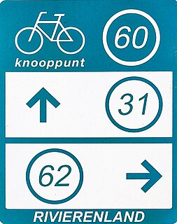
Numbered-node cycle network European bicycle path intersection numbering system

The numbered-node cycle network is a wayfinding system. It spans the Netherlands, Belgium, parts of Germany, and parts of Croatia, and is expanding rapidly, as of 2017. Each intersection or node is given a number, and the numbers are signposted, so the cyclist always knows which way to go to get to the next node.

References

  1. De Grote Shell Atlas: Benelux en Europa. Editie 1966.
  2. Elsevier Atlas van Nederland, België en Luxemburg, samengesteld door de Winkler Prins redactie, Amsterdam/Brussel 1960.
  3. Former Administrative Highway (F.A.H.) refers to the Nationale Straatwegen, but are not signposted as such anymore.
  4. Shell Stratenboek -Alle straatnamen van Nederland, Edition 56, Royal Dutch - Shell BV, 2012.