
Nijmegen is a city in the Dutch province of Gelderland, on the Waal river close to the German border.
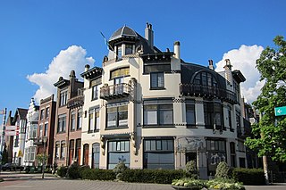
Arnhem is a city and municipality situated in the eastern part of the Netherlands. It is the capital of the province of Gelderland, located on both banks of the rivers Nederrijn and Sint-Jansbeek, which was the source of the city's development. Arnhem had a population of 163.972 on 1 december 2021, which made it one of the larger cities of the Netherlands. The municipality is part of the Arnhem–Nijmegen metropolitan area which has a combined 736,500 inhabitants.
Gennep is a municipality and a city in upper southeastern Netherlands. It lies in the very northern part of the province of Limburg, 18 km south of Nijmegen. Furthermore, it lies on the right bank of the Meuse river, and south of the forest of the Klever Reichswald. The municipality of Gennep has 17,277 inhabitants (2014).

Lingewaard is a municipality in the eastern Netherlands. It is located in the province of Gelderland, in the most eastern part of the Betuwe. The municipality is situated in the lowlands between the major cities of Arnhem and Nijmegen, where most inhabitants work. Lingewaard was part of the Arnhem–Nijmegen metropolitan area until 2015.

Beuningen is a municipality and a town in the eastern Netherlands. The municipality consists of the towns Beuningen, Ewijk, Winssen and Weurt. 1.5 kilometres (1 mi) to the north lies the river Waal

Overbetuwe is a municipality in the province of Gelderland in the Netherlands. It was formed on 1 January 2001 as a merger of three former municipalities: Elst, Heteren and Valburg. Overbetuwe is bordered in the north by the river Rhine and in the south by the river Waal. The city hall is located in Elst, the largest town in the municipality. Together with eighteen other municipalities it forms the 'Knooppunt Arnhem-Nijmegen', or simply 'KAN', which is a regional collaboration.

Bemmel is a town in the eastern Netherlands, in the province of Gelderland. It is located in the Betuwe region, and falls under the municipality of Lingewaard. The town is situated between the major cities of Arnhem and Nijmegen, and is bordered by the Waal river in the south. Bemmel has a population of 12,161.

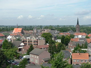
Huissen is a town with city rights in the Netherlands, in the province of Gelderland. The town is located in the Betuwe region and belongs to the municipality of Lingewaard, in the area between the major cities of Arnhem and Nijmegen. Huissen is situated along the rivers Nederrijn and Linge. The town has a population of 19,414.

Gendt is a small city with city rights in the Netherlands, in the province of Gelderland. The town is located in the Betuwe region, and is part of the municipality of Lingewaard. Gendt is situated along the rivers Waal and Linge. It has a population of 7,230.

Titus Brandsma was a Dutch Carmelite friar, Catholic priest and professor of philosophy. Brandsma was vehemently opposed to Nazi ideology and spoke out against it many times before the Second World War. He was imprisoned in the infamous Dachau concentration camp, where he was murdered. He has been beatified by the Roman Catholic Church as a martyr of the faith.

Ewijk is a village in the Dutch province of Gelderland. It is a part of the municipality of Beuningen, and lies about 9 km west of Nijmegen. The river Waal runs in the north.

The Arnhem–Nijmegen metropolitan area is a former Dutch plusregio, public body and intermunicipal institution, founded in 1988, for the co-operation in the areas of housing, transport and economics in the conurbation consisting of the Dutch cities of Nijmegen and Arnhem as well as the bordering municipalities of Berg en Dal, Beuningen, Doesburg, Duiven, Heumen, Lingewaard, Montferland, Mook en Middelaar, Overbetuwe, Renkum, Rheden, Rijnwaarden, Rozendaal, Westervoort, Wijchen, and Zevenaar. All except Mook en Middelaar (Limburg) are in the province of Gelderland. Its aim is regional cooperation. In 2011, a total of 736,107 people were living in the municipalities(1,000 km2).
Kapel is a hamlet in the Dutch province of Gelderland. It is located in the municipality of Lingewaard, about 1 km north of the town of Gendt.
Mark Otten is a Dutch former professional footballer who played as a defender. He currently manages the NEC U21 team.

Berg en Dal is a village in the Dutch province of Gelderland. It is located to the southeast of the city of Nijmegen. The village lies in the municipality of Berg en Dal.

Baal is a hamlet in the Dutch province of Gelderland. It is located in the municipality of Lingewaard, about 1 km northeast of Bemmel, and located 1 kilometer north of Haalderen and is therefore part of Haalderen.

Provincial road N325 is a Dutch provincial road. The road runs from Arnhem, through Nijmegen, to the nearby German border. The N325 was previously named Rijksweg 52, which was constructed during World War II. When responsibility for the road was transferred from the Dutch state to the province of Gelderland in 1993 it was renamed A325/N325.

Loo is a village in the municipality of Duiven in the province of Gelderland, the Netherlands. The village has a ferry connection to Huissen. A couple of houses of Loo are part of Huissen, Lingewaard, because they were on a former river island which used to belong the Duchy of Cleves.

Foxhol is a village in the Dutch province of Groningen. It is part of the municipality of Midden-Groningen. In 1842, the potato starch factory Eureka was founded in Foxhol by Willem Albert Scholten. Foxhol became an industrial area with factories and shipyards. The village is nowadays part of the urban area of Hoogezand.

Elisabeth Marij (Lisa) Westerveld is a Dutch politician serving as a member of GroenLinks in the House of Representatives of the Netherlands since 2017. Between 2014 and 2017 she was a member of the municipality council of Nijmegen.


