Doornik, Gelderland

Last updated
Doornik
Bergstraat tussen Bemmel en Lent.jpg
Street view
2010-NL-P05-Gelderland-positiekaart-gemnamen.jpg
Red pog.svg
Doornik
Location in the Netherlands
Netherlands location map.svg
Red pog.svg
Doornik
Doornik (Netherlands)
Coordinates: 51°52′20″N5°52′44″E / 51.8722°N 5.8789°E / 51.8722; 5.8789 Coordinates: 51°52′20″N5°52′44″E / 51.8722°N 5.8789°E / 51.8722; 5.8789
Country Netherlands
Province Gelderland
Municipality Heerde
Elevation
[1]
9 m (30 ft)
Time zone UTC+1 (CET)
  Summer (DST) UTC+2 (CEST)
Postal code
6681
Dialing code 0418

Doornik is a hamlet in the municipality of Lingewaard, between Lent and Bemmel, in the province of Gelderland, the Netherlands. Most of Doornik was destroyed at a Dyke breach in 1799, the village never recovered. Doornik had an own castle which burned down in 1823.

History

It was first mentioned at the end of 11th century as apud Tornacum. The etymology is unknown. [2] Doornik is not a statistical entity, [3] and the postal authorities have placed it under Bemmel. [4]

Doornik used be an heerlijkheid together with Ressen. It was first mentioned in 1324 and had a castle. [5] The castle had become derelict in 1649. [6]

The town of Bemmel was threatened by the Waal and was flooded several times during the 16th century. In 1648, it was decided to dig a canal to eliminate the bend in the river. The new canal threatened Doornik, and in 1799, the dike breached destroying the village, farms and the castle. [7] Doornik was never rebuilt except for a few farms. [8]

In 1823, the remains of the castle were lost in a fire [6] In 1827, a manor house was built in its place. During World War II, it was used by the Germans to store ammunition, and in 1944, everything exploded destroying the manor house. [5] In 1840, Doornik was home to 94 people. Nowadays, it consists of a handful of houses. [8]

Related Research Articles

Lingewaard Municipality in Gelderland, Netherlands

Lingewaard is a municipality in the eastern Netherlands. It is located in the province of Gelderland, in the most eastern part of the Betuwe. The municipality is situated in the lowlands between the major cities of Arnhem and Nijmegen, where most inhabitants work. Lingewaard was part of the Arnhem–Nijmegen metropolitan area until 2015.

IJzevoorde Hamlet in Gelderland, Netherlands

IJzevoorde is a hamlet in the municipalities of Doetinchem and Bronckhorst in the province of Gelderland in the east part of the Netherlands.

Wordragen Hamlet in Gelderland, Netherlands

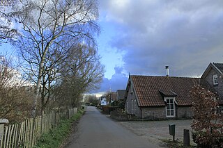
Wordragen is a Dutch hamlet, north of Ammerzoden in the Maasdriel municipality of Gelderland province.

Aalst, Buren Hamlet in Gelderland, Netherlands

Aalst is a hamlet in the Dutch province of Gelderland. It is a part of the municipality of Buren, and lies about 10 km southwest of Wageningen.

Asch, Netherlands Village in Gelderland, Netherlands

Asch is a village in the Dutch province of Gelderland. It is a part of the municipality of Buren, and lies about 9 km northwest of Tiel.

Eck en Wiel Village in Gelderland, Netherlands

Eck en Wiel is a village in the Dutch province of Gelderland. It is a part of the municipality of Buren, and lies about 9 km southwest of Veenendaal.

Hoogmeien Hamlet in Gelderland, Netherlands

Hoogmeien is a hamlet in the Dutch province of Gelderland. It is a part of the municipality of Buren, and lies about 8 km northeast of Tiel.

Luchtenburg Hamlet in Gelderland, Netherlands

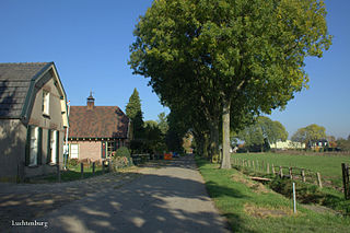
Luchtenburg is a hamlet in the Dutch province of Gelderland. It is a part of the municipality of Buren, and is located in about 8 km southwest of Veenendaal.

Lutterveld Hamlet in Gelderland, Netherlands

Lutterveld is a hamlet in the Dutch province of Gelderland. It is a part of the municipality of Buren, and lies about 4 km west of Tiel.

Ravenswaaij Village in Gelderland, Netherlands

Ravenswaaij is a village in the Dutch province of Gelderland. It is a part of the municipality of Buren, and lies about 10 km northwest of Tiel.

Zandberg, Gelderland Hamlet in Gelderland, Netherlands

Zandberg is a hamlet in the Dutch province of Gelderland. It is a part of the municipality of Buren, and lies about 9 km northwest of Tiel.

Zwarte Paard is a hamlet in the Dutch province of Gelderland. It is a part of the municipality of Buren, and lies about 7 km north of Tiel.

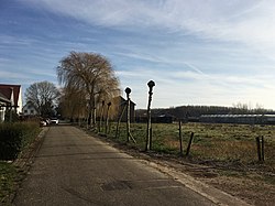
Kapel is a hamlet in the Dutch province of Gelderland. It is located in the municipality of Lingewaard, about 1 km north of the town of Gendt.

Californië, Gelderland Hamlet in Gelderland, Netherlands

Californië is a hamlet in the Dutch province of Gelderland. It is located in the municipality of Maasdriel, between the villages Ammerzoden and Hedel.

Almen Village in Gelderland, Netherlands

Almen is a village in the Dutch province of Gelderland. It is in the municipality Lochem, about 7 km east of the city of Zutphen.

Baal, Netherlands Hamlet in Gelderland, Netherlands

Baal is a hamlet in the Dutch province of Gelderland. It is located in the municipality of Lingewaard, about 1 km northeast of Bemmel, and located 1 kilometer north of Haalderen and is therefore part of Haalderen.

Hierden Village in Gelderland, Netherlands

Hierden is a farming village in the centre-east of Netherlands. It is located in the municipality of Harderwijk, Gelderland.

Ooij, Berg en Dal Village in Gelderland, Netherlands

Ooij is a village in the eastern Netherlands. It is located in the municipality of Berg en Dal, Gelderland.

Persingen Village in Gelderland, Netherlands

Persingen is a village situated in the municipality of Berg en Dal in the province of Gelderland. In 2021, Persingen had 105 inhabitants. The village claims to be the smallest village of the Netherlands for tourist reasons, however there are many more contestants who are much smaller; the former island of Schokland and the former squatter village of Ruigoord have the best credentials.

Hulhuizen Hamlet in Gelderland, Netherlands

Hulhuizen is a hamlet near Gendt in the municipality of Lingewaard in the province of Gelderland, the Netherlands. Hulhuizen became Dutch in 1817 together with Huissen.

References

  1. "Postcodetool for 6681AA". Actueel Hoogtebestand Nederland (in Dutch). Het Waterschapshuis. Retrieved 22 March 2022.
  2. "Doornik - (geografische naam)". Etymologiebank (in Dutch). Retrieved 22 March 2022.
  3. "Kerncijfers wijken en buurten 2021". Central Bureau of Statistics. Retrieved 22 March 2022. Not found
  4. "Postcode Doornik in Bemmel". Postcode bij adres (in Dutch). Retrieved 22 March 2022.
  5. 1 2 "Doornik, geteisterd door het water en doortrekkend oorlogsvolk". Alleen leuke dingen (in Dutch). Retrieved 22 March 2022.
  6. 1 2 "Huis Doornik". Dag van het Kasteel (in Dutch). Retrieved 22 March 2022.
  7. "Bemmel gered, Doornik verdrinkt". Mijn Gelderland (in Dutch). Retrieved 22 March 2022.
  8. 1 2 "Doornik". Plaatsengids (in Dutch). Retrieved 22 March 2022.