Related Research Articles

Bhagalpur district is one of the thirty-eight districts of Bihar state, India. Bhagalpur is the oldest district of Bihar. Bhagalpur city is the administrative headquarters of this district.

Dakshin Dinajpur, also known as South Dinajpur, is a district in the Indian state of West Bengal, India. It was created on 1 April 1992 by the division of the erstwhile West Dinajpur District.The Headquarter (sadar) of the district is at Balurghat. It comprises two subdivisions: Balurghat and Gangarampur. According to the 2011 census, it is the third least populous district of West Bengal.
Sirohi District is a district of Rajasthan state in western India. The city of Sirohi is the district headquarters.
Bihpur is a block in Bhagalpur district of Bihar, India. It is one of sixteen blocks under Bhagalpur district.According to Census 2011, the sub-district code of Bihpur Block (CD) is 01330.It lies in the Anga Region of Bihar.
Lokur is a village in Kagwad tehsil, Belgaum district, in the state of Karnataka, India. According to Census 2011 information the location code or village code of Lokur village is 597287. It is 32 kilometres (20 mi) from the sub-district headquarters at Athni and 122 kilometres (76 mi) from the district headquarters at Belgaum. As per 2009 stats, Mangasuli is the gram panchayat of Lokur village.
Dharhara is a village in the Gopalpur sub division of Bhagalpur district of Bihar, India. There is a tradition of plantation when a girl is born in any family of this village. The most main industry of the village is agriculture.
Shuklapuri or Shukul Puri is a village and gram panchayat in Barhalganj, Gorakhpur district, Uttar Pradesh, India. It has a post office with pin code 273402.
Palra is a village of Bangra Block, Mau Ranipur Tehsil, Jhansi district, in the state of Uttar Pradesh. It is located in the Bangra block of Jhansi. Bangara is 50 km from the district headquarters, namely, Jhansi on NH-76. The village of Palra is located 3 km to the north. The predominant caste is Thakur. Kuswaha and Dhobi are the other major groups who reside here. From palra village there is famous historical temple GAIRAHA TEMPLE which is coming under ASI and good place to see.

Alanallur is a gram panchayat in the Palakkad district, state of Kerala, India. It is a local government organization that serves the villages of Alanallur-I, Alanallur-II and Alanallur-III.
Kuzhalmannam is a gram panchayat in the Palakkad district, state of Kerala, India. It is a local government organisation that serves the villages of Kuzhalmannam-I and Kuzhalmannam-II.

Nathnagar Assembly constituency is one of 243 constituencies of legislative assembly of Bihar. It comes under Bhagalpur Lok Sabha constituency along with other assembly constituencies viz. Gopalpur, Pirpainti, Kahalgaon, Bhagalpur and Bihpur.
Gangadharpur is a census town in the Chanditala I CD Block located in the Srirampore subdivision of the Hooghly district in the state of West Bengal, India.

Sihali Kalan is a small village in the gram panchayat of Sihali Khurd, Mundawar tehsil, Alwar district, Rajasthan, India. It is 10 km from Mandawar and 60 km from Alwar. The nearest town of any size is Khairthal, 19 km away.
Partapnagar is a village in Naugachhia Block, Bhagalpur District, Bihar, India. It is located on the north of Bhagalpur District, about 20 kilometres northeast of the district capital Bhagalpur, and 2 kilometres northwest of the block capital Naugachhia. In the year 2011, it had a population of 35,878.
Naugachhia Block is a community development block in the Bhagalpur district of the Indian state of Bihar. It is situated in the eastern part of Bihar and is known for its rich cultural heritage and historical significance. It lies in the Anga Region of Bihar,IndiaIt comes under Naugachhia subdivision.
Bhawanpura is a village in Kharik Block of Bhagalpur District of Bihar. As of 2009 stats, It is also a Gram Panchayat. The village is famous for Maa Jaleshwari Temple.
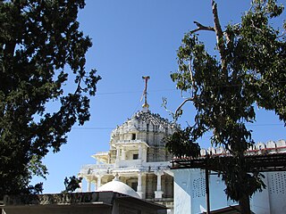
Tetari is a village in Naugachhia Block of Bhagalpur District in Bihar, India. According to Census 2011,information the location code or village code of Tetari village is 238955. Tetari is famous for the Tetri Durga Temple which is believed to be 450 years old.According to 2009 stats,it is also a Gram Panchayat.
Pakra is a village in Naugachhia Block of Bhagalpur District in the Indian State of Bihar. According to 2009 stats, it is also a Gram Panchayat. According to Census 2011 information the location code or village code of Pakra village is 238957.
Gopalpur is a block in Bhagalpur district of Bihar, India. It is one of sixteen blocks under Bhagalpur district.According to census 2011 information the sub-district code of Gopalpur Block (CD) is 01334. It lies in the Anga region of India.It comes under Naugachhia subdivision of the District.
Ismailpur Block is block within the Bhagalpur District of Bihar, India. The pin code for Ismailpur is 853205, and the postal head office is S.T. Goriar.It comes under Naugachhia subdivisionIt is a part of Anga region of Bihar.
References
- ↑ "District/Panchayat Level Asset Declaration | Bhagalpur | India" . Retrieved 2024-02-24.
- ↑ "Gram Panchayat (ग्राम पंचायत): NAGRAH (नगरह )". localbodydata.com. Retrieved 2024-02-24.
31°09′13″N76°00′12″E / 31.15361°N 76.00333°E
| | This article related to a location in Bihar is a stub. You can help Wikipedia by expanding it. |