Ghoga is a census town in Bhagalpur district in the state of Bihar, India.

Sugauli is a city and a notified area in East Champaran district in the Indian state of Bihar. It is the setting for Rudyard Kipling's story "Rikki-Tikki-Tavi", and the place where a treaty was signed with Nepal in 1816.

Harishchandrapur I is a community development block that forms an administrative division in Chanchal subdivision of Malda district in the Indian state of West Bengal.

Kaliachak I is a community development block that forms an administrative division in Malda Sadar subdivision of Malda district in the Indian state of West Bengal.

Manikchak is a community development block that forms an administrative division in Malda Sadar subdivision of Malda district in the Indian state of West Bengal.

Kaliachak II is a community development block that forms an administrative division in Malda Sadar subdivision of Malda district in the Indian state of West Bengal.

Kaliachak III is a community development block that forms an administrative division in Malda Sadar subdivision of Malda district in the Indian state of West Bengal.

English Bazar is a community development block that forms an administrative division in Malda Sadar subdivision of Malda district in the Indian state of West Bengal.

Chanchal II is a community development block that forms an administrative division in Chanchal subdivision of Malda district in the Indian state of West Bengal.
Pirpainti is a town and a notified area in Bhagalpur district in the Indian state of Bihar. It is a block of the Bhagalpur district and also a vidhansabha.
Udhwa is a community development block that forms an administrative division in the Rajmahal subdivision of the Sahibganj district, Jharkhand state, India.
Brkhera Basantpur urf Dayanathpur Village is near a distance of 167 km (104 mi) from the national capital, New Delhi and 370 km north-west of the state capital Lucknow.
Hansdiha is a village in the Saraiyahat community development block which is an administrative division in the Dumka Sadar subdivision of the Dumka district, Jharkhand state of India.

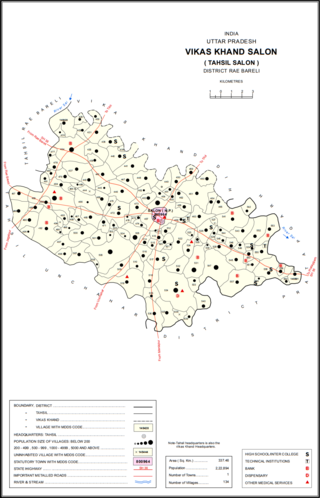
Khanpur Urf Birbhanpur is a village in Salon block of Rae Bareli district, Uttar Pradesh, India. It is located 43 km from Raebareli, the district headquarters. As of 2011, Khanpur Urf Birbhanpur has a population of 1,929 people, in 363 households. It has one primary school and no healthcare facilities. It does not host a permanent market or a periodic haat.

Shaistabad Urf Bhurkushpur is a village in Lalganj block of Rae Bareli district, Uttar Pradesh, India. It is located 8 km from Lalganj, the block and tehsil headquarters. As of 2011, it has a population of 1,072 people, in 199 households. It has one primary school and no healthcare facilities, and it hosts a permanent market but not a weekly haat. It belongs to the nyaya panchayat of Bahai.
Kharik is a village and the administrative center of Kharik Block, Bhagalpur District, Bihar, India. It is located on the northern part of the district, approximately 14 kilometres north of the district capital Bhagalpur. In 2011, It has 42,354 inhabitants.
Shankarpur Khawas is a village in Colgong Block, Bhagalpur District, Bihar, India. It is situated near the state border with Jharkhand, about 16 kilometres east of the district seat of Bhagalpur, and 12 kilometres southwest of the block seat of Kahalgaon. In 2011, it had a population of 38,852.
Saidpur Dabra is a village in Gopalpur Block, Bhagalpur District, Bihar, India. It is located near the state boundary with Jharkhand, about 21 kilometres northeast of the district seat Bhagalpur, and 19 kilometres northeast of the block seat Gopalpur. In the year 2011, it has a total population of 37,101.
Partapnagar is a village in Naugachhia Block, Bhagalpur District, Bihar, India. It is located on the north of Bhagalpur District, about 20 kilometres northeast of the district capital Bhagalpur, and 2 kilometres northwest of the block capital Naugachhia. In the year 2011, it had a population of 35,878.


