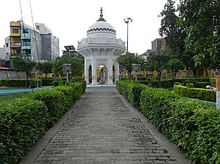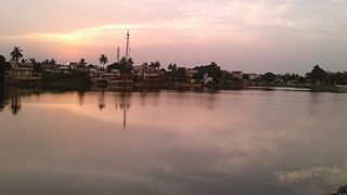
Khandwa is a city and a nagar nigam in the Nimar region of Madhya Pradesh, India. It is the administrative headquarters of the Khandwa district, formerly known as East Nimar District.

Gorakhpur is a city in the Indian state of Uttar Pradesh, along the banks of the Rapti river in the Purvanchal region. It is situated 272 kilometres east of the state capital, Lucknow. It is the administrative headquarters of Gorakhpur district, North Eastern Railway Zone and Gorakhpur division. The city is home to the Gorakhnath Math, a Gorakhnath temple. The city also has had an Indian Air Force station since 1963. Gita Press, the world's largest publisher of Hindu religious texts like Ramayana and Mahabharat, has been established here since 1926.

Bettiah is a city and the administrative headquarters of West Champaran district - (Tirhut). It is near the Indo-Nepal border, 225 kilometres (140 mi) northwest of Patna, in the state of Bihar, India.

Ballia is a city with a municipal board in the Indian state of Uttar Pradesh. The eastern boundary of the city lies at the junction of two major rivers, the Ganges and the Ghaghara.The city is situated 140 km (87 mi) east of Varanasi and about 380 km from the state capital Lucknow. It is home to a protected area, the Jai Prakash Narayan bird sanctuary. Ballia is around 4 km (2.5 mi) from Bihar.

Structurally Bihar is divided into divisions ), districts (Zila), sub-divisions (Anumandal) & circles (Anchal). The state is divided into 9 divisions, 38 districts, 101 subdivisions and 534 circles. 12 municipal corporations, 49 Nagar Parishads and 80 Nagar Panchayats for administrative purposes.
Shivdaspur is a census town and a red light district in Varanasi in eastern Uttar Pradesh in India. It resides on periphery of Varanasi city, surrounded by Lahartara, Manduadih.

Forbesganj is a city with municipality in the Araria District in the state of Bihar, India, situated at the border of Nepal.
Ganj Dundawara is a city and a municipal board in Kasganj District and the Aligarh zone in the state Uttar Pradesh, India.
Kanti is a town and a notified area in Muzaffarpur district in the Indian state of Bihar. It is also a block headquarters belongs to "Tirhut Division". It is located 15 km by road from District headquarters Muzaffarpur. Kanti holds a distinct history for it was a spot for indigo production. Kanti was once a site for saltpeter production. In 2022, Kanti Nagar Panchayat was upgraded to Nagar Parishad. Pin Code 843109.
Khekra is an NCR City and sub-district headquarters of Baghpat district in the Indian state of Uttar Pradesh.

Machhlishahr is a town in Jaunpur district in the Indian state of Uttar Pradesh. It is situated 30 km west of district headquarters Jaunpur. NH-231 passes through the city. Machhlishahr – Janghai – Bhadohi four-lane highway is under construction which will boost the economy of the region. Machhlishahr is a Nagar panchayat and there has been a longstanding demand for making it a Nagar palika parishad. In 2020, Machhalisahar nagar panchayat has secured 33rd all India rank in Swachh Survekshan cleanliness survey.
Mariahu (Mariyahu) is a town and a nagar panchayat in Jaunpur district in the Indian state of Uttar Pradesh. Its name Mariahu was given by Nanwag (Nandwak) king Naun Rao in 16th century on the name of Mandav Deo, the patreon deity of the Nanwag clan. The samadhi of Mandav dev is situated near to Chutka Devi temple which is in the east of tehsil. Mostly tehsil was ruled by Nanwag Rajputs who were the local rulers during 16th and 17th century. Baghi Sangram Singh a leader of the Nanwags revolted against the British East India company during the revolt of 1857 and defeated them on several occasions. It is one of the six tehsils of Jaunpur district, with the others being Jaunpur city, Shahganj, Machalishahar, Badlapur and Keraket.
Nasrullaganj, also known as Bherunda or Bhairunda, is a nagar panchayat in Sehore district in the Indian state of Madhya Pradesh. The nearest airport is in Bhopal.
Shahganj is a town and a municipal board in Jaunpur district in the Indian state of Uttar Pradesh.three block 1suetha 2khuthan 3shodha.three police station
Bihar is a state situated in Eastern India. It is surrounded by West Bengal to the east, Uttar Pradesh to the west, Jharkhand to the south and Nepal to the north.

Saifai is a large village and university town in the Etawah district of the Indian state of Uttar Pradesh. It is also a sub-division (Tehsil) and Block of the Etawah district. It is the birthplace of Mulayam Singh Yadav, the founding president of the Samajwadi Party, former Minister of Defence, in India and former Chief Minister of Uttar Pradesh.
Sabour is a satellite town of Bhagalpur city and a block in bhagalpur district in the India state of Anga (region) region of Bihar.
Nathnagar or Nurpur is a town in Bhagalpur district in the Anga region of Bihar,India.It is a census town of Bhagalpur District and the headquarters of Nathnagar C.D block.
List of cities and towns in Bhagalpur district in the Indian state of Bihar.


